
Nesna is a municipality in Nordland county, Norway. It is part of the Helgeland traditional region. The administrative centre of the municipality is the village of Nesna. Other villages in Nesna include Handnesneset, Husby, Saura, and Vikholmen.

Hemnes is a municipality in Nordland county, Norway. It is part of the Helgeland traditional region. The administrative centre of the municipality is the village of Korgen. Other villages include Bjerka, Bleikvasslia, Hemnesberget, and Sund.
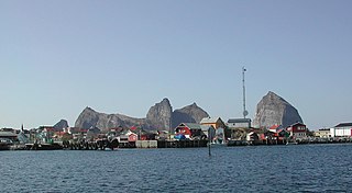
Træna is a municipality in Nordland county, Norway. It is part of the Helgeland traditional region. The administrative centre of the municipality is the island/village of Husøya. Other population centres include Selvær and Sanna.
Rødøy is a municipality in Nordland county, Norway. It is part of the Helgeland traditional region. The administrative centre of the municipality is the village of Vågaholmen. Other villages include Gjerøy, Jektvika, Kilboghamn, Melfjordbotn, Oldervika, Sørfjorden, and Tjong. The municipality consists of many islands to the west of Norway's second biggest glacier, Svartisen.
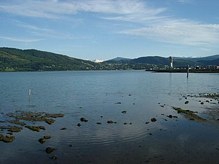
Mo i Rana is a town and the administrative centre of the municipality of Rana in Nordland county, Norway. It is located in the Helgeland region of Nordland, just south of the Arctic Circle. Some of the outlying areas of the town include the suburbs of Båsmoen and Ytteren in the north and Selfors in the east and Åga/Hauknes/Dalsgrenda in the south.

Korgen is the administrative centre of Hemnes Municipality in Nordland county, Norway. The village located along the river Røssåga, about 8 kilometres (5.0 mi) south of the village of Bjerka. Korgen is connected by the European route E06 highway to the nearby towns of Mo i Rana and Mosjøen. The eastern end of the Korgfjell Tunnel is located in Korgen. The village of Bleikvassli lies about 20 kilometres (12 mi) to the south along the Norwegian County Road 806. The 0.9-square-kilometre (220-acre) village has a population (2017) of 878 which gives the village a population density of 976 inhabitants per square kilometre (2,530/sq mi). This makes it the largest urban area in the municipality.

Bjerka is a village in the municipality of Hemnes in Nordland county, Norway. It is located along the European route E06 highway and the Nordland Line, about 20 kilometres (12 mi) southeast of Hemnesberget and about 7 kilometres (4.3 mi) north of the municipal center of Korgen.

Andfiskvatnet is a lake in the municipality of Rana in Nordland county, Norway. The 2.7-square-kilometre (1.0 sq mi) lake lies about 3 kilometres (1.9 mi) southeast of the village of Hauknes and about 6 kilometres (3.7 mi) south of the town of Mo i Rana. The lake flows out into the river Andfiskåga which flows into the Ranfjorden.
Helgåvatnet is a lake in the municipality of Rana in Nordland county, Norway. The 3.52-square-kilometre (1.36 sq mi) lake lies about 5 kilometres (3.1 mi) northeast of the village of Flostrand.
Reine is the administrative centre of Moskenes Municipality in Nordland county, Norway. The fishing village is located on the island of Moskenesøya in the Lofoten archipelago, above the Arctic Circle, about 300 kilometres (190 mi) southwest of the town of Tromsø. Reine Church is located here and it serves the northern part of the municipality.
Trofors is the administrative centre of the municipality of Grane in Nordland county, Norway. It is located at the confluence of the rivers Austervefsna and Svenningdalselva which forms the large river Vefsna. The village of Leiren lies about 25 kilometres (16 mi) to the southeast and the village of Majavatn lies about 45 kilometres (28 mi) to the south.
Storforshei is a village in the Dunderland Valley in the municipality of Rana in Nordland county, Norway. The village is located along the river Ranelva, about 25 kilometres (16 mi) northeast of the town of Mo i Rana. The European route E06 and the Nordland Line both pass through the village. The village of Nevernes and the Nevernes Church both lie about 3 kilometres (1.9 mi) to the south.
Alsvåg is a village in the municipality of Øksnes in Nordland county, Norway. It is located on the western bank of the Gavlfjorden on the island of Langøya and about 8 kilometres (5.0 mi) east of the municipal centre of Myre. Alsvåg Church is located in this village.

Sigerfjord is a village in Sortland Municipality in Nordland county, Norway. The village is located on the island of Hinnøya by the entrance to the Sigerfjorden. The village of Strand and the Sortland Bridge are located about 6 kilometres (3.7 mi) to the north. Sigerfjord Church is located in this village.

Sør-Rana is a former municipality in Nordland county, Norway. The 777-square-kilometre (300 sq mi) municipality existed from 1929 until 1964. Sør-Rana encompassed an area on both sides of the middle section of the Ranfjorden around where the Sørfjorden and Elsfjorden branch off the main fjord.
Nord-Rana is a former municipality in Nordland county, Norway. The 3,980-square-kilometre (1,540 sq mi) municipality existed from 1839 until its dissolution in 1964. From 1839 until 1844, it was named Nord-Ranen, from 1844 until 1923, it was called Mo, and then from 1923 until 1964 it was named Nord-Rana. The former municipality was located at the innermost part of the Ranfjorden. It encompassed the eastern 90% of what is now Rana Municipality. The administrative centre was the village of Ytteren, just north of the town of Mo i Rana.
Mæla is a village in the municipality of Rana in Nordland county, Norway. It is located along Norwegian County Road 17 at the eastern end of the Sjona fjord, about 2 kilometres (1.2 mi) north of the villages of Utskarpen and Myklebustad.

Överuman or Uman is a lake on the border between Norway and Sweden. Most of the 52.49-square-kilometre (20.27 sq mi) lake is located in Storuman Municipality in Västerbotten County in Sweden. A small 3.17-square-kilometre (1.22 sq mi) part of the lake, known as Umbukta, is located in Rana Municipality in Nordland County in Norway. The European route E12 highway runs along the eastern side of the lake. The lake lies just southeast of the large lake Storakersvatnet.
Elsfjord is a former municipality in Nordland county, Norway. The 280-square-kilometre (110 sq mi) municipality existed from 1929 until its dissolution in 1962. The municipality included the area around the Elsfjorden and the valley leading up to the fjord. The municipality is now a part of Vefsn Municipality. The administrative centre was the village of Elsfjord.


