The Beardmore Glacier in Antarctica is one of the largest valley glaciers in the world, being 200 km (125 mi) long and having a width of 40 km (25 mi). It descends about 2,200 m (7,200 ft) from the Antarctic Plateau to the Ross Ice Shelf and is bordered by the Commonwealth Range of the Queen Maud Mountains on the eastern side and the Queen Alexandra Range of the Central Transantarctic Mountains on the western. Its mouth is east of the Lennox-King Glacier. It is northwest of the Ramsey Glacier.
The Commonwealth Range is a north-south trending range of rugged mountains, 60 nautical miles long, located within the Queen Maud Mountains on the Dufek Coast of the continent of Antarctica. The range borders the eastern side of Beardmore Glacier from Keltie Glacier to the Ross Ice Shelf. The range is southeast of the Queen Alexandra Range, which is to the west of the Beardmore Glacier. It is west of the Hughes Range and north of the Supporters Range and the Barton Mountains.
The Homerun Range is a northwest-trending range, 28 nautical miles long and 2 to 7 nautical miles wide, east of Everett Range at the heads of the Ebbe Glacier and Tucker Glacier in Victoria Land, Antarctica.

The Clyde River is a river of New Zealand, one of Canterbury's braided rivers. It is formed from the confluence of the Frances River and McCoy Stream, flowing southwest to join with the Havelock River and Lawrence River to form the Rangitata River.
The Fairhall River is a river in the Marlborough region of New Zealand. It arises near Blairich Pass and flows north-east to join the Ōpaoa River between Renwick and Blenheim. The locality of Fairhall is east of the river. The river and locality were named in 1847 for a chainman in a survey team in the area.
The Forbes River is a river in the Canterbury region of New Zealand. It arises in the Two Thumb Range and flows east into the Havelock River which joins the Rangitata River, which flows into the Pacific Ocean. The river was named by Julius von Haast after James David Forbes, Professor of Natural Philosophy at the University of Edinburgh in the mid 19th century.

The Frances River is a river of New Zealand. It arises near Lambert Col and flows south to join McCoy Stream to form the Clyde River. The Clyde flows into the Rangitata River, which eventually exits into the Pacific Ocean.
The Gunn River is a river on the West Coast of New Zealand. It starts in the Price Range and flows east into the Whataroa River, which eventually drains into the Tasman Sea.

The Lawrence River is a river of inland Canterbury in New Zealand's South Island. One of the headwaters of the Rangitata River system, it flows south from its source north of Mount Arrowsmith, before joining with the Clyde River and Havelock River to become the Rangitata.

The Whenuakura River is a river of the Taranaki Region of New Zealand's North Island. It flows south from its origins northeast of Lake Rotorangi and reaches the coast five kilometres southeast of Patea.
The Dickson River is a river of the West Coast Region of New Zealand. It arises near the Dickson Pass in the Southern Alps and flows north-west. It joins the Tuke River and flows into the Mikonui River, which exits in the Tasman Sea near Ross.
The Worcester Range is a high coastal range, about 30 nautical miles long, in Antarctica. It stands between Skelton Glacier and Mulock Glacier on the western side of the Ross Ice Shelf. It is southwest of the Royal Society Range and north of the Conway Range of the Cook Mountains.
Daniell Peninsula is the large peninsula between Cape Daniell and Cape Jones on the coast of Victoria Land, Antarctica. It is an elongated basalt dome similar to Adare Peninsula and Hallett Peninsula and rises to 2,000 metres (6,600 ft). It is partly separated from the Victory Mountains by Whitehall Glacier, which is afloat in its lower reaches, but is joined to these mountains by the higher land in the vicinity of Mount Prior. It was named by the New Zealand Geological Survey Antarctic Expedition (NZGSAE), 1957–58, after Cape Daniell, and by analogy with the Adare and Hallett peninsulas.

Kukri Hills is a prominent east-west trending range, about 25 nautical miles (46 km) long and over 2,000 metres (6,600 ft) high, forming the divide between Ferrar Glacier on the south and Taylor Glacier and Taylor Valley on the north, in Victoria Land, Antarctica. They are south of the Asgard Range, east of the Quartermain Mountains and north of the Royal Society Range.

Dixon Peak, previously known as Mount Dixon, is the 23rd highest peak in New Zealand, rising to a height of 3,004 metres (9,856 ft). It is located in the Southern Alps of the South Island in the Mackenzie District, within Aoraki / Mount Cook National Park, and only a short distance from its more illustrious neighbour Aoraki / Mount Cook. The mountain is a popular peak for climbers, and is used as a practice run for ascents of Cook.
The small settlement of Caberfeidh is located in The Catlins, in the Otago region of New Zealand's South Island. The site of a former railway station on the Catlins Branch Line, it is sited close to a tributary of the Maclennan River, 5 kilometres north of the coast at Tahakopa Bay and 12 kilometres southwest of Owaka.

Lauriston is a lightly populated locality in the Canterbury region of New Zealand's South Island. It is situated on the Canterbury Plains south of the Rakaia River, some 20 kilometres (12 mi) inland from Rakaia. It was named after one of its pioneer settlers with the name of Laurie.
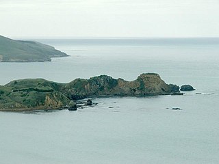
Huriawa, commonly known as Huriawa Peninsula or Karitane Peninsula, is a headland on the coast of Otago, New Zealand. It is located 35 kilometres north of Dunedin city centre, immediately to the southeast of the settlement of Karitane.
Maruakoa is a small farming settlement in Waitaki District, New Zealand. It is located close to the banks of the Kakanui River just south of its emergence form the Kakanui Gorge. It is 18 kilometres northwest of Oamaru and 4 kilometres southwest of Windsor, between the two settlements of Five Forks and Tapui. The name Maruakoa is a Māori word literally meaning "Happy valley".

The Two Thumb Range is a range of mountains in the Canterbury Region of New Zealand's South Island. It is located to the east of Lake Tekapo and has several peaks which rise to around 2,500 metres (8,200 ft). The southern end of the range contains one of Canterbury's main skifields, Mount Dobson.
