Hazelwood Park, Adelaide

Last updated

Hazelwood Park
Hazelwoodparksign.jpg
Sign heralding Hazelwood Park from Greenhill Road
Australia South Australia location map.svg
Red pog.svg
Location Hazelwood Park, South Australia
Coordinates 34°56′17″S138°39′20″E / 34.938026°S 138.655425°E / -34.938026; 138.655425 Coordinates: 34°56′17″S138°39′20″E / 34.938026°S 138.655425°E / -34.938026; 138.655425 [1]
Created15 July 1915 [2]
Operated by City of Burnside
Website https://www.burnside.sa.gov.au/Parks/Hazelwood-Park
First Creek running through Hazelwood Park, 1920. Hazelwood park first creek 1920.jpg
First Creek running through Hazelwood Park, 1920.

Hazelwood Park is a park in the Australian state of South Australia located in the suburb of Hazelwood Park within the Adelaide Metropolitan Area. [1]

Contents

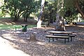
First creek continues its journey from the hills through the park, the water flowing from Waterfall Gully and into Tusmore. The park contains an assortment of play areas, picnic tables and barbecues. It is relatively large by suburban standards, but unusually there are no playing fields. It is strongly characterised by massive old eucalyptus trees that can be seen from blocks away. Although it is well facilitated, it is normally not as popular as the nearby smaller Tusmore Park.

Hazelwood Park was listed on the South Australian Heritage Register on 11 May 1995. [1] [3]

George Bolton Swimming Centre

Burnsideswimmingcentre.jpg

The park also contains the George Bolton Swimming Centre, sometimes referred to as the Burnside Swimming Centre, or just Burnside Pool, comprising an outdoor 50 metres (160 ft) lap pool, a 25 metres (82 ft) children's pool and a wading pool. There is also a sauna and steam room, two playgrounds and a kiosk. The facility is only open in the summer months, and is very popular on hot days in Adelaide (greater than 32 °C) when it is open until late in the evening. [4]

History

The Burnside Swimming Centre is a large swimming complex in the park, opened in 1966. The swimming centre was a pet project of then-Mayor George Bolton; he had a grand vision of what he wanted Hazelwood Park to become. Bolton met unprecedented public opposition in 1964 when the idea was first unveiled. The substantial elderly population of Burnside (15%) was wholly opposed to the idea, suggesting the influx of troublemakers and noise was hardly worth the effort. The cost was estimated at £75,000. While architects were resigning over the scale of the proposed development and a number of residents were up in arms, the Adelaide newspapers had a ball; cartoonists spent many of their daily cartoons covering the debacle. With the failure of a poll to decide the fate of the idea on 24 March 1964, the Sunday Mail proclaimed the headline "Burnside Says NO to Swim Pool". Mayor Bolton was not dismayed by the result; he pushed further ahead with his idea, announcing new plans in December 1964. After a strong PR campaign and minor changes to the project, a poll in February 1965 voted strongly in favour of the idea. The Mayor had won his battle and it was named the George Bolton Swimming Centre in his honour upon opening in 1966.[ citation needed ]

See also

Related Research Articles

River Torrens river in Australia

The River Torrens, is the most significant river of the Adelaide Plains. It was one of the main reasons for the siting of the city of Adelaide, capital of South Australia. It flows 85 kilometres (53 mi) from its source in the Adelaide Hills near Mount Pleasant, across the Adelaide Plains, past the city centre and empties into Gulf St Vincent between Henley Beach South and West Beach. The upper stretches of the river and the reservoirs in its watershed supply a significant part of the city's water supply.

City of Playford Local government area in South Australia

The City of Playford is a local government area of South Australia in Adelaide's northern suburbs. The name 'Playford' comes from the recognition of Sir Thomas Playford, who played a part in the development of the area, and was South Australia's premier from 1938–1965. The City covers an area of 345 km2 (133 sq mi), and is home to approximately 90,000 residents. Playford is the fastest growing local government area in South Australia. As of 2016 the city motto is: "a great place to live, work and play".

Waterfall Gully, South Australia Suburb of Adelaide, South Australia

Waterfall Gully is an eastern suburb of the South Australian capital city of Adelaide. It is located in the foothills of the Mount Lofty Ranges around 5 km (3.1 mi) east-south-east of the Adelaide city centre. For the most part, the suburb encompasses one long gully with First Creek at its centre and Waterfall Gully Road running adjacent to the creek. At the southern end of the gully is First Falls, the waterfall for which the suburb was named. Part of the City of Burnside, Waterfall Gully is bounded to the north by the suburb of Burnside, from the north-east to south-east by Cleland Conservation Park, to the south by Crafers West, and to the west by Leawood Gardens and Mount Osmond.

Bents Basin State Conservation Area Protected area in New South Wales, Australia

Bents Basin is a protected nature reserve and state park near Wallacia, New South Wales, Australia in the Sydney metropolitan area. The lake basin, which formed at the efflux of the Nepean River from the Hawkesbury Sandstone gorge, is a popular swimming hole with a camping area and an education centre used by local school groups. Also featuring a large woodland area and native wildlife, the reserve is the only picnic area along the Nepean River and it is one of the most popular water-based picnic parks in Greater Western Sydney.

City of Burnside Local government area in South Australia

The City of Burnside is a local government area in the South Australian city of Adelaide stretching from the Adelaide Parklands into the Adelaide foothills with an area of 2,753 hectares. It was founded in August 1856 as the District Council of Burnside, the name of a property of an early settler, and was classed as a city in 1943. The LGA is bounded by Adelaide, Adelaide Hills Council, Campbelltown, Mitcham, Norwood Payneham and St Peters and Unley.

Burnside, South Australia Suburb of Adelaide, South Australia

Burnside is suburb in the City of Burnside council area in the eastern suburbs of Adelaide. It is primarily a residential suburb. It was named Burnside, an amalgamation of the Scottish word for creek, "burn" and "side" because of the original property's location on the side of Second Creek. Burnside is 7.5 kilometres (4.7 mi) east of the Adelaide city centre by road.

Electoral district of Bragg state electoral district of South Australia

Bragg is a single-member electoral district for the South Australian House of Assembly. The seat is named after the eminent physicists Bragg – William Henry and his son, William Lawrence. The electorate is largely suburban and encompasses a significant portion of the City of Burnside, stretching from the east parklands of Adelaide into the Adelaide Hills. After the redistribution following the 2006 election, the boundary moved eastwards to include suburbs that had formerly been in the electorate of Heysen and now borders Kavel. Bragg currently includes the metropolitan suburbs of Auldana, Beaumont, Beulah Park, Burnside, Cleland, Erindale, Greenhill, Hazelwood Park, Heathpool, Horsnell Gully, Kensington, Kensington Park, Kensington Gardens, Leabrook, Leawood Gardens, Linden Park, Marryatville, Mount Osmond, Rosslyn Park, Skye, St Georges, Stonyfell, Toorak Gardens, Tusmore, Waterfall Gully, Wattle Park and part of Glen Osmond.

Beaumont, South Australia Suburb of Adelaide, South Australia

Beaumont is a suburb of Adelaide in the City of Burnside. Founded as a purpose-built village by Sir Samuel Davenport in 1848, it initially struggled due to high land prices in the area. However, with Adelaide's inevitable expansion residents eventually settled. The early village had quite a cosmopolitan flavour–although predominantly Anglo-Saxon like most of Australia at this point, many of Beaumont's early residents were veterans of the British Navy or Army or had lived in other countries for some time.

Greenhill Road is a major road in Adelaide, South Australia, that provides a connection to the eastern and hills suburbs.

Hazelwood Park, South Australia Suburb of Adelaide, South Australia

Hazelwood Park is an upper class suburb in the City of Burnside, Adelaide, South Australia with a census area population of 1,717 people. The suburb is about 5 kilometres east of the Central business district. Hazelwood Park, a suburban park inside the suburb, is the major attraction in the suburb. This includes the Burnside Swimming Centre, a popular site in the summer. Much of the remainder of the suburb is residential but there is a small shopping area along Glynburn Road on the eastern edge. The area was first settled by Europeans in 1848 but has seen many community changes over the years.

Stonyfell, South Australia eastern suburb of Adelaide, in the City of Burnside council area, South Australia

Stonyfell is an eastern suburb in the foothills of Adelaide, Australia, within the council area of the City of Burnside. It has parks with walking tracks, and two creeks running through it. St Peter's Collegiate Girls' School is the only school in Stonyfell. There is a quarry and a winery, the present-day remnants of industries dating back to the early days of the colonisation of South Australia.

Tusmore, South Australia Suburb of Adelaide, South Australia

Tusmore is a suburb in the inner east of Adelaide, South Australia.

Marryatville is a small suburb about 4–5 kilometres (2.5–3.1 mi) east of Adelaide's central business district, in the local council area of City of Norwood Payneham St Peters. Comprising low- to medium-density housing, two large schools, a church and several shops, it also has two creeks running through it. The first European settler on the land was George Brunskill in 1839, with part of the land purchased and laid out as a village in 1848 by James Philcox.

Kingscote, South Australia Town in South Australia

Kingscote is a town in the Australian state of South Australia located on Kangaroo Island about 119 kilometres (74 mi) south-west of the state capital of Adelaide. It is South Australia's oldest European settlement and the island's largest town. At the 2016 census, Kingscote had a population of 1,790. It is a well-established tourist centre and the administrative and communications centre. It is home to a colony of the smallest penguins in the world, the little penguin.

History of the City of Burnside History of area in Adelaide, Australia

The history of the City of Burnside, a local government area in the metropolitan area of Adelaide, spans three centuries. Prior to European settlement Burnside was inhabited by the Kaurna people, who lived around the creeks of the River Torrens during the winter and in the Adelaide Hills during the summer.

Cobbler Creek Recreation Park Protected area in South Australia

Cobbler Creek Recreation Park is a 266-hectare (657-acre) protected area located in South Australia about 19 kilometres (12 mi) north of the Adelaide city centre in the suburb of Salisbury East. Originally part of the lands of the Kaurna aboriginal people, it was farmed from European settlement of South Australia until the declaration of the park in 1989.

Adelaide Aquatic Centre

The Adelaide Aquatic Centre is a complex of indoor heated swimming pools operated by the Adelaide City Council and located in the northernmost extent of the Adelaide Parklands in North Adelaide, Australia. It is located in the square of parkland bordered by Jeffcott Street, Barton Terrace West, Prospect Road and Fitzroy Terrace. There is a car park to the west whose entrance is off Jeffcott Street, but the entrance to the centre itself faces north, towards Fitzroy Terrace. The centre opened on 20 December 1969.

Newland Head Conservation Park Protected area in South Australia

Newland Head Conservation Park is a protected area located in South Australia within the locality of Waitpinga on the southern coast of the Fleurieu Peninsula 91 km south of the centre of Adelaide, and 7 km southwest of Victor Harbor. Its name is taken from Newland Head that feature prominently at the eastern boundary of the park. The conservation park is classified as an IUCN Category III protected area.

City of Kensington and Norwood Local government area in South Australia

The City of Kensington and Norwood, originally the Corporate Town of Kensington and Norwood, was a local government area in South Australia from 1853 to 1997, centred on the inner eastern Adelaide suburbs of Kensington and Norwood. In November 1997 it amalgamated with the City of Payneham and the Town of St Peters to form the City of Norwood Payneham & St Peters.

References

  1. 1 2 3 "Search results for "Hazelwood Park, RESV" with the following datasets selected - 'Suburbs and Localities', 'Local Government Areas', 'Gazetteer' and 'SA Heritage Places Indicative Footprints'". Location SA Map Viewer. Government of South Australia. Retrieved 8 November 2018.
  2. Styles, A.W. (15 July 1915). "GRANT OF HAZELWOOD PARK AS A PUBLIC PLEASURE RESORT, &c" (PDF). The South Australian Government Gazette. South Australian Government. p. 330. Retrieved 21 May 2018.
  3. "Hazelwood Park [Boundaries: Greenhill Rd, Howard & Davenport Tces, Hazelwood Ave & Hawthorn Cres]". South Australian Heritage Register. Government of South Australia. 11 May 1995. Retrieved 8 November 2018.
  4. "George Bolton Swimming Centre Burnside". City of Burnside. 21 September 2019. Retrieved 5 June 2020.