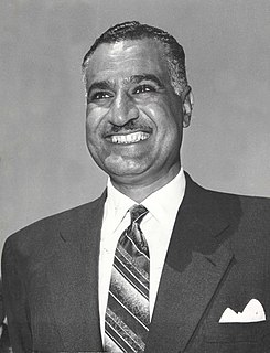
The Cairo International Stadium or "Stad El Qahira El Dawly", is an Olympic-standard, multi-use stadium with an all-seated capacity of 75,000. The architect of the stadium is the German Werner March, who had built from 1934 to 1936 the Olympic Stadium in Berlin. Before becoming an all seater stadium, it had the ability to hold over 100,000 spectators, reaching a record of 120,000. It is the foremost Olympic-standard facility befitting the role of Cairo, Egypt as the center of events in the region. It is also the 69th largest stadium in the world. Located in Nasr City; a suburb north east of Cairo, it was completed in 1960, and was inaugurated by President Gamal Abd El Nasser on 23 July that year, the eighth anniversary of the Egyptian Revolution of 1952. Zamalek SC currently use the Petro Sport Stadium for most of their home games and Al Ahly use Al-Salam Stadium for most of their home games.

Mohandessin, is a area in the municipal division of Agouza in the governorate of Giza. Its name means in Arabic literally the engineers, which was because it was given to at cheaper prices to engineers in Egypt; there is a similar area in Muhandisin called Ṣaḥafiyyīn (journalists), Mu‘allimīn (teachers), and Aṭibbā’ (doctors), all designed for people with these professions.
In its early years, the Arab League concentrated mainly on economic, cultural and social programs. In 1959, it held the first Arab Petroleum Congress, and in 1964, established the Arab League Educational, Cultural, and Scientific Organization. In 1974, despite objections by Jordan, the league recognized the PLO as the sole legitimate representative of all Palestinians.

Bulaq, is a district of Cairo, in Egypt. It neighbours Downtown Cairo, Azbakeya, and the River Nile.
The 1978 Arab League summit was meeting held between Arab leaders on 2 November in Baghdad as the 9th Arab League Summit. The summit came in the aftermath of the Egypt's Anwar Sadat's unilateral peace treaty with Israel. The conference resolved that the agreements signed by the Egyptian Government at Camp David harmed the rights of the Palestinian people. The Egyptian government was urged not to ratify the agreements and to align itself with the Arab League. Most importantly, the League froze its relations with the Government of Egypt. On 31 March 1979, five days after the ratification of the Egypt-Israel Peace Treaty, Arab leaders again convened in Baghdad in the absence of Egypt and decided to expel it from the Arab League. Consequently, the secretariat of the League was moved out of its Cairo headquarters to Tunis. This decision was slowly reversed in the 1980s after president Hosni Mubarak ascended to power. Egypt, which regained strong influence in the region as rival nation Syria was suffering setbacks during the Lebanon Civil War, returned to the Arab League on 23 May 1989 and the headquarters, which never saw completed construction in Tunis, return to Cairo on 12 March 1990.

Khairy Pasha Palace is a neo-Mameluk building and former palace of Khairy Pasha, located on 113 Qasr El Eyni Street, in Tahrir Square, Cairo. It served as the American University in Cairo's Tahrir Square campus since 1920 until 2008 when the new campus was inaugurated in New Cairo. The building in the photograph on the right was originally the Girls' School of the Greek Community of Cairo. In 1964 it was sold to the AUC and served as the Greek Campus.

The Qasr El Nil Bridge, also commonly spelled Kasr El Nil Bridge, is a historic structure dating from 1931 and replaced the first bridge to span the Nile River in central Cairo, Egypt. It connects Tahrir Square in downtown Cairo to the modern Cairo Opera complex toward the southern end of Gezira Island. At the bridge's east and west approaches are four famous large bronze lion statues; they are late 19th-century works by Henri Alfred Jacquemart, French sculptor and animalier. The newer and wider 6th October Bridge parallels its route 0.8 kilometres (0.50 mi) just to the north.

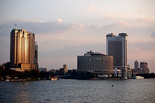
Gezira is an island in the Nile River, in central Cairo, Egypt. The southern portion of the island contains the Gezira district, and the northern third contains the Zamalek district.
Inshas is a village located in Bilbeis, Sharqia Governorate, 60 kilometers east of Cairo, Egypt.

Qasr El Eyni Street is one of the oldest streets in downtown Cairo, Egypt.

Qasr El Nil Street is a street in downtown Cairo, Egypt, one of the biggest streets in Cairo, with many businesses, restaurants, and an active nightlife.

Garden City is a wealthy residential district in Central Cairo that spans the east side of the Nile just south of downtown. It is the location of the famous Midan Tahrir. Two main streets, Qasr al-Ayni Street on the east and Nile Corniche on the west, delineate its eastern and western borders. Garden City is known for its quiet, upscale, and secure atmosphere and is a major destination for wealthy tourists. The United States, British, and Italian Embassies are all located there.

The Mogamma is a government building in Cairo, Egypt. The Mogamma was the result of a series of master plans for the Qasr el Nil area, which used to be occupied by the British barracks. In 1945 when King Farouk ordered the demolition of the barracks upon the departure of British troops from the area, a series of urban planning proposals ensued. The idea for a centralised, all-in-one administrative building emerged from the 1945 plans. Construction began in 1946, and ended in 1949. The building's style reflects typical 1940s modernism, and government buildings in the same style can be found in Buffalo, New York, and Paris. Contrary to popular belief, there is no Soviet association or inspiration, and the building was not constructed by the government of Egypt's second President, Gamal Abdel Nasser. Indeed, Nasser did not become the leader of Egypt until November 1954, several years after the building was completed.

The Egyptian revolution of 2011, also known as the January 25 Revolution, started on 25 January 2011 and spread across Egypt. The date was set by various youth groups to coincide with the annual Egyptian "Police holiday" as a statement against increasing police brutality during the last few years of Mubarak's presidency. It consisted of demonstrations, marches, occupations of plazas, non-violent civil resistance, acts of civil disobedience and strikes. Millions of protesters from a range of socio-economic and religious backgrounds demanded the overthrow of Egyptian President Hosni Mubarak. Violent clashes between security forces and protesters resulted in at least 846 people killed and over 6,000 injured. Protesters retaliated by burning over 90 police stations across the country.
Lara Baladi is an acclaimed Egyptian-Lebanese photographer, archivist and multimedia artist. She was educated in Paris and London and currently lives in Cairo. Baladi exhibits and publishes worldwide. Her body of work encompasses photography, video, visual montages/collages, installations, architectural constructions, tapestries, sculptures and even perfume. Much of her work reflects her "concerns with Egypt's extremely alarming sociopolitical context."
The following is a timeline of the history of the city of Cairo, Egypt.

The following chronological summary of major events took place during the 2011 Egyptian revolution right up to Hosni Mubarak's resignation as the fourth President of Egypt on 11 February 2011.

The mass sexual assault of women in public has been documented in Egypt since 2005. In May 2005 Egyptian security forces and their agents were blamed for using it during political demonstrations in Tahrir Square, Cairo, as a weapon against female protesters. The behavior spread, and by 2012 sexual assault by crowds of young men was regularly seen at protests and religious festivals in Egypt.