The Mississippi River is the second-longest river and chief river of the second-largest drainage system on the North American continent, second only to the Hudson Bay drainage system. From its traditional source of Lake Itasca in northern Minnesota, it flows generally south for 2,340 miles (3,770 km) to the Mississippi River Delta in the Gulf of Mexico. With its many tributaries, the Mississippi's watershed drains all or parts of 32 U.S. states and two Canadian provinces between the Rocky and Appalachian mountains. The main stem is entirely within the United States; the total drainage basin is 1,151,000 sq mi (2,980,000 km2), of which only about one percent is in Canada. The Mississippi ranks as the thirteenth-largest river by discharge in the world. The river either borders or passes through the states of Minnesota, Wisconsin, Iowa, Illinois, Missouri, Kentucky, Tennessee, Arkansas, Mississippi, and Louisiana.

The Missouri River is the longest river in the United States. Rising in the Rocky Mountains of the Eastern Centennial Mountains of Southwestern Montana, the Missouri flows east and south for 2,341 miles (3,767 km) before entering the Mississippi River north of St. Louis, Missouri. The river drains a sparsely populated, semi-arid watershed of more than 500,000 square miles (1,300,000 km2), which includes parts of ten U.S. states and two Canadian provinces. Although nominally considered a tributary of the Mississippi, the Missouri River above the confluence is much longer than the Mississippi above the confluence and carries a comparable volume of water. When combined with the lower Mississippi River, it forms the world's fourth longest river system.

The Kansas River, also known as the Kaw, is a river in northeastern Kansas in the United States. It is the southwesternmost part of the Missouri River drainage, which is in turn the northwesternmost portion of the extensive Mississippi River drainage. Its two names both come from the Kanza (Kaw) people who once inhabited the area; Kansas was one of the anglicizations of the French transcription Cansez of the original kką:ze. The city of Kansas City, Missouri, was named for the river, as was later the state of Kansas.

The headwaters of a river or stream is the farthest place in that river or stream from its estuary or downstream confluence with another river, as measured along the course of the river. It is also known as a river's source.

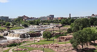
The Big Sioux River is a tributary of the Missouri River in eastern South Dakota and northwestern Iowa in the United States. It flows generally southwardly for 419 mi (674 km), and its watershed is 9,006 sq mi (23,330 km2). The United States Board on Geographic Names settled on "Big Sioux River" as the stream's name in 1931. The river was named after the Lakota people which was known by them as Tehankasandata, or Thick Wooded River.

The River des Peres is a 9.3-mile (15.0 km) metropolitan river in St. Louis, Missouri. It is the backbone of sanitary and storm water systems in the city of St. Louis and portions of St. Louis County. Its largest tributaries are Deer Creek and Gravois Creek. At St. Louis, the river has a mean annual discharge of 79 cubic feet per second.

The Castor River is divided into the Upper Castor River and the Lower Castor River by the Headwater Diversion Channel.

The Kenogami River is a river in the James Bay drainage basin in Thunder Bay and Cochrane districts in Northern Ontario, Canada, which flows north from Long Lake near Longlac to empty into the Albany River. The river is 320 kilometres (199 mi) in length and its name means "long water" in the Cree language. A portion of the river's headwaters have been diverted into the Lake Superior drainage basin.

The Little River is a tributary of the St. Francis River, about 148 miles (238 km) long, in southeastern Missouri and northeastern Arkansas in the United States. Via the St. Francis, it is part of the watershed of the Mississippi River.

The North River is an 82-mile-long (132 km) river in northeastern Missouri, the United States. It rises in Knox County at 40°03′30″N92°15′26″W and flows southeast and east through Shelby and Marion counties, emptying into the Mississippi River at 39°51′21″N91°26′41″W between West Quincy and Hannibal.
Clear Creek is a southern Illinois watercourse that rises in Jackson County and Union County, and discharges into the Mississippi River in Alexander County.

The Nonconnah Creek is a 29.7-mile-long (47.8 km) waterway in southwest Tennessee. It starts in extreme southeastern Shelby County, Tennessee, near the town of Collierville. From there, it flows westward, forming the southern border of Germantown. The creek continues to flow west through Memphis and through Whitehaven. Nonconnah Creek empties into McKellar Lake, an oxbow of the Mississippi River. There are three major expressways that follow most of its route. These are Interstate 55, Interstate 240, and Tennessee State Route 385, formerly named and still locally referred to as "Nonconnah Parkway".
Sikeston Ridge is a two-mile (3 km) wide topographic terrace with an average height of 20 feet (6.1 m) deposited by the Mississippi River. It was formed when the Mississippi River flowed west of Sikeston, United States. This Southeast Missouri ridge runs from the area of Haywood City south through Sikeston towards the Mississippi River town of New Madrid, Missouri. The most dominant ridge in the area is Crowley's Ridge which is 150 miles (240 km) long and with an average height of 400 feet (120 m).
Hubble Creek is a stream in Cape Girardeau County, Missouri in the United States. It is a tributary of the Castor River Diversion Channel.
Hawker Creek is a stream in Bollinger County in the U.S. state of Missouri. It was a tributary to the Castor River, but now flows into the Headwater Diversion Channel.
Malone Creek is a stream in southern Bollinger County in the U.S. state of Missouri. The stream is a tributary of the Castor River within the Castor River Diversion Channel.
Juden Creek is a stream in Cape Girardeau County in the U.S. state of Missouri. It is a tributary of the Mississippi River.

Historically, the name Whitewater River applied to a 120 km (75 mi) long stream that headed approximately two miles east of the community of Womack in St. Francois County flowing south through Perry, Bollinger, Cape Girardeau and Stoddard counties before entering the Little River near Bell City. However, in the early 20th century, the Little River Drainage District constructed the Headwater Diversion Channel, which bisected the Whitewater River, causing the northern section of the stream to be diverted into the diversion channel, and separating the southern portion from its original headwaters. In 2007, the Board on Geographic Names approved a proposal to rename the two portions Upper Whitewater Creek and Lower Whitewater Creek. With the Upper Whitewater Creek now flowing through the Headwater Diversion Channel to the Mississippi River just south of Cape Girardeau.
Crooked Creek is a stream in Bollinger and Cape Girardeau counties of southeast Missouri. It is a tributary to the Headwater Diversion Channel.


