
Bloemfontein, also known as Bloem, is the capital and the largest city of the Free State province in South Africa. It is often, and has been traditionally, referred to as the country's "judicial capital", alongside the legislative capital Cape Town and administrative capital Pretoria, although the highest court in South Africa, the Constitutional Court, has been in Johannesburg since 1994.

Polokwane, also known as Pietersburg, is the capital city of the Limpopo Province in South Africa. It is the country's largest urban centre north of Gauteng. It was one of the nine host cities of the 2010 FIFA World Cup.

Potchefstroom, colloquially known as Potch, is an academic city in the North West Province of South Africa. It hosts the Potchefstroom Campus of the North-West University. Potchefstroom is on the Mooirivier, roughly 120 km (75 mi) west-southwest of Johannesburg and 45 km (28 mi) east-northeast of Klerksdorp.

Alberton is a town situated on the southern part of the East Rand of the Gauteng Province in South Africa and is situated very close to the major urban centre of Johannesburg.

Welkom is the second-largest city in the Free State province of South Africa, located about 140 kilometres (90 mi) northeast of Bloemfontein, the provincial capital. Welkom is also known as Circle City, City Within A Garden, Mvela and Matjhabeng. The city's Sesotho name, Matjhabeng means 'where nations meet', derived from the migrant labour system, where people of various countries such as Lesotho, Malawi and Mozambique etc. met to work in the mines of the gold fields.
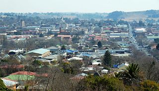
Bethlehem is a city in the eastern Free State province of South Africa that is situated on the Liebenbergs river along a fertile valley just north of the Rooiberg Mountains on the N5 road. It is the fastest growing city in the Free state province, with its target of being the third largest city after Bloemfontein and Welkom.

Kitwe is the third largest city in terms of infrastructure development and second largest city in terms of size and population in Zambia. With a population of 517,543 Kitwe is one of the most developed commercial and industrial areas in the nation, alongside Ndola and Lusaka. It has a complex of mines on its north-western and western edges.
Brislington is an area in the south east of the city of Bristol, England. It is on the edge of Bristol and 10 miles (16 km) from Bath. Brislington Brook runs through the area in the woodlands of Nightingale Valley and St Anne's Wood. Brislington formerly housed the HTV West Studios on Bath Road, and this is situated next to the historic Arnos Vale Cemetery. Other notable landmarks include Brislington House and the 15th-century St Luke's Church. During the 18th–19th century, Brislington was regarded as a picturesque country village and contained many country homes.

Middelburg is a large farming and industrial town in the South African province of Mpumalanga.
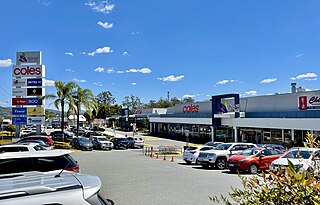
Rustenburg is a city at the foot of the Magaliesberg mountain range. Rustenburg is the most populous city in North West province, South Africa. In 2017, the city's Gross Domestic Product (GDP) reached ZAR 63.8 billion, accounting for 21.1% of the GDP of the North West Province, and 1.28% of the GDP of South Africa. Rustenburg was one of the official host cities of the 2010 FIFA World Cup, being in close proximity to Phokeng, the capital of the Royal Bafokeng Nation, where the Royal Bafokeng Stadium is located. The England national football team also used this as their base camp for the tournament.

Victoria Falls, popularly known as Vic Falls, is a resort town and city in the province of Matabeleland North, Zimbabwe. It lies on the southern bank of the Zambezi River at the western end of Victoria Falls themselves. According to the 2022 Population Census, the town had a population of 35,199.
Maletswai is a town in central South Africa on the banks of the Orange River, Eastern Cape Province. It is a medium-sized commercial centre in the northernmost part of the Eastern Cape. The Dutch Reformed Church was built in 1855.
Toyota Stadium may refer to:
Kenmore is a riverside suburb in the City of Brisbane, Queensland, Australia. In the 2021 census, Kenmore had a population of 9,675 people.
Zambia, officially known as the Republic of Zambia, is a landlocked country in Southern Africa. The neighbouring countries are the Democratic Republic of the Congo to the north, Tanzania to the north-east, Malawi to the east, Mozambique, Zimbabwe, Botswana, and Namibia to the south, and Angola to the west. The capital city is Lusaka, located in the southeast of the country. The population is concentrated mainly around the capital and the Copperbelt to the northwest.

Lusaka is the capital and largest city of Zambia. It is one of the fastest-developing cities in southern Africa. Lusaka is in the southern part of the central plateau at an elevation of about 1,279 metres (4,196 ft). As of 2019, the city's population was about 3.3 million, while the urban population is estimated at 2.5 million in 2018. Lusaka is the centre of both commerce and government in Zambia and connects to the country's four main highways heading north, south, east, and west. English is the official language of the city administration, while Bemba and Nyanja are the commonly spoken street languages.

Bretton is a settlement and civil parish on the north western edge of Peterborough, in the Peterborough district, in the ceremonial county of Cambridgeshire, England. Bretton has been designed as a green environment; the major roads are tree-lined and there are several large parks and playing fields. It consists of two main areas; North Bretton and South Bretton, these are divided by Bretton Centre. North Bretton has the larger population and is home to the industrial estates and most leisure facilities as well as the Crematorium. The main entrance to Milton Hall is from Bretton Way in South Bretton and Nene Park is accessed via an under pass beneath the A47.

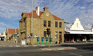
Burgersdorp is a medium-sized town in Walter Sisulu in the Joe Gqabi District Municipality of the Eastern Cape province of South Africa.
Thabong is the second largest township after Botshabelo in the Free State province of South Africa. The township was established during the years of segregation of black people as well as the township of Bronville for coloured people adjacent to the city of Welkom, to accommodate workers at the world's richest gold mines.
Gayton McKenzie is a South African politician who is currently serving as Minister of Sports, Arts and Culture since July 2024.


