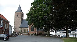
Sint-Martens-Lierde is a village which is part of the municipality of Lierde. It is located in the Denderstreek and in the Flemish Ardennes, the hilly southern part of the Belgian province of East Flanders.

Deftinge is a village which makes up part of the municipality of Lierde. It is located in the Denderstreek and in the Flemish Ardennes, the hilly southern part of the Belgian province of East Flanders. It was an independent municipality until 1977 when it was merged into Lierde.

Sint-Maria-Lierde is a village which makes up part of the municipality of Lierde. It is located in the Denderstreek and in the Flemish Ardennes, the hilly southern part of the Belgian province of East Flanders.
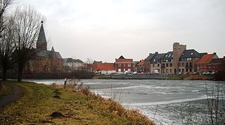
Machelen, or in full Machelen-aan-de-Leie, is a village in the municipality of Zulte in the province of East-Flanders of Belgium. It was the hometown of the painter Roger Raveel.

Bazel is a village in Belgium, in the municipality of Kruibeke in the province of East Flanders. The village is home to the Wissekerke Castle. The municipality of Bazel merged into Kruibeke in 1977.

Kemzeke is a village in the Belgian municipality of Stekene in the province of East-Flanders. Until 1977, it was an independent municipality. It is located between the Dutch border and Sint-Niklaas.
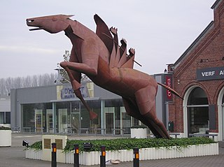
Grembergen is a town in the municipality of Dendermonde in the Denderstreek in the province of East Flanders in Belgium. It is often confused with the municipality of Grimbergen in the province of Flemish Brabant.

Melsele is a small town in the Belgian province of East Flanders, between the city of Beveren and the nearby town of Zwijndrecht. Tram route 3 which starts just outside the town connects it to Zwijndrecht and Antwerp. Melsele can be reached by the E17 and the E34.

Nederbrakel is a town in the municipality of Brakel. It is located in the Denderstreek and in the Flemish Ardennes, the hilly southern part of the province of East Flanders, Belgium. With 5,972 residents as of 2000, it forms the largest individual part of the municipality. Nederbrakel is located near the language border.
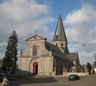
Sint-Maria-Oudenhove is a village in the Denderstreek and in the Flemish Ardennes, the hilly southern part of the province of East Flanders, Belgium.

Beerlegem is a village belonging to the municipality of Zwalm. It is located in the Flemish Ardennes, the hilly southern part of the province of East Flanders, Belgium. Until 1970, it was an indendent municipality.
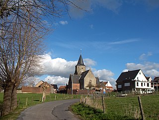
Godveerdegem is a village belonging to the municipality of Zottegem. It is located on the Molenbeek-Ter Erpenbeek in the Denderstreek and in the Flemish Ardennes, the hilly southern part of the province of East Flanders, Belgium.

Louise-Marie is a hamlet partly belonging to the municipality of Ronse and partly to the municipality of Maarkedal. It is located in the Flemish Ardennes, the southern part of the province of East Flanders, Belgium.

Broechem is a part of the municipality of Ranst in Antwerp Province, Flemish Region, Belgium. The village is located on the highest point of the region.

Verrebroek is a village and deelgemeente in the municipality of Beveren in East Flanders, Belgium. Verrebroek was an independent municipality until January 1, 1977 when it merged with Beveren as part of the fusion of municipalities in Belgium.

Morkhoven is a village in the Belgian province of Antwerp belonging to the municipality of the city of Herentals.

Watervliet is a village in the Belgian province of East Flanders and suburb of the town of Sint-Laureins. Watervliet is part of the Meetjesland, and is adjacent to the Dutch border. It was a separate municipality until 1977.

Rutten is a village in the Tongeren municipality of the Limburg province in the Flemish Community of Belgium. The village is located in the Haspengouw region, and was a separate municipality until its merger into Tongeren in 1977.

Viane is a village in the Geraardsbergen municipality of the East-Flanders province in the Flemish Community of Belgium. The village is situated in the Denderstreek in the south east of the province, on the border with Flemish Brabant and Hainaut. The river Mark separates the village from the rest of Geraardsbergen.

Ruisbroek is a village in the municipality of Puurs-Sint-Amands located in the Antwerp Province of Belgium.
