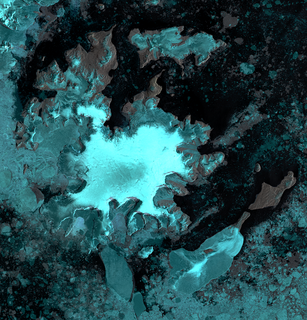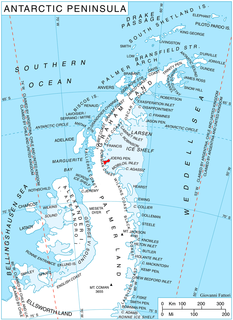
Alexander Island, which is also known as Alexander I Island, Alexander I Land, Alexander Land, Alexander I Archipelago, and Zemlja Alexandra I, is the largest island of Antarctica. It lies in the Bellingshausen Sea west of Palmer Land, Antarctic Peninsula from which it is separated by Marguerite Bay and George VI Sound. George VI Ice Shelf entirely fills George VI Sound and connects Alexander Island to Palmer Land. The island partly surrounds Wilkins Sound, which lies to its west. Alexander Island is about 390 kilometres (240 mi) long in a north-south direction, 80 kilometres (50 mi) wide in the north, and 240 kilometres (150 mi) wide in the south. Alexander Island is the second largest uninhabited island in the world, after Devon Island.

Foundation Ice Stream is a major ice stream in Antarctica's Pensacola Mountains. The ice stream drains northward for 150 nautical miles along the west side of the Patuxent Range and the Neptune Range to enter the Ronne Ice Shelf westward of Dufek Massif. The United States Geological Survey mapped the stream from surveys and U.S. Navy air photos, 1956–66. The Advisory Committee on Antarctic Names named the stream in recognition of the National Science Foundation, which provided major support to the U.S. Antarctic Research Program during this period.
Fowler Ice Rise is a very large Antarctic ice rise between Evans Ice Stream and Carlson Inlet, in the southwest part of the Ronne Ice Shelf. The feature appears to be completely ice-covered except for the Haag Nunataks, which protrude above the surface in the northwestern portion. It was mapped by the United States Geological Survey from Landsat imagery taken 1973–74, and named by the Advisory Committee on Antarctic Names for Captain Alfred N. Fowler, U.S. Navy, Commander of the U.S. Naval Support Force, Antarctica, 1972–74.

The Evans Ice Stream is a large ice stream draining from Ellsworth Land, between Cape Zumberge and Fowler Ice Rise, into the western part of the Ronne Ice Shelf. Mills Glacier flows adjacently into the ice stream from the southwest side. The feature was recorded on February 5, 1974 in Landsat imagery. It was named by the UK Antarctic Place-Names Committee for Stanley Evans, a British physicist who, starting in 1961, developed apparatus for radio echo sounding of icecaps and glaciers from aircraft; he carried out upper atmosphere research at Brunt Ice Shelf, 1956–57.

Aagaard Glacier, also known as Glaciar Alderete, is an 8-mile (13 km) long Antarctic glacier which lies close to the east of Gould Glacier and flows in a southerly direction into Mill Inlet, on the east coast of Graham Land. It was charted by the Falkland Islands Dependencies Survey (FIDS) and photographed from the air by the Ronne Antarctic Research Expedition during December 1947; it was named by the FIDS for Bjarne Aagaard, a Norwegian authority on Antarctic whaling and exploration.
Hag Pike is a conspicuous rock column, 710 metres (2,330 ft) high, on the north side of the Wordie Ice Shelf near the west coast of the Antarctic Peninsula. Together with the mountain to the north, it forms the west side of the mouth of Hariot Glacier. Hag Pike was photographed from the air by the British Graham Land Expedition, 1937, and by the Ronne Antarctic Research Expedition, 1947. It was surveyed by the Falkland Islands Dependencies Survey, 1948–50, and 1958. The name by the UK Antarctic Place-Names Committee is descriptive, "hag" being the stump of a tree which remains after felling.
The Eklund Islands are a group of islands which rise through the ice near the southwest end of George VI Sound towards the south of the Antarctic Peninsula.
Andreassen Point is a low ice-free point in northern James Ross Island, fronting on Herbert Sound, 8 nautical miles (15 km) south of Cape Lachman. Probably first seen by Otto Nordenskiöld in 1903, it was surveyed by the Falkland Islands Dependencies Survey in 1945, and named by the UK Antarctic Place-Names Committee for F.L. Andreassen, first mate on the Antarctic, the ship of the Swedish Antarctic Expedition, 1901–04.
Ashton Glacier is a glacier 9 nautical miles (17 km) long, which flows east-southeast from Mount Thompson to the northwest side of Lehrke Inlet, on the east coast of Palmer Land. The glacier was photographed from the air in December 1940 by the United States Antarctic Service (USAS), and was probably seen by the USAS ground survey party which explored this coast. A joint party consisting of members of the Ronne Antarctic Research Expedition and the Falkland Islands Dependencies Survey (FIDS) charted the glacier in 1947. It was named by the FIDS for L. Ashton, a carpenter with the FIDS at the Port Lockroy and Hope Bay bases in 1944–45 and 1945–46, respectively.
Clarsach Glacier is a glacier flowing south between Prague Spur and the Finlandia Foothills in northern Alexander Island, Antarctica. The feature was photographed from the air by the Ronne Antarctic Research Expedition, 1947–48, and was mapped from these photographs by D. Searle of the Falkland Islands Dependencies Survey, 1960. Further delineation was made from U.S. Navy aerial photographs taken 1966–67 and from U.S. Landsat imagery taken January 1974. It was so named by the UK Antarctic Place-Names Committee, 1977; in plan view the outline of the glacier resembles a clàrsach, or Irish harp.

Swift Glacier is a steep glacier about 2 nautical miles (3.7 km) long, close west of Jefford Point, James Ross Island. Named by United Kingdom Antarctic Place-Names Committee (UK-APC) following Falkland Islands Dependencies Survey (FIDS) surveys, 1958-61. The name is descriptive, this being one of the most active glaciers on the island.

Pelter Glacier is a glacier about 5 nautical miles long on Thurston Island, flowing from the east side of Noville Peninsula into the west side of Murphy Inlet. Delineated from air photos taken by U.S. Navy Squadron VX-6 in January 1960. Named by Advisory Committee on Antarctic Names (US-ACAN) for J.A. Pelter, aerial photographer with the Byrd Antarctic Expedition in 1933-35.
Dvořák Ice Rise is an ice rise 1.5 nautical miles (3 km) in extent, rising above the ice of Mendelssohn Inlet in the southwest part of Alexander Island, Antarctica. It was first mapped, from air photos taken by the Ronne Antarctic Research Expedition, 1947–48, by D. Searle of the Falkland Islands Dependencies Survey in 1960, and was named by the UK Antarctic Place-Names Committee after Antonín Dvořák, the Czech composer. (1841-1904).

Getman Ice Piedmont is an ice piedmont between Reichle Mesa and Three Slice Nunatak at the east end of Joerg Peninsula, Bowman Coast, Antarctica. It drains north-northeastwards into Hondius Inlet. The feature was explored from the ground and photographed from the air by the United States Antarctic Service, 1939–41, the Ronne Antarctic Research Expedition, 1947–48, and was surveyed by the Falkland Islands Dependencies Survey, 1946–48. It was named by the Advisory Committee on Antarctic Names in 1977 for Commander Robert T. Getman of the United States Coast Guard, an Executive Officer on USCGC Southwind during U.S. Navy Operation Deep Freeze, 1969.
Gipps Ice Rise is a roughly elliptical ice rise, 10 nautical miles (19 km) long and bounded by an ice cliff on all sides, lying at the edge of the Larsen Ice Shelf about 35 nautical miles (65 km) northeast of Hearst Island. The feature was discovered by William R. MacDonald of the United States Geological Survey (USGS), December 18, 1966, while on a photographic mapping mission of this area aboard a Super Constellation aircraft crewed by the U.S. Navy VXE-6 Squadron. The ice rise was first mapped from these photos by the USGS. The name was proposed by the UK Antarctic Place-Names Committee for Derek R. Gipps, a Senior Executive Officer with the British Antarctic Survey, 1961–73.
Glen Peak is a peak on the north end of Liard Island in Hanusse Bay, Antarctica. It was mapped from air photos obtained by the Ronne Antarctic Research Expedition (1947–48) and the Falkland Islands and Dependencies Aerial Survey Expedition (1956–57). It was named by the UK Antarctic Place-Names Committee for John W. Glen, a British physicist who has made laboratory investigations on the flow of single and polycrystalline ice.
Mason Inlet is an ice-filled inlet which recedes 28 kilometres (15 nmi) southwest between Cape Mackintosh and the coastline south of Cape Herdman, along the east coast of Palmer Land, Antarctica. It was first seen and photographed from the air in December 1940 by members of the United States Antarctic Service, and during 1947 was photographed from the air by the Ronne Antarctic Research Expedition, who in conjunction with the Falkland Islands Dependencies Survey (FIDS) charted it from the ground. The inlet was named by the FIDS for D.P. Mason, their surveyor on the joint British–American sledge journey during the charting of this coast in 1947.

Tierney Peninsula is an ice-covered peninsula about 14 nautical miles (26 km) long, between Savage Glacier and Morgan Inlet in the east end of Thurston Island. The east extremity of the peninsula is Cape Annawan. These features were discovered on helicopter flights from the USS Burton Island and Glacier of the U.S. Navy Bellingshausen Sea Expedition in February 1960 and named by the Advisory Committee on Antarctic Names (US-ACAN). The peninsula was named for J.Q. Tierney, oceanographer aboard the Burton Island on this expedition. The cape was named for the ship Annawan of the United States Expedition of 1829-31, which with the Penguin sailed west from the South Shetland Islands in February 1830, holding a course between 62S and 58S and exploring as far as 103W, northward of this cape.
Hall Glacier is a glacier flowing north between Lidke Ice Stream and Nikitin Glacier into Stange Sound on the English Coast of Palmer Land. Named by the Advisory Committee on Antarctic Names in 2006 after Dann V. Hall, a U.S. Geological Survey (USGS) surveyor in support of the Ross Ice Shelf Project, 1976–77; team member, joint USGS-British Antarctic Survey Doppler Landsat Control Project, 1977–78, via Twin Otter aircraft and ship to discrete positions at Haag Nunataks, Orville Coast, the Antarctic Peninsula, Ronne Ice Shelf, Filchner Ice Shelf, Lyddan Island, Theron Mountains, Deception Island, Signy Island, Bird Island and South Georgia.


