Capon Springs is an unincorporated community in Hampshire County, West Virginia, United States. According to the 2000 census, the Capon Springs community has a population of 95.
Evansville is an unincorporated community in Preston County, West Virginia, United States. Evansville lies on the Northwestern Turnpike along Little Sandy Creek.

Talcott is an unincorporated community in Summers County, West Virginia, United States.

Sandstone is an unincorporated community in Summers County, West Virginia, United States. It lies along West Virginia Route 20 and the New River to the north of the city of Hinton, the county seat of Summers County. Its elevation is 1,352 feet. It has a post office, with the ZIP code of 25985.
Linden is an unincorporated community in Roane County, West Virginia, United States, along the Henry Fork. Its elevation is 755 feet (230 m).
Ballengee is an unincorporated community in Monroe and Summers counties, West Virginia, United States. Ballengee is about 15 miles (24 km) southwest of Alderson.
True is an unincorporated community in Summers County, West Virginia, United States. True is located near West Virginia Route 20, south of Hinton.
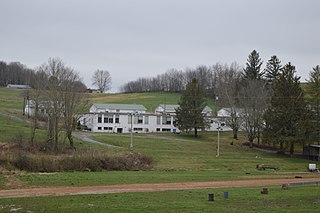
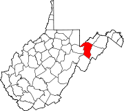
Gap Mills is an unincorporated community in Monroe County, West Virginia, United States. Established in 1775 and located on West Virginia Route 3 east of Union, Gap Mills has a post office with ZIP code 24941.
Frankford is an unincorporated community in Greenbrier County, West Virginia, United States. Frankford is located on U.S. Route 219, south of Falling Spring and north of Maxwelton. Frankford has a post office with ZIP code 24938.
Hansford is an unincorporated community in Kanawha County, West Virginia, United States. Hansford is located along the Kanawha River and West Virginia Route 61, adjacent to Pratt. Hansford has a post office with ZIP code 25103.
McWhorter is an unincorporated community and coal town in Harrison County, West Virginia, United States. McWhorter is 2 miles (3.2 km) northeast of Jane Lew.
Wallback is an unincorporated community in Clay and Roane counties, West Virginia, United States. Wallback is located at the junction of Interstate 79 and West Virginia Route 36, 7.5 miles (12.1 km) north-northwest of Clay. Wallback has a post office with ZIP code 25285.
Twin Branch is an unincorporated community in McDowell County, West Virginia, United States. Twin Branch is 1 mile (1.6 km) west-southwest of Davy. It was founded by Henry Ford as a mining community.
Rocksdale is an unincorporated community in Calhoun County, West Virginia, United States. Rocksdale is located along County Route 9 at the confluence of the Henry Fork and the West Fork Little Kanawha River, site of now closed post office established in late 1800s with a country store, 7.5 miles (12.1 km) east-northeast of Spencer.
Sanger is an unincorporated community in Fayette County, West Virginia, United States.
Weaver is an unincorporated community in Randolph County, West Virginia, United States.
Nuttallburg was an unincorporated community located in Fayette County, West Virginia, named by English pioneer John Nuttall who discovered coal in the area. Nuttallburg had a post office until 1955. It is no longer inhabited and is just outside Winona.
Waggy was an unincorporated community on the border of Braxton and Nicholas counties, West Virginia, United States, located just west of the Webster County line on the road from Bays to Erbacon and a logging railroad from Ramp Run. It was also known as Rose Hill.
Canterbury is an unincorporated community in Mingo County, West Virginia, United States. Its post office is closed.
Ben Lomond is an unincorporated community in Mason County, West Virginia, United States. It is located on the eastern bank of the Ohio River at the junction of West Virginia Route 2 and County Route 56,, some 9.7 miles (15.6 km) south-southwest of Point Pleasant.