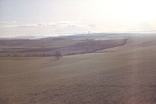
The Dorset Downs are an area of chalk downland in the centre of the county Dorset in south west England. The downs are the most western part of a larger chalk formation which also includes Cranborne Chase, Salisbury Plain, Hampshire Downs, Chiltern Hills, North Downs and South Downs.

Cranborne Chase is a chalk plateau in central southern England, straddling the counties Dorset, Hampshire and Wiltshire. The plateau is part of the English Chalk Formation and is adjacent to Salisbury Plain and the West Wiltshire Downs in the north, and the Dorset Downs to the south west. The scarp slope of the hills faces the Blackmore Vale to the west, and to some extent the Vale of Wardour to the north. The chalk gently slopes south and dips under clays and gravels. The highest point is Win Green Down, in Wiltshire, at 910 feet (280 m).
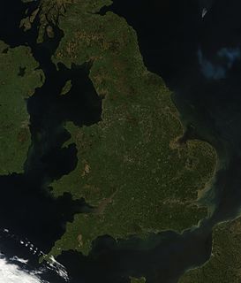
England comprises most of the central and southern two-thirds of the island of Great Britain, in addition to a number of small islands of which the largest is the Isle of Wight. England is bordered to the north by Scotland and to the west by Wales. It is closer to continental Europe than any other part of mainland Britain, divided from France only by a 33 km (21 mi) sea gap, the English Channel. The 50 km (31 mi) Channel Tunnel, near Folkestone, directly links England to mainland Europe. The English/French border is halfway along the tunnel.

The Shropshire Hills is an upland area and one of the natural regions of England. They lie wholly within the county of Shropshire and encompass several distinctive and well-known landmarks, such as the Long Mynd, Wenlock Edge, The Wrekin and the Clees.

Treverbyn is a civil parish and village in mid-Cornwall, England, United Kingdom.

Carnmenellis Hill gives its name to the area of west Cornwall in England, between Redruth, Helston and Penryn. The hill itself is situated approximately three miles (5 km) south of Redruth. It is one of five Marilyns in Cornwall; the others being Brown Willy, Kit Hill, Hensbarrow Beacon and Watch Croft. The natural region of Carnmenellis has been designated as national character area 155 by Natural England.

Hensbarrow Beacon is a hill in Cornwall, England, United Kingdom. It is situated a mile north-west of Stenalees village at grid reference SW 996 575. It is the highest natural point of the Hensbarrow uplands, a natural region and national character area.

The St Austell River properly known as the River Vinnick, but historically called The White River, is a 12 kilometres (7.5 mi) long river located in south Cornwall, England, United Kingdom. 50.337°N 4.793°W. The river has also been known as the "red river" due to tin streaming and mining activity upstream.
South Devon is the southern part of Devon, England. Because Devon has its major population centres on its two coasts, the county is divided informally into North Devon and South Devon. In a narrower sense "South Devon" is used to refer to the part of Devon south of Exeter and Dartmoor, including Plymouth, Torbay and the districts of South Hams, West Devon and Teignbridge.

The Dorset Heaths form an important area of heathland within the Poole Basin in southern England. Much of the area is protected.

The Weymouth Lowlands form a natural region on the south coast of England in the county of Dorset. Much of the area lies with the Dorset Area of Outstanding Natural Beauty.
The South Coast Plain is a natural region in England running along the central south coast in the counties of East and West Sussex and Hampshire.
The Oswestry Uplands are a small natural region in the English county of Shropshire on the border with Wales.

The Mid Somerset Hills are a major natural region in the county of Somerset in southwest west England, forming a series of low hills and ridges that divide up the Somerset Levels.

The Northumberland Sandstone Hills are a major natural region that lies entirely within the English county of Northumberland. Their sandstone hills form distinctive skylines with generally level tops, northwest facing scarps and craggy outcrops offering exceptional views to the Cheviots further west.

The Mid Severn Sandstone Plateau is a rural landscape and one of the natural regions of central England, straddling the border between the counties of Shropshire and Staffordshire. It stretches from the western fringes of the Birmingham conurbation to Telford in the north and Kidderminster in the south. The major feature of the plateau is the valley of the River Severn, which cuts through it from north to south. It consists of Permian and Triassic-age New Red Sandstone getting older as one goes west until one reaches Silurian and Carboniferous-age siltstones and coals west of the river.
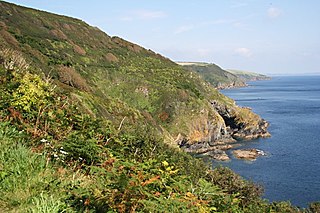
The Cornish Killas is a natural region covering most of the county of Cornwall in southwest England. It has been designated as National Character Area 152 by Natural England.
Poole Basin is a geological formation that forms the western part of the much larger Hampshire Basin from which it is separated by the River Avon.

The Devon Redlands is a natural region in southwest Britain that has been designated as National Character Area (NCA) 148 by Natural England.

The Vale of Taunton and Quantock Fringes form a natural region in the southwest of England in the county of Somerset. Natural England have designated the Vale of Taunton and Quantock Fringes as National Character Area 146.
