
Fowey is a port town and civil parish at the mouth of the River Fowey in south Cornwall, England, United Kingdom. The town has been in existence since well before the Norman invasion, with the local church first established some time in the 7th century; the estuary of the River Fowey forms a natural harbour which enabled the town to become an important trading centre. Privateers also made use of the sheltered harbourage. The Lostwithiel and Fowey Railway brought China clay here for export.

St Austell is a town in Cornwall, England, 10 miles (16 km) south of Bodmin and 30 miles (48 km) west of the border with Devon.

Charlestown is a village and port on the south coast of Cornwall, England, in the civil parish of St Austell Bay. It is situated approximately 2 miles (3 km) south east of St Austell town centre.

A clay pit is a quarry or mine for the extraction of clay, which is generally used for manufacturing pottery, bricks or Portland cement. Quarries where clay is mined to make bricks are sometimes called brick pits.
Luxulyan, also spelt Luxullian or Luxulian, is a village and civil parish in mid Cornwall, England, United Kingdom. The village lies four miles (6.5 km) northeast of St Austell and six miles (10 km) south of Bodmin. The population of the parish was 1,371 in the 2001 census. This had risen to 1,381 at the 2011 census.

Trewoon is a village in south Cornwall, England, United Kingdom. It is on the western outskirts of St Austell, on the A3058 road and is a linear settlement, with housing estates, a village hall, park and playing fields. The village has many amenities and local businesses: a garage, a post office, a Convenience store, hairdressers, "The White Pyramid" pub, and Trinity Methodist church.
The Lansalson branch line was a railway line built by the Great Western Railway (GWR) to serve the china clay industry in the Trenance valley near St Austell in Cornwall, UK. The line was authorised by the GWR in 1910 and after setbacks due to World War I the line opened to Bojea Sidings on 1 May 1920 for mineral and goods traffic only, and to Lansalson Sidings on 24 May 1920. It closed in 1968.

St Dennis is a civil parish and village in Cornwall, England, United Kingdom. The village is situated on the B3279 between Newquay and St Austell.

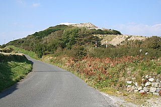
Roche is a civil parish and village in mid-Cornwall, England. The village gets its name from the 20-metre (66-foot) high Roche Rock, a quartz-schorl outcrop east of the village. Roche is the Norman-French word for Rock. The parish population at the 2011 census including Belowda, Bilberry, Carbis, Coldvreath and Criggan is 3,381, and the ward population at the same census was 3,867.

The Gover Stream is an approximately 3 kilometres (1.9 mi) long stream located in mid south Cornwall, England, United Kingdom.

The Clay Trails are a series of bicycle trails located in mid Cornwall, England, United Kingdom. The trails pass through the St Austell moorland which for over two centuries has been extensively quarried for china clay, hence the name.

Pentewan is a coastal village and former port in south Cornwall, England, United Kingdom. It is situated at grid reference SX 019 472 3 miles (4.8 km) south of St Austell at the mouth of the St Austell River.
Foxhole is a village in mid Cornwall, England, in the United Kingdom. It lies within the parish of St Stephen-in-Brannel, and has a primary school.
The St Austell and Clay Country Eco-town is a plan to build a new town on a cluster of sites owned by mining company Imerys near St Austell, in Cornwall, UK. The plan was given outline government approval in July 2009. The plan would need to gain full planning permission before construction commenced.

The St Austell River properly known as the River Vinnick, but historically called The White River, is a 12 kilometres (7.5 mi) long river located in south Cornwall, England, United Kingdom. 50.337°N 4.793°W. The river has also been known as the "red river" due to tin streaming and mining activity upstream.
St Austell Clay Pits, are a group of locations within active china clay quarries that form a single Site of Special Scientific Interest (SSSI) and Special Area of Conservation, noted for its biological characteristics. In particular, the site is known for the rare western rustwort, a plant that grows only at two other sites in the UK.


