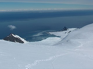
Porpoise Bay is an ice-filled embayment about 90 miles (140 km) wide indenting the coast of Antarctica between Cape Goodenough and Cape Morse. The United States Exploring Expedition (1838–42) under Charles Wilkes applied the name "Porpoise Bay", after the USEE brig "Porpoise", to a large bay at about 66°S, 130°E. US-ACAN's identification of Porpoise Bay is based on the correlation of Wilkes' chart (1840) with G.D. Blodgett's reconnaissance map (1955) compiled from air photos taken by USN Operation Highjump (1946–47). The name has been applied to the large embayment lying close southwest in keeping with Wilkes' original naming.
Princess Martha Coast is the portion of the coast of Queen Maud Land lying between 05° E and the terminus of Stancomb-Wills Glacier, at 20° W. The entire coastline is bounded by ice shelves with ice cliffs 20 to 35 metres high.

Bransfield Strait or Fleet Sea is a body of water about 100 kilometres (60 mi) wide extending for 300 miles (500 km) in a general northeast – southwest direction between the South Shetland Islands and the Antarctic Peninsula.

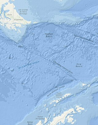
The Shackleton Fracture Zone (SFZ) is an undersea fracture zone, mid-oceanic ridge and fault located in the Drake Passage, at the separation between the Scotia plate from the Antarctic plate. It extends between 59° and 60°40' south latitude and between 56°30' and 61° west longitude and runs in a northwest to southeast direction from the South American continental shelf to the South Shetland Islands. Chile claims the area as part of its Outer Continental Shelf boundary.
Iselin Bank is a submarine bank in the Ross Sea off Antarctica. The name was approved by the Advisory Committee for Undersea Features in April 1980.
JOIDES Basin is a northeast trending undersea basin of the central Ross continental shelf. It was named for the "Joint Oceanographic Institutes Deep Earth Sampling" project, the name being approved by the Advisory Committee for Undersea Features in June 1988.
Endurance Ridge is an Antarctic undersea ridge, south-east of Coronation Island in the South Atlantic Ocean. It was named after the Endurance Expedition of 1914–1917, and its name was approved by the Advisory Committee for Undersea Features in June 1987.

Union Glacier, is a large, heavily crevassed glacier which receives the flow of several tributaries and drains through the middle of the Heritage Range, Ellsworth Mountains, Antarctica. The glacier drains from the plateau at Edson Hills on the west side of the range and flows east between Pioneer Heights and Enterprise Hills. Union Glacier was mapped by U.S. Geological Survey (USGS) from surveys and U.S. Navy (USN) air photos, 1961–66. The name was applied by Advisory Committee on Antarctic Names (US-ACAN) in association with the name Heritage Range.
The Antipodes fracture zone is an undersea fracture zone named in association with Antipodes Island. The name was proposed by Dr. Steven C. Cande of the Scripps Institution of Oceanography, and approved by the Advisory Committee on Undersea Features in September 1997.

Balleny Seamounts are seamounts named in association with the Balleny Islands. The name was approved by the Advisory Committee for Undersea Features in June 1988.
Belgrano Bank is an undersea bank in the Weddell Sea. It is named after General Manuel Belgrano, an Argentine general and revolutionary hero, after whom the main Argentine Antarctic base is also named. The name of the bank was approved by the Advisory Committee for Undersea Features in June, 1988.
Colbeck Basin is a deep undersea basin of the central Ross Ice Shelf named in association with Cape Colbeck. The name was approved by the Advisory Committee for Undersea Features in June 1988.
Kosminskaya Fracture Zone is an undersea fracture zone named for Professor Irina Kosminskaya, a Russian scientist specializing in Marine Geophysics and Seismology. The name was proposed by Dr. Galina Agapova of the Geological Institute of the Russian Academy of Sciences, and was approved by the Advisory Committee on Undersea Features in September 1997.
Vinogradov Fracture Zone is an Antarctic undersea fracture zone named for Alexandr Vinogradov, a Russian scientist/geochemist and first Director of the Vernadsky Institute of Geochemistry (GEOKHI). The name was proposed by Dr. Galina Agapova of the Geological Institute of the Russian Academy of Sciences, and was approved in September 1997.
Pitman fracture zone is an undersea fracture zone named for Dr. Walter C. Pitman III, a geophysicist and pioneer in studies of continental drift and seafloor spreading. Name proposed by Drs. Cande, Haxby and Raymond, Lamont–Doherty Geological Observatory ; name approved 3/93.
Pendleton Strait is a strait between Rabot and Lavoisier Islands, in the Biscoe Islands. The French Antarctic Expedition, in accordance with Charcot's conception of this water feature, applied the name Pendleton Bay in January 1909. The British Graham Land Expedition (BGLE) under Rymill, 1934–37, recognizing that it is really a strait, renamed it Pendleton Strait. Named by Charcot for Captain Benjamin Pendleton, Yankee sealer of Stonington, CT. Captain Pendleton was commodore of the little fleet which included the sloop Hero under Captain Nathaniel B. Palmer who, at Pendleton's direction, explored this area in January 1821.
Explora Knoll is an undersea knoll named for the Antarctic science ship F.S. Explora. The name was proposed by Dr. Heinrich Hinze of the Alfred Wegener Institute for Polar and Marine Research, Bremerhaven, Germany, and was approved by the Advisory Committee for Undersea Features in June 1997.
The Heirtzler fracture zone is an undersea fracture zone located south of New Zealand, near Antarctica.
The Hjort Fracture Zone is an undersea fracture zone in Antarctica. The name was approved by the Advisory Committee for Undersea Features in December 1971.
The Hofmann Trough is a submarine bank in the Weddell Sea. It is named for Walther Hofmann (1920–1993), a cartographer/photogrammetrist on polar expeditions. The name was proposed by Heinrich Hinze of the Alfred Wegener Institute for Polar and Marine Research, Bremerhaven, Germany, and was approved by the Advisory Committee for Undersea Features in June 1997.


