
Attala County is a county located in the U.S. state of Mississippi. As of the 2020 census, the population was 17,889. Its county seat is Kosciusko. Attala County is named for Atala, a fictional Native American heroine from an early-19th-century novel of the same name by François-René de Chateaubriand.

Sallis is a town in Attala County, Mississippi, United States. The population was 134 at the 2010 census.

Kosciusko is a city in Attala County, Mississippi, United States. The population was 7,402 at the 2010 census. It is the county seat of Attala County.

USS Attala (APA-130) was a Haskell-class attack transport in service with the United States Navy from 1944 to 1946. She was scrapped in 1974.

The Yockanookany River is a 78.4-mile-long (126.2 km) river in central Mississippi in the United States. It is a tributary of the Pearl River, which flows to the Gulf of Mexico.

Mississippi Highway 43 is a state highway in Mississippi that generally runs north–south in three segments: the first from US 90 near Bay St. Louis to MS 13 south of Columbia, resuming at MS 13 in southern Jefferson Davis County to end near Mendenhall, and finally starting again at MS 18 near Puckett to end at Attala Road 3122 in northern Attala County. It traverses approximately 235 miles (378 km), serving Hancock, Pearl River, Marion, Jefferson Davis, Lawrence, Simpson, Rankin, Madison, Leake, and Attala counties.
The Attala County School District is a public school district based in Attala County, Mississippi (USA).
Holmes Community College is a public community college with its main campus in Goodman, Mississippi. It also has campuses in Grenada and Ridgeland, and satellite campuses in Attala, Webster, and Yazoo counties.

McAdams is an unincorporated community in Attala County, Mississippi, United States. McAdams is located on Mississippi Highway 12 and is approximately 4 miles (6.4 km) east of Sallis and approximately 6 miles (9.7 km) west of Kosciusko.

This is a list of the National Register of Historic Places listings in Attala County, Mississippi.

The tornado outbreak of April 22–25, 2010 was a multi-day tornado outbreak across a large portion of the Southern United States, originally starting in the High Plains on April 22, 2010, and continuing through the Southern Plains on April 23, and the Mississippi and Tennessee Valleys on April 24. The most severe activity was on April 24, particularly in Mississippi. The outbreak was responsible for ten tornado-related fatalities on April 24, all in Mississippi from a single supercell that crossed the entire state.
Zama is an unincorporated community in Attala County, Mississippi, United States. A post office operated under the name Ayres from 1891 to 1908 and under the name Zama from 1918 to 1964. On April 27, 2011, a tornado hit the Zama area as part of the 2011 Super Outbreak, causing heavy tree and power line damage. The tornado was rated EF1, with estimated wind speeds of 95 mph. The tornado destroyed a barn in its path of destruction of 50 yards (46 m) wide as it travelled a path of 1 mile (1.6 km).
Timothy L. "Tim" Johnson is an American politician. Johnson was a member of the Mississippi State Senate representing District 19 from 1995 to 2003 as a Republican. The district encompassed Attala, Leake and Madison counties.
Valena is a ghost town in Attala County, Mississippi, United States.

The COVID-19 pandemic reached the U.S. state of Mississippi in March 2020.

Icey Wiley Day was a longtime Democratic member of the Mississippi House of Representatives, representing Attala County. He was blind.
James Carlisle Wasson was a Democratic member of the Mississippi House of Representatives, representing Attala County, from 1916 to 1920.
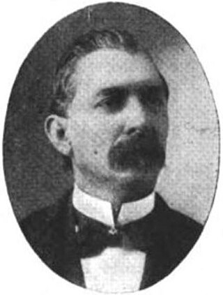
James Franklin McCool was an American Democratic politician and jurist. He was a member of the Mississippi House of Representatives from 1882 to 1886 and from 1896 to 1900, and was its Speaker during the latter term.

Possumneck is an unincorporated community located in Attala County, Mississippi, United States, along Mississippi Highway 19 and is approximately 4.3 miles (6.9 km) south-southeast of West.

