
Attala County is a county located in the U.S. state of Mississippi. As of the 2010 census, the population was 19,564. Its county seat is Kosciusko. Attala County is named for Atala, a fictional Native American heroine from an early-19th-century novel of the same name by François-René de Chateaubriand.

The 1974 Super Outbreak was the second-largest tornado outbreak on record for a single 24-hour period, just behind the 2011 Super Outbreak. It was also the most violent tornado outbreak ever recorded, with 30 F4/F5 tornadoes confirmed. From April 3 to 4, 1974, there were 148 tornadoes confirmed in 13 U.S. states and the Canadian province of Ontario. In the United States, tornadoes struck Illinois, Indiana, Michigan, Ohio, Kentucky, Tennessee, Alabama, Mississippi, Georgia, North Carolina, Virginia, West Virginia, and New York. The outbreak caused roughly $843 million USD with more than $600 million in damage occurring in the United States. The outbreak extensively damaged approximately 900 sq mi (2,331 km2) along a total combined path length of 2,600 mi (4,184 km). At one point, as many as 15 separate tornadoes were on the ground simultaneously.

Hurricane Katrina's winds and storm surge reached the Mississippi coastline on the morning of August 29, 2005. beginning a two-day path of destruction through central Mississippi; by 10 a.m. CDT on August 29, 2005, the eye of Katrina began traveling up the entire state, only slowing from hurricane-force winds at Meridian near 7 p.m. and entering Tennessee as a tropical storm. Many coastal towns of Mississippi had already been obliterated, in a single night. Hurricane-force winds reached coastal Mississippi by 2 a.m. and lasted over 17 hours, spawning 11 tornadoes and a 28-foot storm surge flooding 6–12 miles (10–19 km) inland. Many, unable to evacuate, survived by climbing to attics or rooftops, or swimming to higher buildings and trees. The worst property damage from Katrina occurred in coastal Mississippi, where all towns flooded over 90% in hours, and waves destroyed many historic buildings, with others gutted to the 3rd story. Afterward, 238 people died in Mississippi, and all counties in Mississippi were declared disaster areas, 49 for full federal assistance. Regulations were changed later for emergency centers and casinos. The emergency command centers were moved higher because all 3 coastal centers flooded at 30 ft (9 m) above sea level. Casinos were allowed on land rather than limited to floating casino barges as in 2005.

This page documents notable tornadoes and tornado outbreaks worldwide in 2006. Strong and destructive tornadoes form most frequently in the United States, Bangladesh, and Eastern India, but they can occur almost anywhere under the right conditions. Tornadoes also develop occasionally in southern Canada during the Northern Hemisphere's summer and somewhat regularly at other times of the year across Europe, Asia, Argentina, Brazil and Australia. Tornadic events are often accompanied with other forms of severe weather, including strong thunderstorms, strong winds, and hail.
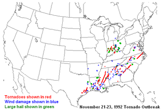
The Tornado outbreak of November 1992, sometimes referred to as The Widespread Outbreak, was a devastating, three-day outbreak that struck the Eastern and Midwestern United States on November 21-23. This exceptionally long-lived and geographically large outbreak produced 95 tornadoes over a 41 hour period, making it one of the longest-lasting and largest outbreaks ever recorded in the US, and published studies of the outbreak have indicated the possibility of even more tornadoes. There were 26 fatalities, 641 injuries, and over $300 million in damage.

A violent severe weather outbreak struck the Southeast on April 4–5, 1977. A total of 21 tornadoes touched down with the strongest ones occurring in Mississippi, Alabama, and Georgia. The strongest was a catastrophic F5 tornado that struck the Northern Birmingham, Alabama suburbs during the afternoon of Monday, April 4, 1977. In the end, the entire outbreak directly caused 24 deaths and over 200 injuries. The storm system also caused the crash of Southern Airways Flight 242, which killed 72 and injured 22.
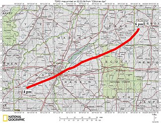
A destructive series of four tornadoes hit the Southeastern United States during March 3-4, 1966. The worst event was a violent and long-lived F5 tornado, dubbed the Candlestick Park tornado after the name of a Jackson, Mississippi shopping mall which was leveled by the storm, that wrought catastrophic damage in Mississippi and Alabama along a 202.5 mi (325.9 km) track. The outbreak killed 58, injured 521, and caused $75.552 million in damage.
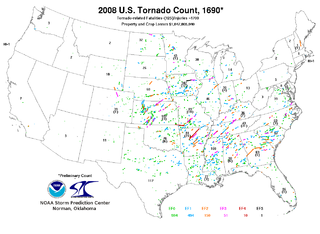
This page documents notable tornadoes and tornado outbreaks worldwide in 2008. Strong and destructive tornadoes form most frequently in the United States, Bangladesh, and Eastern India, but they can occur almost anywhere under the right conditions. Tornadoes also develop occasionally in southern Canada during the Northern Hemisphere's summer and somewhat regularly at other times of the year across Europe, Asia, and Australia. Tornadic events are often accompanied with other forms of severe weather, including strong thunderstorms, strong winds, and hail.

The February 1971 Mississippi Delta tornado outbreak struck portions of the Lower Mississippi River Valley and the Southeastern United States on February 21–22. The two-day tornado outbreak produced at least 19 tornadoes, and probably several more, mostly brief events in rural areas; killed 123 people across three states; and "virtually leveled" entire communities in the state of Mississippi. Three violent, long-lived tornadoes—two of which may have been tornado families—in western Mississippi and northeastern Louisiana caused most of the deaths along 300 miles (483 km) of path. One of the tornadoes attained F5 intensity in Louisiana, the only such event on record in the state, although the rating is disputed. The outbreak also generated strong tornadoes from Texas to Ohio and North Carolina. The entire outbreak is the second deadliest ever in February, behind only the Enigma tornado outbreak in 1884 and ahead of the 2008 Super Tuesday tornado outbreak. February 21 was the fourth-deadliest day for tornadoes in Mississippi on record. At one point, the National Weather Service WSR-57 radar in Jackson, Mississippi, reported four hook echoes, often indicative of tornado-producing supercells, simultaneously.

In 2009, tornadic activity was generally near average. Each year, tornadoes and tornado outbreaks occur worldwide primarily under conductive conditions, though a majority of tornadoes form in the United States. Tornadoes also occur to a less frequent extent in Europe, Asia, and Australia. In the U.S., there were 1,304 reports of tornadoes received by the Storm Prediction Center (SPC), and 1,159 tornadoes were confirmed to have taken place. Worldwide, 45 fatalities were caused by tornadoes; 22 in the United States, 20 in India, eight in the Philippines, four in Canada, two in Greece and one each in Serbia and Russia.
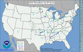
This page documents the tornadoes and tornado outbreaks of 2010. The majority of tornadoes form in the U.S., but they can occur almost anywhere under the right conditions. A lesser number occur outside the U.S., most notably in parts of neighboring southern Canada during the Northern Hemisphere's summer season, but are also known in South America, Europe, Asia, and Australia.

The tornado outbreak of April 22–25, 2010 was a multi-day tornado outbreak across a large portion of the Southern United States, originally starting in the High Plains on April 22, 2010 and continuing through the Southern Plains on April 23, and the Mississippi and Tennessee Valleys on April 24. The most severe activity was on April 24, particularly in Mississippi. The outbreak was responsible for ten tornado-related fatalities on April 24, all in Mississippi from a single supercell that crossed the entire state.

This page documents the tornadoes and tornado outbreaks of 2011. Extremely destructive tornadoes form most frequently in the United States, Bangladesh, Brazil and Eastern India, but they can occur almost anywhere under the right conditions. Tornadoes also appear regularly in neighboring southern Canada during the Northern Hemisphere's summer season, and somewhat regularly in Europe, Asia, and Australia.

The tornado outbreak of April 14–16, 2011 was among the largest recorded tornado outbreaks in U.S. history, producing 178 confirmed tornadoes across 16 states and severe destruction on all three days of the outbreak. A total of 38 people were killed from tornadoes and an additional five people were killed as a result of straight-line winds associated with the storm system. The outbreak of severe weather and tornadoes led to 43 deaths in the Southern United States. This was the largest number of fatalities in an outbreak in the United States since the 2008 Super Tuesday tornado outbreak. However, this outbreak was soon surpassed no less than two weeks later by the 2011 Super Outbreak, which killed 324 people.

Hesterville is an unincorporated community in Attala County, Mississippi, United States. A post office operated under the name Hesterville from 1881 to 1923. On April 27, 2011, a tornado reportedly hit the Hesterville area along the Mississippi State Highway 19 corridor as part of the 2011 Super Outbreak, downing numerous trees and rolling some trailers onto County Road 3031.

Poplar Creek is an unincorporated community in Montgomery County, Mississippi. On April 27, 2011, a tornado hit the Poplar Creek area as part of the 2011 Super Outbreak, causing heavy tree and power line damage. The tornado was classified rated EF2, with estimated wind speeds of 125 mph. The path of destruction was 1 mile (1.6 km) wide and the tornado travelled a path of 11.5 miles (18.5 km).

Endville is an unincorporated community in Pontotoc County, Mississippi, United States.

The 2011 Hackleburg–Phil Campbell tornado was an extremely violent and long-tracked EF5 wedge tornado that devastated several towns in rural northern Alabama, before tearing through the northern suburbs of Huntsville and causing damage in rural portions of southern Tennessee on the afternoon and early evening of April 27, 2011. It was the deadliest tornado of the 2011 Super Outbreak, the largest tornado outbreak in United States history. The tornado reached a maximum width of 1.25 miles (2.01 km) and was estimated to have had peak winds of 210 mph (340 km/h). The tornado killed 72 people, making it the deadliest tornado in Alabama history, and injured at least 145 others. At the time, it was the deadliest tornado to strike the United States since the 1955 Udall, Kansas, tornado.

This page documents the tornadoes and tornado outbreaks of 2014. Strong and destructive tornadoes form most frequently in the United States, Bangladesh, Brazil, and Eastern India, but they can occur almost anywhere under the right conditions. Tornadoes also appear regularly in neighboring southern Canada during the Northern Hemisphere's summer season, and somewhat regularly in Europe, Asia, and Australia.
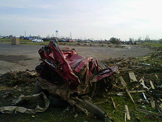
On April 27, 2011, an extremely violent EF5 wedge tornado, with estimated winds of up to 205 mph (330 km/h), struck the town of Smithville, Mississippi at 3:47 p.m. CDT on April 27, resulting in catastrophic damage and numerous fatalities.


