The Shumagin Islands are a group of 20 islands in the Aleutians East Borough south of the mainland of Alaska, United States, at 54°54'–55°20' North 159°15'–160°45' West. The largest islands are Unga Island, Popof Island, Korovin Island, and Nagai Island. Other islands include Andronica, Big Koniuji, Little Koniuji, Simeonof, Chernabura, and Bird. The total land area is 1,192.369 km2 and their total population as of the 2000 census was 953 persons, almost entirely in the city of Sand Point, on Popof Island.
Pearse Island is an island in western British Columbia, Canada, in the Portland Inlet, an inlet of the Pacific Ocean. The island was first charted in 1793 by George Vancouver during his 1791-95 expedition. It was named by George Henry Richards, captain of HMS Plumper, circa 1860, in honour of William Alfred Rombulow Pearse of the Royal Navy, who had been commander of HMS Alert.

Khutzeymateen Inlet is one of the lesser principal inlets of the British Columbia Coast. It is important in being part of the first area in Canada protected to preserve grizzly bears and their habitat via the Khutzeymateen Grizzly Bear Sanctuary. The inlet and the park-sanctuary surrounding it are between the mouths of the Skeena and Nass Rivers; the Khutzeymateen is the next inlet north from Work Inlet, which is the north side of the Tsimpsean Peninsula of "Greater Prince Rupert". The inlet's mouth opens onto an arm of Portland Inlet, Steamer Passage, which lies next to Sommerville Island. The entrance to Khutzeymateen Inlet is between Keemein Point and Welgeegenk Point. The closest community is Port Simpson.

Princess Royal Island is the largest island on the North Coast of British Columbia, Canada. It is located amongst the isolated inlets and islands east of Hecate Strait on the British Columbia Coast. At 2,251 square kilometres (869 sq mi), it is the fourth largest island in British Columbia. Princess Royal Island was named in 1788 by Captain Charles Duncan, after his sloop, the Princess Royal.
Eskers Provincial Park is a provincial park in British Columbia, Canada. The park comprises roughly 3,979 hectares and was created in 1987. Located west of Nukko Lake, which lies northwest of the city of Prince George, it protects an area of the 40-kilometre (25 mi) Stuart River Eskers Complex. Eskers are winding ridges of gravel formed by the glaciers which once covered the British Columbia Interior.
There are several lakes named Mud Lake within the Canadian province of Alberta.

The Bonaparte Indian Band a.k.a. Bonaparte First Nation, is a member band of the Shuswap Nation Tribal Council of the Secwepemc (Shuswap) people.
The Alkali Lake Indian Band, also known as the Esketemc First Nation, is a First Nations government of the Secwepemc (Shuswap) people, located at Alkali Lake in the Cariboo region of the Central Interior of the Canadian province of British Columbia. It was created when the government of the then-Colony of British Columbia established an Indian Reserve system in the 1860s. It is one of three Secwepemc bands that is not a member of either the Shuswap Nation Tribal Council or the Northern Shuswap Tribal Council.

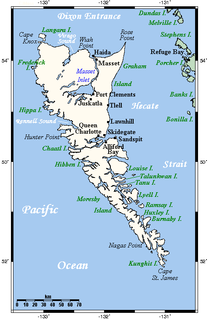
Tow Hill is a large isolated volcanic plug located 21 km (13 mi) east of Masset on the north end of the Naikoon Peninsula of northeast Graham Island in Haida Gwaii, British Columbia, Canada, east of McIntyre Bay and near the mouth of the Hiellen River, which is the site of Hiellen, a now-abandoned Haida village and of the Hiellen Indian Reserve No. 2, on the site of that village. Formerly Tow Hill Provincial Park, it is now part of Naikoon Provincial Park, which covers most of the northeastern flatland of Graham Island.
Marie Canyon is a canyon on the Cowichan River, just below Skutz Falls, on southern Vancouver Island, British Columbia, Canada.
Cancajanag is located within the municipal boundary of Dagami in the province of Leyte, on the island of Leyte, Region VIII, of the Philippines.
The Tahltan First Nation, also known as the Tahltan Indian Band, is a band government of the Tahltan people. Their main community and reserves are located at Telegraph Creek, British Columbia. Their language is the Tahltan language, which is an Athabaskan language also known as Nahanni, is closely related to Kaska and Dunneza. Their Indian and Northern Affairs Canada band number is 682. The Tahltan First Nation is joined with the Iskut First Nation in a combined tribal council-type organization known as the Tahltan Nation.

The Iskut River is the largest tributary of the Stikine River in northwestern British Columbia, Canada, entering it a few miles above its entry into Alaska.
Thompson Sound is a sound on the Central Coast of British Columbia, Canada, located on the east side of Tribune Channel and to the east of Gilford Island, part of the Broughton Archipelago. The headland on the north side of the sound's entrance is London Point at 50°46′09″N126°07′07″W. The south side of the entrance is demarcated by Cleave Point at 50°44′35″N126°07′28″W.
Hiellen 2, properly known as Hiellen Indian Reserve No. 2, is an Indian Reserve on the north coast of Graham Island in the Queen Charlotte Islands, British Columbia, Canada. It is located at the mouth of the Hiellen River and is the site of the former Haida village of Hiellen, once one of the largest and most important. The reserve is under the administration of the Old Massett Village Council and is 27.4 ha in size.
Tyoax Pass is a mountain pass in the Chilcotin Ranges of the Pacific Ranges, the southernmost main subdivision of the Coast Mountains of British Columbia, Canada. Located at the head of Tyaughton Creek, a north tributary of the Bridge River, it connects the basin of the Bridge River with that of Big Creek in the southern Chilcotin District, and is therefore at the boundary between the Spruce Lake Protected Area and Big Creek Provincial Park.
Tahltan Indian Reserve No. 10, referred to by Statistics Canada for census purposes as Tahtlan 10, is an Indian Reserve of the Tahltan First Nation located one mile north of the confluence of the Klastline River with the Stikine in the Stikine Country of the northwestern British Columbia Interior of Canada.
Esowista Indian Reserve No. 3, also known as Esowista 3, is an Indian reserve located on the Esowista Peninsula in the Clayoquot Sound region of the west coast of Vancouver Island, British Columbia, Canada. Located at the head of Wickaninnish Bay, just east of Schooner Cove, it is part of the group of reserves under the governance of the Tla-o-qui-aht First Nations of the Nuu-chah-nulth peoples. Its population in 2006 was 160.

Dodelen Glacier is the 3.6 km long and 2.8 km wide glacier on Pasteur Peninsula, Brabant Island in the Palmer Archipelago, Antarctica, situated southwest of Podayva Glacier, northwest of Lister Glacier and north of Oshane Glacier. It drains the west slopes of Mount Hunter in Stribog Mountains, and flows westwards into Guyou Bay.