Richford is a town in Franklin County, Vermont, United States, located along the Canada–United States border. The population was 2,308 at the 2010 census.

Derby is a town in Orleans County, Vermont, United States. The population was 4,604 at the 2000 census. The town contains four unincorporated villages: Beebe Plain, Clyde Pond, Lake Salem and North Derby; and two incorporated villages: Derby Center and Derby Line.

Abercorn is a village in the Brome-Missisquoi Regional County Municipality in the Montérégie region of Québec, Canada. The population as of the Canada 2011 Census was 391.
Shefford County is an historical county in southern Québec, Canada. It is named after Shefford, a small town in Bedfordshire county, England of the same name and is in the Eastern Townships region of Québec.

Beebe Plain is an unincorporated community in the town of Derby in Orleans County, Vermont, United States which extends into the Canadian municipality of Stanstead, Quebec. The village is divided by the Canada–United States border between Canada and the United States; the Canadian portion of Beebe Plain had the status of an incorporated municipality in its own right until 1995.
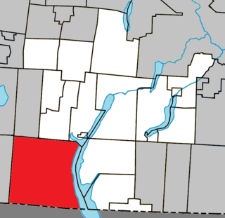
Missisquoi County is a historical county in Quebec. It was formed between 1825 and 1831 and included historical Bedford County. In the early 1980s Quebec abolished its counties. Much of Missisquoi County became the Brome-Missisquoi Regional County Municipality except the southwestern part was transferred to Le Haut-Richelieu Regional County Municipality.
The Central Vermont Railway was a railroad that operated in the U.S. states of Connecticut, Massachusetts, New Hampshire, New York, and Vermont, as well as the Canadian province of Quebec.
Brome County, is a historical county of Quebec. It takes its name from the name of a manor in the parish of Barham in Kent, England that was named after the broom plant. It was named by English surveyors. The earliest settlers to this region were brought from New Hampshire by the Quaker leader, Nicholas Austin in the 1790s. The county was formed in 1855 from parts of Stanstead, Shefford and Missisquoi counties. The county is located in the Eastern Townships, one of the 12 regions of Quebec. The county lies in the foothills of the Appalachian Mountains. Its eastern half is rolling countryside while its western half is part of the Richelieu River plains.

The Missisquoi River is a tributary of Lake Champlain, approximately 80 mi (130 km) long, in northern Vermont in the United States and southern Quebec in Canada. It drains a rural area of the northern Green Mountains along the Canada–US border northeast of Lake Champlain, and an area of Quebec's Eastern Townships. The South Branch rises in Vermont and runs generally from southeast to northwest; the North Branch rises in Lake d'Argent in Eastman, Quebec, and runs from north to south. The North Branch and the South Branch join at Highwater, Quebec, just downriver from North Troy, Vermont. The river then runs in Quebec for approximately 15 miles (24 km), re-entering Vermont at Richford and thence to Lake Champlain's Missisquoi Bay.

Lake Memphremagog is a fresh water glacial lake located between Newport, Vermont, United States and Magog, Quebec, Canada. The lake spans both Quebec and Vermont, but is mostly in Quebec. Most of the watershed that feeds the lake is located in Vermont, and is a source for accumulated phosphorus, sediments and other pollutants. Cleanup efforts since the late 1980s have improved the water quality. The lake furnishes potable (drinking) water for 200,000 people.

Route 243 is a north/south highway on the south shore of the Saint Lawrence River. Its northern terminus is in Saint-Félix-de-Kingsey at the junction of Route 255 and its southern terminus is in the township of Potton where it crosses the Canada–US border at the North Troy-Highwater Border Crossing into Vermont and becomes Vermont Route 243. Route 243 is not a busy highway as it does not go through big towns.

Mansonville is a village in the Potton township of the Eastern Townships of Quebec, Canada, in Memphrémagog Regional County Municipality of the Estrie region, across the Canada–United States border from North Troy, Vermont. Now Mansonville is the business center and the seat of Municipalite du canton de Potton.
The Northern Forest Canoe Trail (NFCT) is a 740-mile (1,190 km) marked canoeing trail in the northeastern United States and Canada, extending from Old Forge in the Adirondacks of New York to Fort Kent, Maine. Along the way, the trail also passes through the states and provinces of Vermont, Quebec, and New Hampshire. The trail was opened on June 3, 2006.
Orford is a provincial electoral district in the Estrie region of Quebec, Canada that elects members to the National Assembly of Quebec. It includes the township of Orford, the township of Hatley and the municipality of Hatley, the cities of Magog and North Hatley, the township of Stanstead and the city of Stanstead, and various other municipalities.

The Tomifobia River is a flowing body of fresh water in Memphremagog Regional County Municipality, in the Eastern Townships, in the province of Quebec, in Canada. The river forms a part of an international border between Canada and the United States near the village of Beebe Plain, Vermont.

The North Troy–Highwater Border Crossing connects the town of Highwater, Quebec with North Troy, Vermont on the Canada–US border. It is located at the meeting point of Vermont Route 243 and Quebec Route 243. Both stations are open 24 hours per day for non-commercial traffic; the Canadian station is open to commercial traffic on weekdays during business hours. The former US station facilities, dating to the 1930s, are listed on the National Register of Historic Places.
The Massawippi Valley Railway was a short line railway established 1870 between Lennoxville, Quebec, and the Vermont border. Part of the Quebec Central Railway from 1926, the line was abandoned in 1990 and removed in 1992. Most of the former railway's path is now bicycle trails.

Vermont Route 139 (VT 139) is a state highway in the U.S. state of Vermont. The highway, which lies within Richford in northern Franklin County, has a length of 1.822 miles (2.932 km) from VT 105 north to the Canada–United States border. VT 139 provides access to the Richford–Abercorn Border Crossing, from which the highway continues as Quebec Route 139.