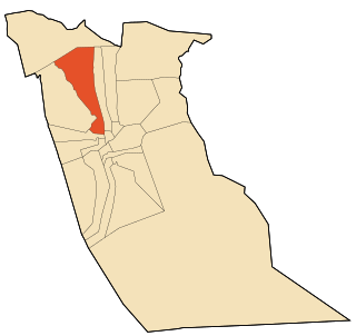
Guemar is a Saharan oasis town in Algeria near the Tunisian border, in the Oued Souf area of the El Oued Province, about 20 km north of El Oued. It includes a zaouia and a border post. According to the 2008 census it has a population of 39,168, up from 29,185 in 1998, with an annual growth rate of 3.0%.

Bundesautobahn 1 is an autobahn in Germany. It runs from Heiligenhafen in Schleswig-Holstein to Saarbrücken, a distance of 749 km (465 mi), but is incomplete between Cologne and Trier. B 207 continues north from Heiligenhafen to Puttgarden, at the end of the island of Fehmarn, with a ferry to Rødby, Denmark.

Bundesautobahn 7 is the longest German Autobahn and the longest national motorway in Europe at 963 km. It bisects the country almost evenly between east and west. In the north, it starts at the border with Denmark as an extension of the Danish part of E45. In the south, the autobahn ends at the Austrian border. This final gap was closed in September 2009.

The autoroute system in France consists largely of toll roads. It is a network of 11,882 km (7,383 mi) of motorways as of 2014. On road signs, autoroute destinations are shown in blue, while destinations reached through a combination of autoroutes are shown with an added autoroute logo. Toll autoroutes are signalled with the word péage.

The M7 motorway is a Hungarian motorway which runs from Budapest towards the Croatian border at Letenye, reaching Székesfehérvár, then Siófok, a town on Lake Balaton, and the city of Nagykanizsa in the southwest of the country.

The A9 autoroute is a motorway in Southern France.

The A8 autoroute, also known as La Provençale, is a 224-kilometer (139 mi)-long highway in France that runs between Aix-en-Provence and the A7 to the Côte d'Azur.

The A20 autoroute or L'Occitane is a highway through central France. A part of France's national network of autoroutes, it is 427 kilometres (265 mi) long.

The A47 autoroute is a 29.5-kilometre-long (18.3 mi) highway in central France. Completed in 1983 it connects Givors (Lyon) to Saint-Étienne. It also serves the suburbs south-west of Lyon and east of Saint-Étienne.

The A50 autoroute is a French motorway connecting Marseille to Toulon. The motorway is 65 km and has a mixture of 2x2 and 2x3 lanes that run through mountainous coastal terrain along the Mediterranean. As such, it has some relatively sharp turns and steep gradients by French motorway standards, and some sections have a reduced speed limit of 110 km/h.
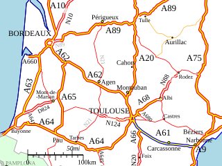
The A61 autoroute is a French motorway forming part of the Autoroute de Deux Mers. It is 147.5 kilometres (91.7 mi) long.
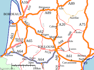
The A64 autoroute is a motorway in southwestern France. It is also called the La Pyrénéenne and numbered the European route E80. It is a toll road for part of its length.
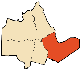
Tazrouk is a town and commune, and district seat of Tazrouk District in Tamanrasset Province, Algeria. According to the 2008 census it has a population of 4,208, up from 3,033 in 1998, with an annual growth rate of 3.1%. Its postal code is 11140 and its municipal code is 1106.

The A2 motorway is a motorway in the Netherlands. It is one of the busiest highways in the Netherlands. The road connects the city of Amsterdam, near the Amstel interchange with the Belgian border, near Maastricht (NL) and Liège (B), and the Belgian A25 road.

Oued El Alenda is a town and commune in Mih Ouensa District, El Oued Province, Algeria. According to the 2008 census it has a population of 6,830, up from 5,839 in 1998, with an annual growth rate of 1.6%. The town is 17 kilometres (11 mi) southwest of the provincial capital El Oued, on the N16 highway connecting it to Touggourt.

The Autostrada A22 or Autobrennero or Autostrada del Brennero is one of the most important autostrada in Italy, as it connects Po Valley, the city of Modena and the Autostrada A1 to Austria through the Brenner Pass, located in the municipality of Brenner. The Autostrada A22 is 315 kilometres (196 mi) long. It is a part of the E45 European route. The operator of the road is Autostrada del Brennero S.p.A.. The Autostrada A22 is located in the regions of Emilia-Romagna, Lombardy, Veneto and Trentino-Alto Adige/Südtirol.
The Offenbacher Kreuz is a cloverleaf interchange in the Frankfurt Rhine-Main Metropolitan Region in the German state of Hesse.
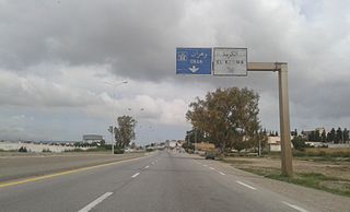
The A62 highway also called The Penetrating Road of Oran is a 24 km long road with a 2x3 lane configuration
The A20 highway also called The Highway of The Soummam is a 100 km (62 mi) long road with a 2x3 lane configuration.

Highway A3 also called The Western Highway is a toll-free controlled-access highway in Algeria


