Hilltop, Tacoma, Washington

Last updated

The Hilltop Neighborhood is a historically diverse neighborhood in the Tacoma, Washington Central District. [1]

Contents

View from Tacoma's Hilltop View of Tacoma From Hilltop Neighborhood.jpg
View from Tacoma's Hilltop
Johnson Candy Company in Tacoma's Hilltop Neighborhood Johnson Candy Company in Tacoma's Hilltop Neighborhood.jpg
Johnson Candy Company in Tacoma's Hilltop Neighborhood

The National Register of Historic Places specifies the geographic area of Hilltop as located within the City of Tacoma and bounded on the east by Tacoma Avenue South, on the north by Division Avenue, on the west by Sprague Avenue, and on the south by the edge of the bluff, which roughly equates to South 27th Street. [2] Hilltop derives its name from its location on a high bluff overlooking Commencement Bay and the Port of Tacoma.

Hilltop is near the historic Tacoma Public Library main branch, Bates Technical College, the Pierce County Courthouse, and the new Pierce County Correctional Facility, all of which are located on Hilltop's east side. Hilltop is also the home of the Evergreen State College's Tacoma Campus. It is adjoined by Tacoma's more affluent Stadium District.

The T Line, a streetcar operated by Sound Transit, runs through Hilltop on Martin Luther King Jr. Way, between Division Avenue and South 19th Street. It opened as an extension of the existing line in September 2023 and connects the neighborhood to the Stadium District and Downtown Tacoma. [3] [4]

Past gang activity

The Hilltop was once notorious for drug-related gang activity, most notably related to the infamous Hilltop Crips. [5] The word "Hilltop" became synonymous specifically with Tacoma's gang problems, and more generally with urban pathologies associated with the US's crack epidemic.

The Hilltop gained a reputation for drugs and violence with the Mother's Day riots in the 1970s. In the early 1980s, Tacoma civic leaders sought federal dollars by accepting a large number of Cuban refugees after the Cuban Adjustment Act and the Cuban Relocation Program. [6] Many of the Cubans were prison inmates released by Castro who violently took over the illicit drug trade on Tacoma’s Hilltop. Around 1984, an unknown Los Angeles Crip association began organizing local Hilltop youth to sell primarily powder and crack cocaine. A yearlong violent struggle between Cuban dealers and the Crips ensued. Eventually, Cubans involved in the drug trade were murdered or left town. By September 23, 1989, the Hilltop Crips had become powerful, with violence and homicides at a peak, and police departments overwhelmed. Hilltop made national news in 1989 when several United States Army Rangers got into a shootout with suspected gang members in what came to be known as the Ash Street shootout. [7] [8]

In 2002 it was reported that neighborhood watch efforts, increased police presence, commercial real estate development efforts along Martin Luther King Way, the creation of the Alcohol Impact Area and rising real estate values in all areas adjoining downtown Tacoma have served to lower the amount of crime in Hilltop. [9] In 2022, Tacoma Police numbers indicated that the Hilltop neighborhood was seeing an increase in crime. Some residents and businesses wrote to city leaders to express their concerns about rising crime. [10]

Employers

Health care is a major employer in Hilltop, with the Hilltop's numerous hospitals and medical centers known as the 'Medical Mile'. This includes:

Education

Hilltop is served by three elementary schools: McCarver Elementary, Stanley Elementary, and Bryant Montessori, all part of Tacoma Public Schools. SOAR Academy, a public K-8 Charter School is also located on Tacoma's Hilltop.

The Evergreen State College's Tacoma Campus is located in the Hilltop neighborhood. The downtown campus of Bates Technical College is located on the border of Hilltop and downtown.

Demographics

The neighborhood's population is 12,002 and remains racially diverse. 41% of residents are White, 30% Black or African-American, 12% Asian, 3% Native American, 1% Pacific Islander, 3% from other races, and 8% from two or more races. Hispanic or Latino of any race were 7% of the population. 32% of residents were below poverty line. [13]

Brick apartment building in Tacoma's Hilltop neighborhood - South J Street Brick Apartment Building in Tacoma's Hilltop Neighborhood.jpg
Brick apartment building in Tacoma's Hilltop neighborhood - South J Street
Historic Victorian Homes in Tacoma's Hilltop Neighborhood. Known as Doctor's Row on South J Street Historic Victorian Houses in Tacoma's Hilltop Neighborhood.jpg
Historic Victorian Homes in Tacoma's Hilltop Neighborhood. Known as Doctor's Row on South J Street
A townhome development in the McCarver area of Tacoma's Hilltop Townhomes in Tacoma, WA McCarver Village - Hilltop.jpg
A townhome development in the McCarver area of Tacoma's Hilltop
Neighbors Park, a small neighborhood park in Hilltop, Tacoma, WA Neighbors Park in Tacoma's Hilltop Neighborhood - Small Park.jpg
Neighbors Park, a small neighborhood park in Hilltop, Tacoma, WA

Boundaries

In 2007, the Tacoma City Council adopted new official boundaries for downtown Tacoma which included a portion of the Hilltop neighborhood as far west as South L Street and changed the name of the Hilltop business district to the Upper Tacoma Business District, a name that local business owners had started using to avoid the gang and crime stigma associated with the name Hilltop, providing "a sort of witness protection program for the shopping district". [14]

In 2011, the City Council recognized that Upper Tacoma was an outdated name. This followed a request from the Hilltop Business Association (formerly the Upper Tacoma Business Association), led by President Eric Crittendon, to reclaim the name Hilltop. [14]

Historic properties

Related Research Articles

<span class="mw-page-title-main">Tacoma, Washington</span> City in Washington, United States

Tacoma is the county seat of Pierce County, Washington, United States. A port city, it is situated along Washington's Puget Sound, 32 miles (51 km) southwest of Seattle, 31 miles (50 km) northeast of the state capital, Olympia, and 58 miles (93 km) northwest of Mount Rainier National Park. The city's population was 219,346 at the time of the 2020 census. Tacoma is the second-largest city in the Puget Sound area and the third-largest in the state. Tacoma also serves as the center of business activity for the South Sound region, which has a population of about 1 million.

<span class="mw-page-title-main">Bloods</span> Street gang founded in Los Angeles, California, US

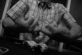
The Bloods are a primarily African-American street gang founded in Los Angeles, California. The gang is widely known for its rivalry with the Crips. It is identified by the red color worn by its members and by particular gang symbols, including distinctive hand signs.

<span class="mw-page-title-main">Raymond Washington</span> American gangster

Raymond Lee Washington was an American gangster, known as the founder of the Crips gang in Los Angeles. Washington formed the Crips as a minor street gang in the late 1960s in South Los Angeles, becoming a prominent local crime boss. In 1971, Washington formed an alliance with Stanley "Tookie" Williams, establishing the Crips as the first major African-American street gang in Los Angeles, and served as one of the co-leaders. In 1974, Washington was convicted of robbery and received a five-year prison sentence, during which his leadership and influence in the Crips declined.

<span class="mw-page-title-main">Stadium District, Tacoma, Washington</span> United States historic place

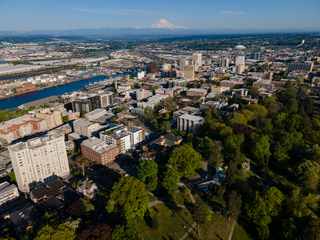
The Stadium District is a neighborhood of the north end of Tacoma, Washington, USA. It is named after Stadium High School, a historic landmark.

<span class="mw-page-title-main">Crips</span> Street gang from Los Angeles, California

The Crips are an alliance of street gangs that is based in the coastal regions of Southern California. Founded in Los Angeles, California, in 1969, mainly by Raymond Washington and Stanley Williams, the Crips were initially a single alliance between two autonomous gangs; it is now a loosely-connected network of individual "sets", often engaged in open warfare with one another. Traditionally, since around 1973, its members have worn blue clothing.

The Jungles faction of the Black P. Stones street gang is a division ("set") of the Bloods gang alliance in Los Angeles. Originating in Los Angeles' Baldwin Village neighborhood in the 1960s, the Black P. Stones became one of the largest gangs in the city. The gang has been linked to various crimes, including murders, assaults, robberies, narcotics violations and firearms violations, and has been the subject of numerous FBI and LAPD investigations.

<span class="mw-page-title-main">T Line (Sound Transit)</span> Streetcar line in Tacoma, Washington

The T Line, formerly known as Tacoma Link, is a light rail line in Tacoma, Washington, part of the Link light rail system operated by Sound Transit. It travels 4.0 miles (6.4 km) and serves 12 stations between Tacoma Dome Station, Downtown Tacoma, and Hilltop. The line carried 934,724 total passengers in 2019, with a weekday average of over 3,100 boardings. Tacoma Link runs for nine to 18 hours per day, using streetcars at frequencies of 12 to 20 minutes.

The municipal government of Winnipeg is represented by 15 city councillors and a mayor elected every four years.

West Columbus, sometimes referred to as westside or the West Side, is a neighborhood in Columbus, Ohio, United States. Unlike other Columbus neighborhoods, it is a broad geographical term used by locals rather than a subdivision or suburb. West Columbus is defined as the entire southwest side of Columbus, bordered on the north by interstates 70 and 670, within Interstate 71 on the east, and on the south and west by the city limits that reach several miles to the outside of the I-270 outerbelt. It covers the ZIP Codes 43223, 43204, 43228, and 43222.

Crime in Los Angeles has varied throughout time, reaching peaks between the 1970s and 1990s. Since the early 2020s, crime has increased in Los Angeles.

Oceanview is a neighborhood in the southern portion of San Francisco, California. It was first established as a community in the 1910s and originally centered on the intersection of Sagamore Street and San Jose Avenue. Today, the neighborhood is bordered by Orizaba Avenue to the west, Lakeview Avenue to the north, and Interstate 280 to the south and east.

The US state of Georgia has seen a rise in the number of gangs over recent years, in the main focused on the illegal drug trade.

Gang activity and associated crime is a long-standing concern in Denver, Colorado. The city's street gang activity received statewide attention in 1993 when a "Summer of Violence" increased public awareness of gang-related violence and led the state to enact harsh penalties for crime by juveniles. From 1992 to 1995, Denver had 331 murders: 95 in 1992, 74 in 1993, and 81 each in 1994 and 1995 In 1997 The first Gang to ever be indicted out of Colorado was the West Side Ballerz Posse WSBP a Chicano gang that resided in West Denver & branched off in Adams county in cities such as Commerce, Thornton, Brighton, Westminster & other surrouIn 1996, members of the FBI's Metro Gang Task Force (“MGTF”) were investigating suspected gang-related drug activity in Denver, Colorado.   Specifically, MGTF was investigating members of the West Side Ballerz Posse whom it suspected were selling controlled substances and engaging in gang-related violence.   As part of this investigation, a series of wiretaps were authorized in late 1996 against suspected members of this drug conspiracy. Gang-related crime has continued, as shown by the New Year's Day 2007 drive-by shooting of Broncos cornerback Darrent Williams by members of the Tre Tre Crips, an East Denver street gang. The Crips in the city have several sub-sets such as Tre Deuce (DOD), Tre Foe, 35 Outlaws and the Tre Tre Gangstas. In 2017, the city's police estimated that there were 38,000 gang members in Denver, affiliated with 220 gangs. The Rollin 30s or Tre Tre Crips still have a powerful presence in the Denver area. In 2017 there were an estimated 2000 Bloods and Crips from Denver. These gangs are in various locations including Five Points, East Denver, Commerce City, Englewood, Aurora, North-East Park Hill and Federal Heights. Crips and Bloods have been commonly sighted almost all over Denver, even in the suburbs outside the city.

<span class="mw-page-title-main">Grape Street Watts Crips</span> African-American street gang

The Grape Street Watts Crips is a Crip subset based in the Watts neighborhood of Los Angeles. The gang's rivalry with the Bounty Hunter Bloods has been described as being "the most violent and long lasting feud between two gangs that are in the Watts area."

Memphis, Tennessee serves as the Southern headquarters for Tennessee based street organizations in the Southern United States. In 2021, there were approximately 102 gangs with 13,400 gang members in the city.

<span class="mw-page-title-main">Tongan Crip Gang</span> Tongan-American street gang

The Tongan Crip Gang (TCG) is a Tongan American street gang that is a subgroup, or "set", of the Crips gang alliance. The gang is active in the U.S. states of California, Utah and Alaska.

The Florencia 13, also known as South Side Florencia 13,Florence Gang, F13 is an American criminal street gang based in Los Angeles, California, composed mainly of Mexican-Americans. The gang is named after the Florence area of Los Angeles County, controlled by the Mexican Mafia. They are involved in drug smuggling, murder, assault and robbery.

<span class="mw-page-title-main">First National Bank of Davenport</span> United States historic place

The First National Bank of Davenport, also known as Brenton Bank and The Brenton, is an historic building located in central Davenport, Iowa, United States. It was added to the National Register of Historic Places in 2018. It is significant for its associations with the history of community planning and development, and as an important example of modernistic design.

The Ash Street shootout was a gunfight on September 23, 1989, in the Hilltop neighborhood of Tacoma, Washington, United States, between off-duty United States Army Rangers and people associated with one Ranger's across-the-street neighbors, who were suspected of drug dealing and gang activity. An already tense neighborhood situation, wherein Staff Sergeant Bill Foulk and others had been advocating for more police action against drug crime, came to a head during a barbecue at Foulk's home on Ash Street, attended by other community members and a few other members of the 2nd Ranger Battalion. Both groups of belligerents claim that the other harassed them during the party. Foulk called for assistance from more Rangers, who arrived with privately owned firearms. Starting at 9:20 PM, 12 or so Rangers and 15 to 20 people from across the street exchanged gunfire with handguns and long guns for five to thirty minutes until police arrived. It is unclear which group fired first; both sides blamed the other. The conflict ended without reported injury after 100 to 300 rounds were fired. Foulk initially affirmed this account, but since 2009 has said that one or more people on the other side were shot but fled.

References

  1. "Our City: Neighborhoods". City of Tacoma. Archived from the original on 2012-02-10. Retrieved 2012-04-04.
  2. National Register of Historic Places Multiple Property Documentation Form: Historic Resources of the Hilltop Neighborhood. Retrieved 6/12/12 from https://npgallery.nps.gov/NRHP/GetAsset/NRHP/64500701_text
  3. Lindblom, Mike (September 16, 2023). "Sound Transit's Tacoma streetcar climbs the Hilltop starting this weekend". The Seattle Times. Retrieved September 18, 2023.
  4. Sailor, Craig (September 14, 2023). "Tacoma Link doubles in length Saturday. Sound Transit isn't delivering what they promised". The News Tribune. Retrieved September 18, 2023.
  5. Mulick, Stacey (2010-10-23). "2 more sentenced in Hilltop Crips crackdown in Tacoma". The News Tribune . Archived from the original on 2012-04-03. Retrieved 2022-07-15.
  6. "United States. Cuban Refugee Program (1961–1994)" [Record]. Collection CHC0218, Series: Cuban Refugee Center Records. Coral Gables, FL: University of Miami Libraries, University of Miami.
  7. Robinson, Sean (2009-09-27). "Ash Street shootout: The night that changed Tacoma's Hilltop". The News Tribune . Archived from the original on 2011-12-21. Retrieved 2022-07-15.
  8. "Off-Duty Soldiers Trade Gunfire At a House Linked to Drug Sales" . The New York Times . Associated Press. 1989-09-27. Archived from the original on 2014-10-20. Retrieved 2020-02-14.
  9. Dunphy, Stephen H. (2002-08-12). "City of Destiny? Tacoma's nickname is starting to fit". The Seattle Times . Archived from the original on 2012-10-01. Retrieved 2022-07-15.
  10. "Neighbors and businesses call for crackdown on crime in Tacoma". 5 April 2022.
  11. Thompson, Joey (2021-10-07). "Federal suit alleges Kaiser Foundation ignored racist treatment at Tacoma Medical Center". Puget Sound Business Journal . Retrieved 2022-07-15.
  12. "Grand opening Nov. 2 for $26M Hilltop Regional Health Center". Tacoma Daily Index . 2013-09-30. Archived from the original on 2017-10-07. Retrieved 2022-07-15.
  13. Census in Pierce County, Washington
  14. 1 2 Merryman, Kathleen (2011-11-28). "Proud to live, play and shop on Tacoma's Hilltop". The News Tribune . Archived from the original on 2012-03-02. Retrieved 2012-06-12.
  15. "(TEXT) National Register of Historic Places Inventory | Engine House No. 4, 220-224 E. 26th St, Tacoma WA" (text). National Register of Historic Places, National Park Service . Retrieved 2022-07-15.
  16. "(IMAGES) National Register of Historic Places Inventory | Engine House No. 4, 220-224 E. 26th St, Tacoma WA" (text). National Register of Historic Places, National Park Service . Retrieved 2022-07-15.
  17. "(TEXT) National Register of Historic Places Inventory | 708, 710, 712, 714, 716, 718, 720, 722 South J Street, Tacoma WA" (text). National Register of Historic Places, National Park Service . Retrieved 2022-07-15.
  18. "(IMAGES) National Register of Historic Places Inventory | 708, 710, 712, 714, 716, 718, 720, 722 South J Street, Tacoma WA" (images). National Register of Historic Places, National Park Service . Retrieved 2022-07-15.

47°14′42″N122°27′11″W / 47.24500°N 122.45306°W / 47.24500; -122.45306