
Kokkola is a town in Finland and the regional capital of Central Ostrobothnia. It is located on the west coast of the country, on the Gulf of Bothnia. The population of Kokkola is approximately 48,000, while the sub-region has a population of approximately 54,000. It is the 22nd most populous municipality in Finland, and the 20th most populous urban area in the country.

Nokia is a town in the Pirkanmaa region of Finland. It lies on the banks of the Nokianvirta, a river of the Kokemäki River watershed, and is situated in the Tampere metropolitan area, about 15 kilometres (9 mi) west of Tampere proper. The population of Nokia is approximately 36,000, while the Tampere metropolitan area has a population of approximately 421,000. It is the 33rd most populous municipality in Finland, and the second largest in the Pirkanmaa region after Tampere.
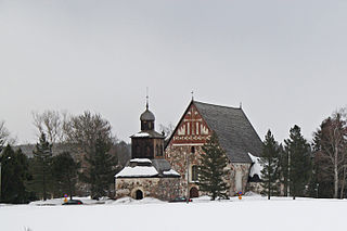
Sipoo is a municipality of Finland. It is part of the Helsinki metropolitan area. The municipality has a population of 22,840 (31 August 2024) and covers an area of 698.60 square kilometres (269.73 sq mi) of which 358.97 km2 (138.60 sq mi) is water. The population density is 67.24 inhabitants per square kilometre (174.2/sq mi). The administrative center of the municipality is Nikkilä, which is located 34 kilometres (21 mi) northeast of the center of Helsinki. Another significant urban area is Söderkulla, located in the southern part of the municipality.

Alavus is a town and municipality of Finland. It is located in the province of Western Finland and is part of the Southern Ostrobothnia region, 52 kilometres (32 mi) southeast of Seinäjoki, 138 kilometres (86 mi) north of Tampere and 319 kilometres (198 mi) north of Helsinki. The town has a population of 10,851 and covers an area of 1,151.46 square kilometres (444.58 sq mi) of which 52.31 km2 (20.20 sq mi) is water. The population density is 9.98 inhabitants per square kilometre (25.8/sq mi). Neighbouring municipalities are Alajärvi, Kuortane, Seinäjoki, Virrat and Ähtäri.
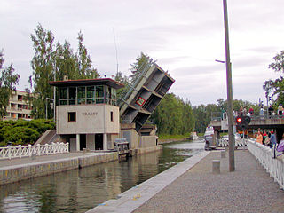
Asikkala is a municipality of Finland. Its seat is in Vääksy, at the shores of the Lake Päijänne. It is located in the province of Southern Finland and is part of the Päijänne Tavastia region. Asikkala's neighboring municipalities are Hämeenlinna, Heinola, Hollola, Lahti, Padasjoki and Sysmä.
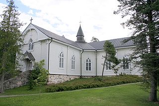
Askola is a municipality of Finland. It is located in the Uusimaa region. The municipality has a population of 4,679 and covers an area of 218.03 square kilometres (84.18 sq mi) of which 5.61 km2 (2.17 sq mi) is water. The population density is 22.03 inhabitants per square kilometre (57.1/sq mi). Monninkylä is the largest village of the municipality in terms of population. Neighbouring municipalities are Myrskylä, Mäntsälä, Pornainen, Porvoo and Pukkila.
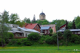
Vihti is a municipality in Finland, located in the southern interior of the country. Vihti is situated in the Uusimaa region. The population of Vihti is approximately 29,000. It is the 37th most populous municipality in Finland. Vihti is part of the Helsinki metropolitan area, which has approximately 1.6 million inhabitants.

Huittinen is a town and municipality in Finland. It is located in the Satakunta region, 63 kilometres (39 mi) southeast of Pori and 75 kilometres (47 mi) southwest of Tampere. The town has a population of 9,560 and covers an area of 539.59 square kilometres (208.34 sq mi) of which 6.97 km2 (2.69 sq mi) is water. The population density is 17.95 inhabitants per square kilometre (46.5/sq mi).

Hailuoto is a Finnish island in the northern Baltic Sea and a municipality in Northern Ostrobothnia region. The population of Hailuoto is 935, making it the smallest municipality in Northern Ostrobothnia and the former Oulu Province in terms of population. The municipality covers an area of 205.65 km2 (79.40 sq mi) of which 1.70 km2 (0.66 sq mi) is inland water. The population density is 4.55/km2 (11.8/sq mi). Of all the Finnish sea islands, Hailuoto is the third largest after Fasta Åland and Kimitoön.
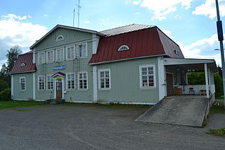
Haapajärvi is a town and municipality of Finland.
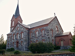
Juva is a municipality of Finland. It is located in the Southern Savonia region some 270 kilometres (170 mi) North-East of Helsinki. It was founded on 19 January 1442, and is the oldest parish/municipality in Finland whose exact date of birth is known. At the time, it was only the second parish in Eastern Finland, and later, several other parishes were separated from it, such as Sääminki,, Kuopio, Iisalmi, Pieksämäki, Joroinen, Leppävirta, Siilinjärvi, Lapinlahti and Maaninka. Secular municipal administration was established in 1868.

Iitti is a municipality of Finland. It is located in the province of Southern Finland and is part of the Päijänne Tavastia region. The municipality has a population of 6,433 and covers an area of 687.09 square kilometres (265.29 sq mi) of which 97.27 km2 (37.56 sq mi) is water. The population density is 10.91 inhabitants per square kilometre (28.3/sq mi). Neighbour municipalities are Heinola, Kouvola, Lapinjärvi, Lahti and Orimattila. The municipality is unilingually Finnish.

Kalajoki is a coastal town and municipality of Finland. It is located in the immediate vicinity of the Gulf of Bothnia in the province of Oulu and is part of the Northern Ostrobothnia region.

Kannus is a town and municipality of Finland. It is situated in the province of Western Finland and is part of the Central Ostrobothnia region. The municipality has a population of 5,251 and covers an area of 470.65 square kilometres (181.72 sq mi), of which 2.41 km2 (0.93 sq mi) is water. The population density is 11.22 inhabitants per square kilometre (29.1/sq mi). The municipality is unilingually Finnish. Neighbour municipalities are Kalajoki, Kokkola, Sievi and Toholampi.

Kaustinen is a municipality of Finland. It is part of the Central Ostrobothnia region. The municipality has a population about 4300 and covers an area of 361.12 square kilometres (139.43 sq mi) of which 7.09 km2 (2.74 sq mi) is water. The population density is 11.66 inhabitants per square kilometre (30.2/sq mi).

Outokumpu is a town and municipality of Finland. It is located in the North Karelia region, 48 kilometres (30 mi) west of Joensuu and 92 kilometres (57 mi) east of Kuopio. The municipality has a population of 6,416 and covers an area of 584.05 square kilometres (225.50 sq mi) of which 138.22 km2 (53.37 sq mi) is water. The population density is 14.39 inhabitants per square kilometre (37.3/sq mi). The most important road connection in the locality is Highway 9.

Loppi is a municipality in Finland. It is located in the province of Southern Finland and is part of the Kanta-Häme region, located about 50 kilometers south of the city of Hämeenlinna. Loppi was founded in 1632. The municipality has a population of 7,693 and covers an area of 655.97 square kilometres (253.27 sq mi) of which 58.36 km2 (22.53 sq mi) is water. The population density is 12.87 inhabitants per square kilometre (33.3/sq mi). The municipality is unilingually Finnish.
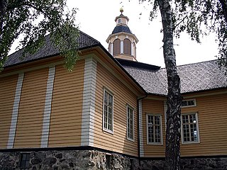
Nastola is a former municipality of Finland. It was merged with the city of Lahti on 1 January 2016.

Nivala is a town and municipality of Finland. It is located in the Northern Ostrobothnia region. The town has a population of 10,399 (31 August 2024) and covers an area of 536.88 square kilometres (207.29 sq mi) of which 8.92 km2 (3.44 sq mi) is water. The population density is 19.72 inhabitants per square kilometre (51.1/sq mi). The municipality is unilingually Finnish.

Säkylä is a municipality of Finland. It is located in the Satakunta region, 65 kilometres (40 mi) southeast of the city of Pori. The municipality has a population of 6,309 and the municipality covers an area of 527.71 square kilometres (203.75 sq mi) of which 107.89 square kilometres (41.66 sq mi) is inland water (2018-01-01). The population density is 16 inhabitants per square kilometre (41/sq mi). The municipality is unilingually Finnish.


