Hmawngbuchhuah

Last updated

Hmawngbuchhuah
village
Location map India Mizoram EN.svg
Red pog.svg
Hmawngbuchhuah
India location map.svg
Red pog.svg
Hmawngbuchhuah
Coordinates: 22°08′55″N92°46′14″E / 22.14861°N 92.77056°E / 22.14861; 92.77056
CountryIndia
State Mizoram
District Lawngtlai district
Population
 (2011)
  Total389
Languages
  Official Mizo
Time zone UTC+5:30 (IST)
Vehicle registration MZ
Website mizoram.nic.in

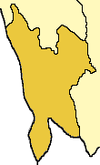
Hmawngbuchhuah is a village in Lawngtlai Block in theLawngtlai district in the state of Mizoram, India.

Contents

Location

147 km from the State capital, Aizawl. It lies on the border between Myanmar and India. It is on the east bank of Sekulh Lui River which makes the border. [1]

Demographics

[ needs update ] As of the 2011 Census of India, the population in Hmawngbuchhuah village is 389, with 97 Households. There are 190 males (49%) and 199 females (51%), with 3% Scheduled Tribe and no Scheduled Caste. [1] [2]

Connectivity

It is 4 km South of the District headquarters Lawngtlai. It is located on the India-Myanmar border where National Highway 502 (India), Kaladan Multi-Modal Transit Transport Project, enters Myanmar. [3] [4]

The 100 km route from the Indo-Myanmar border at Zorinpui to Aizawl has been upgraded to two lanes in both directions (a total of four). From Aizawl it connect to Aizawl-Saiha National Highway at Lawngtlai in Mizoram in India by road on National Highway 54 (India) (NH-54), which then continues further to Dabaka in Assam via 850 km long NH-54 which in turn is part of the larger East-West Corridor connecting North East India with the rest of India. [5] Almost complete (June 2017). [6] Tender has been awarded, upgrade to this national highway is under-construction and to be Completed by 2019. [7]

A survey of the rail line from Sairang to Hmawngbuchhuah on the border near Zorinpui was completed in August 2017 and will be constructed in future phases. [8]

Economy

The mainstay of the economy is agriculture. It is also a border town with integrated check posts being built, which will be operational by April 2019. [3] [4] [ needs update ]

See also

Related Research Articles

<span class="mw-page-title-main">Mizoram</span> State in northeastern India

Mizoram is a state in northeastern India, with Aizawl as its seat of government and largest city. Within India's northeast region, it is the southernmost state, sharing borders with three of the Seven Sister States, namely Tripura, Assam and Manipur, and also shares a 722-kilometre (449 mi) border with the neighbouring countries of Bangladesh and Myanmar. The state spans over an area of approximately 21,087 square kilometres, of which approximately 91% is forested. With an estimated population of 1.25 million in 2023, it is the second least populous state in the country.

Sairang is a town in the Aizawl district of the Indian state of Mizoram.

<span class="mw-page-title-main">National Highway 150 (India, old numbering)</span> Road in India

The National Highway 150, or NH-150, in India runs between the towns of Kohima in Nagaland and Aizwal in Mizoram, passing through the state of Manipur. In Manipur, it passes through the capital city Imphal, Bishnupur, Churachandpur, and Tipaimukh. In the newnumbering, the Imphal–Aizal section of the road is part of National Highway 2, and the Kohima–Imphal section is part of National Highway 202.

The Ministry of Development of North Eastern Region is a Government of India ministry, established in September 2001, which functions as the nodal Department of the Central Government to deal with matters related to the socio-economic development of the eight States of Northeast India: Arunachal Pradesh, Assam, Manipur, Meghalaya, Mizoram, Nagaland, Tripura and Sikkim. It acts as a facilitator between the Central Ministries/ Departments and the State Governments of the North Eastern Region in the economic development including removal of infrastructural bottlenecks, provision of basic minimum services, creating an environment for private investment and to remove impediments to lasting peace and security in the North Eastern Region.

<span class="mw-page-title-main">Lawngtlai district</span> District of Mizoram in India

Lawngtlai district is one of the eleven districts of Mizoram state in India.

<span class="mw-page-title-main">Kaladan River</span> River in Myanmar, India

The Kaladan or Kissapanadi River, also known as the Beino, Bawinu and Kolodyne, is a river in eastern Mizoram State of India, and in Chin State and Rakhine State of western Myanmar. The Kaladan River is called the Chhimtuipui River in India. It forms the international border between India and Burma between 22° 47′ 10" N and 22° 11′ 06" N.

<span class="mw-page-title-main">India–Myanmar relations</span> Bilateral relations

India–Myanmar relations, also known as the Indo–Burmese relations, are the bilateral relations between the Republic of India and the Republic of the Union of Myanmar. These relations encompass the political, economic and socio-cultural relations that exist between the two neighboring Asian countries. Political relations have improved considerably since 1993, overcoming tensions related to drug trafficking, the suppression of democracy and the rule of the military junta in Myanmar. Political leaders from both countries meet regularly on a bilateral basis and within the ASEAN Plus Six community. Economic relations are considerable with India representing Myanmar's 4th largest export market and the country's 5th largest import partner.

<span class="mw-page-title-main">Lawngtlai</span> Town in Mizoram, India

Lawngtlai is a town located in the southern part of Mizoram, India. It serves as the administrative headquarters of the Lawngtlai district and is home to the Pawi people, also known as the Hakha Chin people in Myanmar. Lawngtlai celebrates a variety of indigenous festivals, such as the Hlukhla Kut, similar to that of Chapchar Kut.

Sittwe Port is a deepwater port constructed by India in 2016 at Sittwe, the capital of Rakhine State in Myanmar, on the Bay of Bengal. Situated at the mouth of the Kaladan River, the US$120 Million port is being financed by India as a part of the Kaladan Multi-Modal Transit Transport Project, a collaboration between India and Myanmar. The project is aimed at developing transport infrastructure in Southwestern Myanmar and Northeastern India.

<span class="mw-page-title-main">Kaladan Multi-Modal Transit Transport Project</span> Connection of seaports in India and Myanmar

The Kaladan Road Project is a US$484 million project connecting the eastern Indian seaport of Kolkata with Sittwe seaport in Rakhine State, Myanmar by sea. In Myanmar, it will then link Sittwe seaport to Paletwa in Chin State via the Kaladan river boat route, and then from Paletwa by road to Mizoram state in Northeast India. All components of the project, including Sittwe port and power, river dredging, Paletwa jetty, have been completed, except the under construction Zorinpui-Paletwa road. Originally, the project was scheduled to be completed by 2014, but end-to-end project is expected to be fully operational only by December 2023 as per November 2023 update.

The Bairabi–Sairang line is a 51 kilometres (32 mi) long railway line from Bairabi to Sairang under the Northeast Frontier Railway zone of Indian Railways.

<span class="mw-page-title-main">Chhimtuipui</span> River in Rakhine State, India

The Chhimtuipui river, also known as the Chhimmtuipi Lui or Kaladan river, is a river of Mizoram, northeastern India. It flows in a southerly direction through Myanmar.

<span class="mw-page-title-main">Bharatmala</span> Indian highway and expressway construction project

The Bharatmala Pariyojna is an ongoing project that will interconnect 550 District Headquarters through a minimum 4-lane highway by raising the number of corridors to 50 and move 80% freight traffic to National Highways by interconnecting 24 logistics parks, 66 inter-corridors (IC) of total 8,000 km (5,000 mi), 116 feeder routes (FR) of total 7,500 km (4,700 mi) and 7 north east Multi-Modal waterway ports. The project also includes development of tunnels, bridges, elevated corridors, flyovers, overpass, interchanges, bypasses, ring roads etc. to provide shortest, jam free & optimized connectivity to multiple places, it is a centrally-sponsored and funded Road and Highways project of the Government of India. This ambitious umbrella programme will subsume all existing Highway Projects including the flagship National Highways Development Project (NHDP), launched by the Atal Bihari Vajpayee government in 1998. Bharatmala is mainly focused on connecting remote areas and satellite cities of megacities such as Bengaluru, Pune, Hyderabad etc. The total investment for 83,677 km (51,994 mi) committed new highways is estimated at 10.63 lakh crore (US$130 billion), making it the single largest outlay for a government road construction scheme. The project will build highways from Maharashtra, Gujarat, Rajasthan, Punjab, Haryana and then cover the entire string of Himalayan territories - Jammu and Kashmir, Himachal Pradesh, Uttarakhand - and then portions of borders of Uttar Pradesh and Bihar alongside Terai, and move to West Bengal, Sikkim, Assam, Arunachal Pradesh, and right up to the Indo-Myanmar border in Manipur and Mizoram. Special emphasis will be given on providing connectivity to far-flung border and rural areas including the tribal and backward areas.

Bairabi railway station serves Bairabi city in Kolasib district, Mizoram. Its code is BHRB. The station consists of 3 platforms. Bairabi is one of the railhead of Mizoram and connected with a broad-gauge line. The 84.25 km broad-gauge railway line from Katakhal Junction to Bairabi, was completed on 21 March 2016.

The Lungleng river, also known as the Lungleng Lui, is a river of Mizoram, northeastern India. It flows in a southerly direction towards Myanmar.

Zochawchhuah, also spelt Zochachhuah, is a village on the India-Myanmar border in Lawngtlai Block of Lawngtlai district in the state of Mizoram in India. It is located 4 km south of the District headquarters Lawngtlai, 10 km from Hmawngbuchhuah, 157 km from the State capital Aizawl. It is on the east bank of the Sekulh Lui River, which marks the India-Myanmar border.

Katakhal is a town and railway station in Hailakandi tehsil of Hailakandi district in the Indian state of Assam. The village is named after the Katakhal River which originates in Bhairabi after three other rivers merge. The river ends at Kalinagar Village falling into Barak river. The Hailakandi district is one of the three districts of Southern Assam in the Barak Valley.

<span class="mw-page-title-main">Outline of Mizoram</span> Overview of and topical guide to Mizoram

The following outline is provided as an overview of and topical guide to Mizoram:

National Highway 502A, commonly referred to as NH 502A is a national highway in India. It is a spur road of National Highway 2. NH-502A traverses the state of Mizoram and in India.

<span class="mw-page-title-main">India–Myanmar border</span> Border separating India and Myanmar

The India–Myanmar border is the international border between India and Myanmar. The border is 1,643 kilometres (1,021 mi) in length and runs from the tripoint with China in the north to the tripoint with Bangladesh in the south.

References

  1. 1 2 Hmawngbuchhuah info
  2. Hmawngbuchhuah village
  3. 1 2 Hmawngbuchhuah Kaladan-project details
  4. 1 2 Hmawngbuchhuah Kaladan-project railway survey
  5. "Multi-modal route map". Archived from the original on 22 August 2017. Retrieved 27 November 2018.
  6. India awards road contract to complete Kaladan project in Myanmar, Business Line, 9 June 2017.
  7. Still under construction, The Statesman, 13 May 2018.
  8. India's northeast opened up, PowerUpConstruction.Com