Lower Franconia is one of seven districts of Bavaria, Germany. The districts of Lower, Middle and Upper Franconia make up the region of Franconia.
Bad Kissingen is a Landkreis (district) in Bavaria, Germany. It is bounded by the district Main-Kinzig and Fulda in Hesse, and the districts of Rhön-Grabfeld, Schweinfurt and Main-Spessart.
The Fulda District is a Kreis (district) in the north-east of Hesse, Germany. Neighboring districts are Hersfeld-Rotenburg, Wartburgkreis, Schmalkalden-Meiningen, Rhön-Grabfeld, Bad Kissingen, Main-Kinzig, Vogelsbergkreis.
Haßberge is a Landkreis (district) in Bavaria, Germany. It is bounded by the districts of Coburg, Bamberg, Schweinfurt and Rhön-Grabfeld, and by the state of Thuringia.

Hildburghausen is a district in Thuringia, Germany. It is bounded by the district of Schmalkalden-Meiningen, the city of Suhl, the districts of Ilm-Kreis, Saalfeld-Rudolstadt and Sonneberg, and the state of Bavaria. Located roughly halfway between the mountain chains of the Rhön and the Thuringian Forest, the district is densely forested and covered by hilly countryside. Its territory is similar to that of the former Ernestine duchy, Saxe-Hildburghausen.
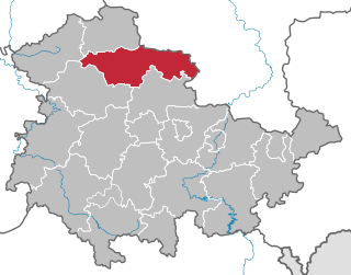
The Kyffhäuserkreis is a district in the northern part of Thuringia, Germany. Neighboring districts are the districts Mansfeld-Südharz, Saalekreis und Burgenlandkreis in Saxony-Anhalt, and the districts Sömmerda, Unstrut-Hainich-Kreis and Eichsfeld.

Schmalkalden-Meiningen is a Landkreis in the southwest of Thuringia, Germany. Its neighboring districts are the districts Wartburgkreis, Gotha, Ilm-Kreis, the district-free city Suhl, the district Hildburghausen, the Bavarian district Rhön-Grabfeld, and the district Fulda in Hesse.

The Rhön Mountains are a group of low mountains in central Germany, located around the border area where the states of Hesse, Bavaria and Thuringia come together. These mountains, which are at the extreme southeast end of the East Hesse Highlands, are partly a result of ancient volcanic activity. They are separated from the Vogelsberg Mountains by the river Fulda and its valley. The highest mountain in the Rhön is the Wasserkuppe which is in Hesse. The Rhön Mountains are a popular tourist destination and walking area.
Rhön-Grabfeld is a Landkreis (district) in Bavaria, Germany. It is bounded by the districts of Hassberge, Schweinfurt and Bad Kissingen, and the states of Hesse and Thuringia.

Schlüchtern is a town in the Main-Kinzig district, in Hesse, Germany. It is located on the river Kinzig, approximately 30 km southwest of Fulda. Schlüchtern has a population close to 16,000.

Geisa is a town in the Wartburgkreis district, in Thuringia, Germany. It is situated in the Rhön Mountains, 26 km northeast of Fulda. The near border with Hesse was the border between West Germany and the GDR during the Cold War. Thus, Geisa was in the East German border restriction area of the former inner German border, which meant that until reunification access to the town was limited. The town is the westernmost municipality in what was formerly East Germany.

Gersfeld is a town in the district of Fulda, in Hesse, Germany. It is situated on the Fulda River, in the Rhön Mountains, 20 km (12.43 mi) southeast of Fulda. It belonged to the abbey-principality of Fulda before secularisation in 1803. It then belonged to the Principality of Nassau-Orange-Fulda between 1803 and 1806, to France between 1806 and 1810, and then later to the Grand Duchy of Frankfurt between 1810 and 1813. After the Battle of Leipzig, it was occupied by the Allied troops of the Sixth Coalition between 1813 and 1815. After that, it was ceded to the Kingdom of Bavaria in 1815. During the Austro-Prussian War, it was occupied by Prussia before its annexation in the newly established Hesse Nassau province. It was finally incorporated in the state of Hesse in 1945.

KaltennordheimGerman: [ˌkaltn̩ˈnɔʁt.haɪ̯m](listen) is a town in the Schmalkalden-Meiningen district, in Thuringia, Germany. It is situated in the Rhön Mountains, 22 km southwest of Bad Salzungen, and 35 km east of Fulda. The former municipalities Aschenhausen, Kaltensundheim, Kaltenwestheim, Melpers, Oberkatz und Unterweid were merged into Kaltennordheim in January 2019. At the same time, Kaltennordheim passed from the Wartburgkreis to Schmalkalden-Meiningen.

Tann is a town in the district of Fulda, in Hesse, Germany. It is situated in the Rhön Mountains, 27 km northeast of Fulda. It is an accredited Spa town at the Ulster River.
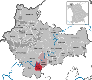
Fuchsstadt is a municipality in the district of Bad Kissingen in Bavaria in Germany.
Pfarrweisach is a municipality in the district of Haßberge in Bavaria in Germany.

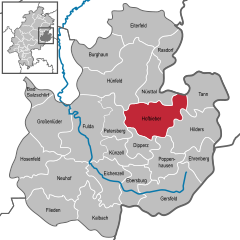
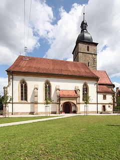
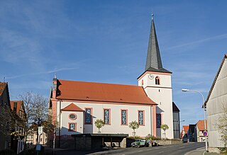
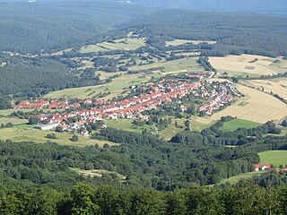
Heustreu is a municipality in the district of Rhön-Grabfeld in Lower Franconia in Germany. It lies on the Streu River.
Stadtlauringen is a municipality in the district of Schweinfurt in Bavaria, Germany.

Üchtelhausen is a municipality and community in the district of Schweinfurt in Bavaria, Germany.
Sandberg is a municipality in the district of Rhön-Grabfeld in Bavaria in Germany.