
Apache County is a county in the northeast corner of the U.S. state of Arizona. Shaped in a long rectangle running north to south, as of the 2020 census, its population was 66,021. The county seat is St. Johns.

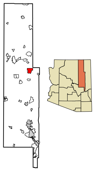
Coconino County is a county in the North-Central part of the U.S. state of Arizona. Its population was 145,101 at the 2020 census. The county seat is Flagstaff. The county takes its name from Cohonino, a name applied to the Havasupai people. It is the second-largest county by area in the contiguous United States, behind San Bernardino County, California. It has 18,661 sq mi (48,300 km2), or 16.4% of Arizona's total area, and is larger than the nine smallest states in the U.S.

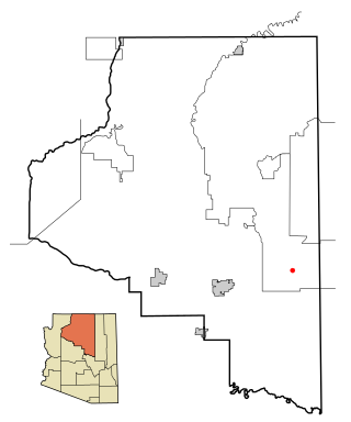
Navajo County is a county in the northern part of the U.S. state of Arizona. As of the 2020 census, its population was 106,717. The county seat is Holbrook.
Chinle is a census-designated place (CDP) in Apache County, Arizona, United States. The name in Navajo means 'flowing out' and is a reference to the location where the water flows out of the Canyon de Chelly. The population was 4,518 at the 2010 census.

Kaibeto is a census-designated place (CDP) in Coconino County, Arizona, United States. The population was 1,522 at the 2010 census.
LeuppLOOP is a census-designated place (CDP) in Coconino County, Arizona, on the Navajo Nation, United States. The population was 951 at the 2010 census.

Dilkon is a census-designated place (CDP) in Navajo County, Arizona, United States. The population was 1,184 at the 2010 census. The name of the town is said to be derived from the Navajo phrase "Smooth black rock" or "Bare surface.”

Greasewood is a census-designated place (CDP) in Navajo County, Arizona, United States. The population was 547 at the 2010 census.
Holbrook is a city in Navajo County, Arizona, United States. According to the 2010 census, the population of the city was 5,053. The city is the county seat of Navajo County.

Kayenta is a U.S. town which is part of the Navajo Nation and is in Navajo County, Arizona, United States. Established November 13, 1986, the Kayenta Township is unique in being the only "township" existing under the laws of the Navajo Nation.

Shonto is a census-designated place (CDP) in Navajo County, Arizona, United States, in the Navajo Nation. The population was 591 at the 2010 census.

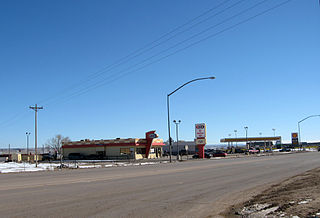
Sun Valley is a populated place in Navajo County, Arizona, United States, east of Holbrook along Interstate 40. It is located in the Painted Desert and covers an area of 31.6 square miles.
Holbrook Unified School District is a school district based in Holbrook, Arizona, United States. Currently it is one of the highest paying school districts in Navajo County.

Indian Wells is a census-designated place in Navajo County, Arizona, United States. Indian Wells Elementary School is located in the town, it serves 600 students. It is also the name of the local Navajo chapter of the Navajo Nation Council. Indian Wells is served by a post office with the ZIP code of 86031. The ZIP Code Tabulation Area for ZIP Code 86031 had a population of 1,856 at the 2010 census, with 255 in Indian Wells itself.

Woodruff is an unincorporated community in Navajo County, Arizona, United States. Woodruff is 10.5 miles (16.9 km) southeast of Holbrook. Woodruff has a post office with ZIP code 85942.

The Bureau of Indian Education (BIE), headquartered in the Main Interior Building in Washington, D.C., and formerly known as the Office of Indian Education Programs (OIEP), is a division of the U.S. Department of the Interior under the Assistant Secretary for Indian Affairs. It is responsible for the line direction and management of all BIE education functions, including the formation of policies and procedures, the supervision of all program activities, and the approval of the expenditure of funds appropriated for BIE education functions.
Joseph City Unified School District #2, also known as Joseph City Schools, is a school district headquartered in Joseph City, Arizona.

Flagstaff High School (FHS) is a secondary school in Flagstaff, Arizona. Flagstaff High School has been opened to the public since 1923. FHS is a four-year public high school of approximately 1,500 students. The students are primarily of five ethnic groups: White, Native American, Hispanic, Asian, and African-American. Approximately 50 percent of the students are minorities; 147 are from various Native American tribes and live at the Bureau of Indian Affairs KinLani Dormitory. The student body represents a broad socio-economic range from low income to upper middle class. Each year approximately 50 percent of the graduates enroll in four-year colleges and universities and 25 percent in two-year institutions.

Michael Vincent Budenholzer is an American professional basketball coach who is the head coach of the Phoenix Suns of the National Basketball Association (NBA).
Whitecone is a census-designated place in Navajo County, in the U.S. state of Arizona. The population was 817 at the 2010 census.

