The Borrowdale Volcanic Group is a group of igneous rock formations named after the Borrowdale area of the Lake District, in England. They are Caradocian in age. It is thought that they represent the remains of a volcanic island arc, approximately similar to the island arcs of the west Pacific today. This developed as oceanic crust to the (present) north-west and was forced by crustal movement under a continental land-mass to the present south-east. Such forcing under, as two plates meet, is termed subduction. This land-mass has been named Avalonia by geologists. It is now incorporated into England and Wales and a sliver of North America.
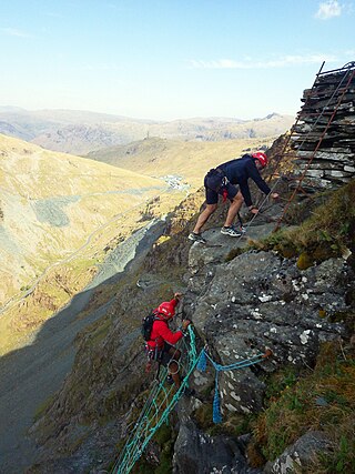
Honister Crag SSSI is a Site of Special Scientific Interest in Cumbria, England. It is designated for both biological and geological interest. The site covers an area of 302.9 ha on Honister Crag, from which it takes its name, and Fleetwith Pike, an adjacent fell.

For the Skiddaw group of hills, see Skiddaw Group

The geology of England's Lake District is dominated by sedimentary and volcanic rocks of mainly Ordovician age underpinned by large granitic intrusions. Younger sedimentary sequences outcrop on the edges of the Lake District area, with Silurian to the south, Carboniferous to the north, east, and west and Permo-Triassic to the west and east. The entire area was covered by a Mesozoic sequence that was eroded off during the Paleogene uplift related to the opening of the North Atlantic. During the Quaternary the area was affected by repeated glaciations, which sculpted the current mountainous landscape.

Quarry Moor is a Site of Special Scientific Interest, or SSSI, at the south edge of Ripon, North Yorkshire, England, and adjacent to the A61 road. It contains an outcrop of Magnesian Limestone, exposed by former quarrying. 255 million years ago this limestone was the peripheral sediment of a tropical sea. The land was donated in 1945 to the people of Ripon by the town's mayor, Alderman Thomas Fowler Spence, a varnish manufacturer. The land was notified as an SSSI in 1986 because its calcareous grassland supported a large diversity of plant species. The site features a Schedule 8 protected plant, thistle broomrape. The land is protected as a nature reserve, and it is also managed as a recreational area. Therefore, its calcareous grass area is fenced off for protection and study, but it also contains a car park, information signs, a children's play area, accessible paths, benches, and dog waste bins.
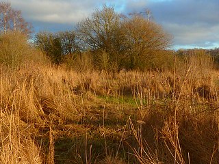
Farnham Mires is a Site of Special Scientific Interest, or SSSI, to the west of the village of Farnham, North Yorkshire, England. It consists of a spring-fed marshy fen or mire with reeds and sedge, and drier calcareous grassland containing a diverse range of flora. It has a history of poaching and fox hunting, but since the late 19th century, the attention of botanists has been drawn to its large variety of flowering plants. It has received some consideration on this account since 1944, and from 1954 it was designated SSSI status. This site has no facilities, and is not open to the public.

Mar Field Fen is a Site of Special Scientific Interest, or SSSI, north of Masham, North Yorkshire, England, in a rural area known as Marfield. It is situated on land containing woodland carr, fen, spring-fed marshy grassland and drier calcareous grassland, between the River Ure to the east and Marfield Wetland nature reserve to the west. As "one of the best examples of fen habitat in the Vale of York," it is a protected habitat for a variety of plants, including the common butterwort, a carnivorous plant. There is no public access to this site.
Cottonshope Head Quarry is a Site of Special Scientific Interest within Northumberland National Park, Northumberland, England. It is located north of the hamlet of Cottonshopeburnfoot. The site is an abandoned quarry within a military training area.
Holystone Burn Woods is a Site of Special Scientific Interest (SSSI) within Northumberland National Park in Northumberland, England. It is located near the village of Holystone. The protected area includes part of the valley along which flows the stream called Holystone Burn. Part of the protected area is managed by the Northumberland Wildlife Trust.
Stawardpeel Woods is a Site of Special Scientific Interest (SSSI) in Northumberland, England. This protected area is located in the valley of the River Allen, near Bardon Mill. The protected area is owned by the National Trust, within the Allen Banks & Staward Gorge estate.
Holystone North Wood is a Site of Special Scientific Interest (SSSI) in Northumberland National Park, Northumberland, England. It is located near the village of Holystone. The woodland was historically an oak coppice.
Muckle Moss is a Site of Special Scientific Interest (SSSI) and a National Nature Reserve located near Bardon Mill in Northumberland, England. Muckle Moss is a mire over deep peat, and its boundaries include Blackdyke Plantation.
Buttermere Fells is a Site of Special Scientific Interest (SSSI) within Lake District National Park in Cumbria, England. The protected area includes many of the hills and mountains between the Buttermere lake valley near the village of Buttermere and the River Derwent valley near the village of Braithwaite. This protected area includes the mountains of Grasmoor, Crag Hill, Causey Pike and Hindscarth. The protected area includes much of the North Western Fells. This protected area contains exceptional examples of montane dwarf shrub heath communities.
Duddon Valley Woodlands is a Site of Special Scientific Interest within the Lake District National Park in Cumbria, England. This protected area comprises eight large patches of woodland along the valley of the River Duddon. The northernmost part of this protected area is near Seathwaite and southern most at Duddon Bridge. This protected area has an exceptional diversity of moss species and also has a population of the common dormouse.
Glencoyne Wood is a Site of Special Scientific Interest (SSSI) in Lake District National Park in Cumbria, England. This protected area is located near the village of Glenridding near Ullswater lake. This woodland is protected because of the exceptional diversity of mosses and liverworts. Red squirrel has been recorded in this woodland.
Gowbarrow Park is a Site of Special Scientific Interest (SSSI) in Lake District National Park in Cumbria, England. It is located on the lower slopes of Gowbarrow Fell and borders Ullswater lake. It is 2 km from the hamlet of Dockray. This protected area has an outstanding diversity of lichen species. Red squirrels have been recorded in this protected area.
Great Wood is a Site of Special Scientific Interest (SSSI) within the Lake District National Park in Cumbria, England. This protected area is located 2km south of Keswick and borders the eastern shore of Derwent Water. This woodland is internationally important because of the diversity of lichens and bryophytes found here.
Johnny Wood is a Site of Special Scientific Interest (SSSI) within the Lake District National Park in Cumbria, England. It is located 300m west of the village of Borrowdale, in the valley of the River Derwent (Borrowdale). This woodland has an exceptional diversity of liverwort species.
Lodore-Troutdale Woods is a Site of Special Scientific Interest (SSSI) within the Lake District National Park. It is located 4km south of Keswick and 1km east of Grange in the valley of the River Derwent within Borrowdale. The woodland here has an exceptional diversity of moss species.
Milkingstead Wood is a Site of Special Scientific Interest (SSSI) within the Lake District National Park in Cumbria, England. It is located 1km south east of Eskdale Green in the valley of the River Esk (Eskdale). This site is important because of the fern species present.