
Dartmoor is an upland area in southern Devon, England. The moorland and surrounding land has been protected by National Park status since 1951. Dartmoor National Park covers 954 km2 (368 sq mi).

Dartmoor Preservation Association (DPA) is one of the oldest environmental or amenity bodies in the UK. It was founded in 1883. It concerns itself with Dartmoor, a National Park in Devon, south-west England. It began with two main areas of concern. Firstly, commoners' rights were being eroded through army use, including the firing of live artillery shells, and piecemeal enclosure of land around the margins. Secondly, there was increasing public interest in Dartmoor's scenery, archaeology, history and wildlife
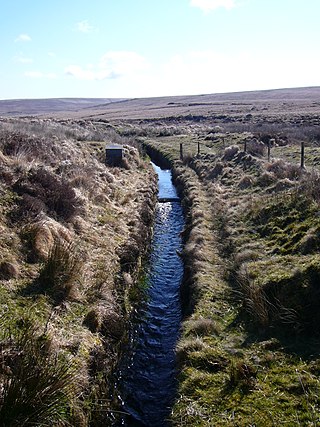
A leat is the name, common in the south and west of England and in Wales, for an artificial watercourse or aqueduct dug into the ground, especially one supplying water to a watermill or its mill pond. Other common uses for leats include delivery of water for hydraulic mining and mineral concentration, for irrigation, to serve a dye works or other industrial plant, and provision of drinking water to a farm or household or as a catchment cut-off to improve the yield of a reservoir.

The Devonport Leat is a leat in Devon constructed in the 1790s to carry fresh drinking water from the high ground of Dartmoor to the expanding dockyards at Plymouth Dock.

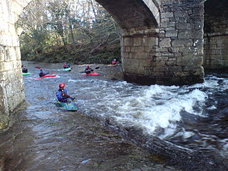
The River Dart is a river in Devon, England, that rises high on Dartmoor and flows for 75 kilometres (47 mi) to the sea at Dartmouth.

Buckfastleigh is a market town and civil parish in Devon, England situated beside the Devon Expressway (A38) at the edge of the Dartmoor National Park. It is part of Teignbridge and, for ecclesiastical purposes, lies within the Totnes Deanery. It is 18 miles east-northeast of Plymouth, 20 miles southwest of Exeter and has a population of 3,661. It is a centre of tourism and is home to Buckfast Abbey, the South Devon Railway, the Buckfastleigh Butterfly Farm and Otter Sanctuary, the Tomb of Squire Richard Cabell and The Valiant Soldier.
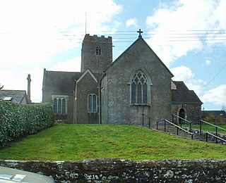
Holne is a village and civil parish on the southeastern slopes of Dartmoor in Devon, England. A community has existed here since at least the 11th century, and today a population of around 250 people is served by a church and a public house, the Church House Inn.
The River Meavy is a river in the southwest part of Dartmoor in Devon in south-west England. It runs entirely in the national park and connects Burrator Reservoir to the River Plym.
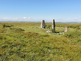
At 515 m, Ryder's Hill is the highest point on the southern part of Dartmoor, Devon, England. On its summit there are two standing stones and a low cairn, on top of which is a triangulation pillar.

Wistman's Wood is one of three remote high-altitude oakwoods on Dartmoor, Devon, England.
Newbridge or New Bridge is a Grade II* listed medieval bridge over the River Dart, Dartmoor, Devon, England.
The Loop is a section of the River Dart, Dartmoor, also known as the Dart Loop.

The Dartmoor crosses are a series of stone crosses found in Dartmoor National Park in the centre of Devon, England. Many of them are old navigational aids, needed because of the remoteness of the moorland and its typically bad weather. Some mark medieval routes between abbeys. Other crosses were erected as memorials, for prayer, as town or market crosses, in churchyards, and as boundary markers. The crosses were erected over a long period of time, some as recently as 100 years ago, the earliest probably almost 1,000 years ago.

Eylesbarrow mine was a tin mine on Dartmoor, Devon, England that was active during the first half of the 19th century. In its early years it was one of the largest and most prosperous of the Dartmoor tin mines, along with Whiteworks and the Birch Tor and Vitifer mines. Its name has several variant spellings, such as Eylesburrow, Ailsborough, Ellisborough, Hillsborough etc. It was also known as Wheal Ruth for a short period around 1850. The extensive remains lie to the north of the River Plym, less than 1 mile (1.6 km) north-east of Drizzlecombe, on the southern shoulder of the hill called Eylesbarrow on top of which are two prominent Bronze Age barrows.

Holy Brook is a tributary of the River Dart in Devon, England. It rises on the eastern flank of the 495 m (1,624 ft)-high hill of Snowdon on Dartmoor, at grid reference SX678687. It was once a much longer stream, but its headwaters were long ago captured by the River Mardle, and the physical evidence of this stream capture is clear when viewed from higher up the side of Snowdon.
Rippon Tor is a striking tor on eastern Dartmoor, in England, that stands at 473 metres (1,552 ft) above sea level. It has three cairns, of which are some of Dartmoor's largest, a triangulation pillar, and several rock piles that overlook the northern high moors near Fernworthy Forest and Great Mis Tor. Field boundaries surround the tor.
This article describes the geology of Dartmoor National Park in Devon, in south-west England. Dartmoor gained national park status in 1951 but the designated area of 954 km2 (368 sq mi) extends beyond the upland of Dartmoor itself to include much of the surrounding land, particularly in the northeast. The geology of the national park consists of a 625 km2 (241 sq mi) core of granite intruded during the early Permian period into a sequence of sedimentary rocks originating in the Devonian and Carboniferous periods. These rocks were faulted and folded, sometimes, intensely, during the Variscan orogeny. Thermal metamorphism has also taken place around the margins of the granite pluton altering the character of the sedimentary rocks whilst mineral veins were emplaced within the granite. A small outlier of Palaeogene sediments occurs on the eastern boundary of the national park.
