
Hawarden is a village and community in Flintshire, Wales. It is part of the Deeside conurbation on the Wales-England border and is home to Hawarden Castle. In the 2011 census the ward of the same name had a population of 1,887, whereas the community of the same name, which also includes Ewloe Mancot and Aston had a population of 13,920. The scenic wooded Hawarden Park abuts the clustered settlement in the south. Hawarden Bridge consists of distribution and industrial business premises beyond Shotton/Queensferry and the Dee. The west of the main street is called The Highway, its start marked by the crossroads with a fountain in the middle, near which are public houses, some with restaurants.

Flintshire is a county in the north-east of Wales. It borders the English ceremonial counties of Merseyside and Cheshire, across the Dee Estuary to the north and by land to the east respectively, Wrexham County Borough to the south, and Denbighshire to the west. Connah's Quay is the largest town, while Flintshire County Council is based in Mold.
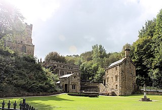
Holywell is a market town and community in Flintshire, Wales. It lies to the west of the estuary of the River Dee. The community includes Greenfield. In 2011 it had a population of 8,886.

Saint Winifred was a Welsh virgin martyr of the 7th century. Her story was celebrated as early as the 8th century, but became popular in England in the 12th, when her hagiography was first written down.

Shotton is a town and community in Flintshire, Wales, within the Deeside conurbation along the River Dee, joined with Connah's Quay, near the border with England. It is located 5 miles (8 km) west of Chester and can be reached by road from the A548. In the 2011 census, Shotton had a population of 6,663.
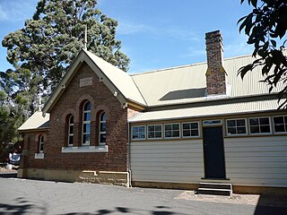
North Ryde is a suburb located in the Northern Sydney region of Sydney, New South Wales, Australia. North Ryde is located 15 kilometres north-west of the Sydney central business district, in the local government area of the City of Ryde.

Delyn was a local government district with borough status from 1974 to 1996, being one of six districts in the county of Clwyd, north-east Wales.

Sealand is a community in Flintshire and electoral ward, north-east Wales, on the edge of the Wirral peninsula. It is west of the city of Chester, England, and is part of the Deeside conurbation on the Wales-England border. At the 2001 Census, it had a population of 2,746, increasing to 2,996 at the 2011 census. The community includes the villages of Garden City and Sealand, and the settlements of Higher Ferry, Sealand Manor and Sealand Road.
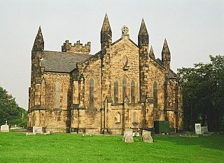
Bagillt is a large village and community in Flintshire, Wales. The village overlooks the Dee Estuary and is between the towns of Holywell and Flint. At the 2001 Census the population was recorded as 3,918, increasing to 4,165 at the 2011 census. The community also includes the settlements of Coleshill, Walwen and Whelston.
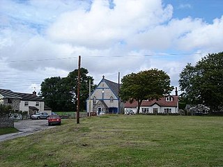
Brynford is a village and community in Flintshire, Wales. It is located to the south west of the town of Holywell and near the A55 road. Brynford had a population of 1,059 at the 2011 census.

The Callan Park Hospital for the Insane (1878–1914) is a heritage-listed former insane asylum, which was subsequently, for a time, used as a college campus, located in the grounds of Callan Park, an area on the shores of Iron Cove in Lilyfield, a suburb of Sydney, New South Wales, Australia. In 1915, the facility was renamed as the Callan Park Mental Hospital and, again in 1976, to Callan Park Hospital. Since 1994, the facility has been formally known as Rozelle Hospital. In April 2008, all Rozelle Hospital services and patients were transferred to Concord Hospital. The Callan Park Act, 2002 (NSW) restricts future uses of the site to health, tertiary education and community uses.
North East Wales NHS Trust was an NHS Trust in Wales. The headquarters of the Trust were in the Maelor Hospital, in Wrexham. It was founded on 1 April 1999, when the NHS Trusts in Wales were reconfigured. The Trust provided secondary care services for the Wrexham and Flintshire Local Authority areas, including mental health care – a population of around 300,000 people, through one major acute hospital, five community hospitals, and a variety of clinics. The Trust reported a budget deficit of £3.6 million at the end of the 2005/06 financial year.
Lluesty Hospital was a community hospital in Holywell, Flintshire, Wales. It was managed by the Betsi Cadwaladr University Health Board.

Mold Community Hospital is a community hospital in Mold, Flintshire, Wales. It is managed by the Betsi Cadwaladr University Health Board.

Greenfield is a village in the community of Holywell, Flintshire, north-east Wales, on the edge of the River Dee estuary. At the time of the 2001 census it had a population of 2,741, which remained unchanged in the 2011 census.

Holywell Town Football Club is a Welsh football club from Holywell, Flintshire. They are nicknamed 'The Wellmen', and play their home games at the Achieve More Training Stadium, Holywell. They currently play in the Cymru North.

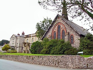
Holywell Workhouse Chapel was built in association with Holywell Workhouse in Old Chester Road, Holywell, Flintshire, Wales. It was built, together with some "vagrants' wards" for the workhouse, in 1883–84 to a design by the Chester architect John Douglas.

Gwespyr is a village in Flintshire on the north coast of Wales in the community of Llanasa. Gwespyr had a population of 289 people in the United Kingdom 2001 census. It overlooks Point of Ayr on the west side of the River Dee estuary and its sandy beaches with dunes. The hills of the Clwydian Range behind the village form the eastern boundary of the Vale of Clwyd. Gwespyr also looks respectively Welsh but is an alien name. It represents Old English for 'West-bury' which came to be interpreted as the 'west fort' meaning the westernmost fort in Mercia. Originally, it is thought to have been a strategic Mercian lookout which was reduced in importance with the development of a fortified Rhuddlan.

Betsi Cadwaladr University Health Board (BCUHB) is the local health board of NHS Wales for the north of Wales. It is the largest health organisation in Wales, providing a full range of primary, community, mental health, and acute hospital services for a population of around 694,000 people across the six principal areas of north Wales as well as some parts of Mid Wales, Cheshire and Shropshire. Betsi Cadwaladr University Health Board is the operational name of Betsi Cadwaladr Local Health Board.

Holywell Junction railway station was a junction station located on the north-eastern edge of Holywell and Greenfield, in Flintshire, Wales, on the estuary of the River Dee.


