
Wynyard is a town in eastern Saskatchewan, Canada, 132 km west of Yorkton and 190 km east of Saskatoon. Wynyard is in but not part of the rural municipality of Big Quill No. 308. It is located on the Yellowhead Highway just south of Big Quill Lake.
Maple Creek is a town in Maple Creek Rural Municipality No. 111, Saskatchewan, Canada. The population was 2,084 at the 2016 Census.

Sam Houston Park is an urban park located in downtown Houston, Texas, United States, dedicated to the buildings and culture of Houston's past. The park, which was the first to be established in the city, was developed on land purchased by former Mayor Sam Brashier in 1900.

Dundurn is a town of 647 residents in the rural municipality of Dundurn No. 314, in the Canadian province of Saskatchewan. Dundurn is located on Highway 11 or Louis Riel Trail in central Saskatchewan, about 42 km south of Saskatoon. As well as being an agricultural town, it is also a bedroom community for both Camp Dundurn and Saskatoon.

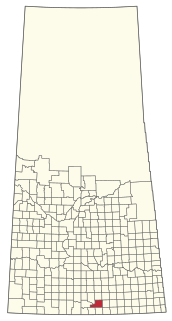
Robsart is an unincorporated hamlet within the rural municipality of Reno No. 51, in the province of Saskatchewan, Canada. Robsart had a population of 20 at the 2016 Canada Census. Robsart previously incorporated an independent village since 1912 until it was dissolved into an unincorporated community on January 1, 2002 under the jurisdiction of the rural municipality of Reno No. 51. Robsart is located 48 km southwest of the town of Eastend at the junction of Highway 18 and Highway 13 approximately 170 km south-east of Medicine Hat, Alberta, 68 km south of the Town of Maple Creek.

Ituna is a town in Saskatchewan, Canada. In 2006, it had a population of 622. It is 165 km north-east of the capital Regina.

Maidstone is a town in southwest Saskatchewan, Canada located 57 km east of Lloydminster and 84 km west of North Battleford at the junction of Highway 16 and Highway 21. The community was named after Maidstone, Kent, England.

Harris is a village within the Rural Municipality of Harris No. 316, in the province of Saskatchewan, Canada. It was the site of the Great Ruby Hoax in 1914. The village had a population of 193 according to the 2016 Canada Census,. Harris was named for Richard Elford Harris, an early settler to the area.
Leross is a village within the Rural Municipality of Kellross No. 247, in the province of Saskatchewan, Canada. Leross had a population of 46 in the 2016 Canada Census,.

Prelate is a village in southwest Saskatchewan, Canada. Located just of Highway 32 it is 12 km east of Leader and 146 km northwest of Swift Current. Prelate was first settled in 1908 and was incorporated as a village in 1913.

All Saints Pastoral Centre was a conference and retreat centre at London Colney on the southern outskirts of St Albans, Hertfordshire, England.
Spalding is a village in the Canadian province of Saskatchewan. The town is named after Spalding, Lincolnshire, birthplace of the wife of the first postmaster for Spalding. The local economy is dominated by agriculture.
Hoosier is an unincorporated hamlet in Antelope Park Rural Municipality No. 322, Saskatchewan, Canada. The hamlet is approximately 40 km north west of the Town of Kindersley at the intersection of Highway 317 and Highway 772. The Canadian Pacific Railway played a big role in the towns economy when it was completed in 1913 in the early years of Hoosier's history. Due to the closure of branch line in 1981 the tracks from Dodsland to Hoosier were pulled and the last of the communities grain elevators was demolished causing Hoosier's population to decline.

Neil R. Darrach (1850–1926) was a noted Canadian architect from St. Thomas, Ontario. He was architect for over five designated heritage properties in St. Thomas, Ontario and Regina, Saskatchewan. He was primarily active in the later 19th century.
Bengough No. 40 is a rural municipality in south-east Saskatchewan, Canada encompassing 1,036.91 square kilometers in area. The rural municipality has within its boundaries the un-incorporated communities of Harptree, and Horizon. The rural municipality maintains its office in Bengough, Saskatchewan. The rural municipality in conjunction with the provincial government is in charge of maintenance of highways in its area. As well, the municipality provides policing, fire protection and municipal governance for the rural district, with a reeve as its administrator. The rural municipality was established on 1910.

Kingsley No. 124 is a rural municipality in south-eastern Saskatchewan, Canada encompassing 844.61 square kilometers in area. The rural municipality maintains its office in Kipling, Saskatchewan. The rural municipality, in conjunction with the provincial government, is in charge of the maintenance of highways in its area. As well as this, the municipality provides policing, fire protection and municipal governance for the rural district, with a reeve as its administrator.

Chester No. 125 is a rural municipality in south-eastern Saskatchewan, Canada encompassing 837.08 square kilometers in area. The rural municipality maintains its office in Glenavon, Saskatchewan. The communities of Glenavon, Windthorst, Peebles and Baring are within the rural municipality. The rural municipality in conjunction with the provincial government is in charge of maintenance of highways in its area. As well, the municipality provides policing, fire protection and municipal governance for the rural district, with a reeve as its administrator.
Newcombe No. 260 is a rural municipality in west-central Saskatchewan, Canada encompassing 1,075.60 square kilometers in area. The rural municipality is at the intersection of Highway 21 and Highway 44. The Lemsford Ferry is located within the rural municipality. The rural municipality maintains its office in Glidden, Saskatchewan. The rural municipality in conjunction with the provincial government is in charge of maintenance of highways in its area. The rural municipality was established in 1911 and is named after Allan Simpson Newcombe who played a leadership role in establishing the Boston Colony of immigrants from Massachusetts. Glidden is named after Charles Glidden who sold the town site to the Canadian Pacific Railway.
New Finland or Uusi Suomi is a district in the Qu'Appelle valley, the south eastern part of the province of Saskatchewan, Canada.
Marysburg Assumption Church & Centre Of The Arts is a Roman Catholic church in the hamlet of Marysburg within the Rural Municipality of Humboldt in Saskatchewan, Canada. The church was designated as a municipal heritage building on September 13, 1983. The brick building contains two towers and is of a Romanesque Revival style while the interior exhibits a Classical Revival influence. The Assumption Church is 12.8 km north of Humboldt, Saskatchewan on Hwy 20 and 3.2 km east on Marysburg Grid 756.
