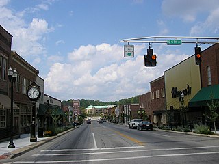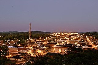
Whitley County is a county located in the southeastern part of the U.S. state of Kentucky. As of the 2020 census, the population was 36,712. Its county seat is at Williamsburg, though the largest city is Corbin, and the county's District Court sits in both cities. Whitley County is included in the London, KY Micropolitan Statistical Area.

Lewis County is a county located in the U.S. state of Kentucky. As of the 2020 census, the population was 13,080. Its county seat is Vanceburg.

Laurel County is a county located in the southeastern portion of the U.S. state of Kentucky. As of the 2020 census, the population was 62,613. Its county seat is London. After a special election in January 2016 alcohol sales are permitted only in the city limits of London. The ordinance went into effect on March 27, 2016, 60 days after results of the election. Laurel County is included in the London, KY Micropolitan Statistical Area.

Jackson County is a county located in the Commonwealth of Kentucky. As of the 2020 census, the population was 12,955. Its county seat is McKee. The county was formed in 1858 from land given by Madison, Estill, Owsley, Clay, Laurel, and Rockcastle counties. It was named for Andrew Jackson, seventh President of the United States. Jackson County became a moist county via a "local-option" referendum in the Fall of 2019 that legalized the sale of alcoholic beverages in the city of McKee.

Pineville is a home rule-class city in Bell County, Kentucky, United States. It is the seat of its county. The population was 1,732 as of the 2010 census. It is located on a small strip of land between the Cumberland River and Pine Mountain.

London is a home rule-class city in Laurel County, Kentucky, in the United States. It is the seat of its county. The population was 8,053 at the time of the 2020 census. It is the second-largest city named "London" in the United States and the fourth-largest in the world. It is part of the London, Kentucky micropolitan area. Of the seventeen micropolitan areas in Kentucky, London is the largest; the London micropolitan area's 2010 Census population was 126,368. London is also home to the annual World Chicken Festival that celebrates the life of Colonel Sanders and features the world's largest skillet.

North Corbin is a census-designated place (CDP) in Laurel and Knox counties in the U.S. state of Kentucky. The population was 1,727 at the 2020 census down from 1,773 at the 2010 census. The census bureau also lists the Laurel County portion of North Corbin as a CCD with a population of 10,729.

The Hopewell tradition, also called the Hopewell culture and Hopewellian exchange, describes a network of precontact Native American cultures that flourished in settlements along rivers in the northeastern and midwestern Eastern Woodlands from 100 BCE to 500 CE, in the Middle Woodland period. The Hopewell tradition was not a single culture or society but a widely dispersed set of populations connected by a common network of trade routes.

Pennsylvania Route 151 is a 13.3-mile-long (21.4 km) state highway located in Beaver County, Pennsylvania. The western terminus of the route is at US 30 near Harshaville. The eastern terminus is at PA 51 in South Heights. The route heads through a mix of suburban and rural areas of southern Beaver County as a two-lane road except at the junction with I-376 near Gringo.

Interstate 75 (I-75) is a part of the Interstate Highway System that runs 1,786.47 miles (2,875.04 km) from Miami Lakes, Florida to the Canada–United States border at Sault Ste. Marie, Michigan. In the U.S. state of Kentucky, I-75 runs through the eastern half of the state, from the Tennessee state line near the city of Williamsburg to the Ohio state line near Covington. The Interstate serves the state's second-most populous city, Lexington. Outside of it, the route is mostly rural or suburban in nature, mainly providing access to other cities via state and U.S. Highways. The major landscapes traversed by I-75 include the rolling hills and mountains of the Cumberland Plateau, the flat Bluegrass region, the urban core of Lexington, and the highly urbanized suburbs of Northern Kentucky; it also very briefly crosses through the Eastern Kentucky Coalfield at its southernmost stretch and passes near the Daniel Boone National Forest in London.

Kentucky Route 30 is an east–west state highway in Kentucky managed by the Kentucky Transportation Cabinet.

The Corbin, Kentucky Micropolitan Area Micropolitan Area (μSA) is made up of four counties in the Eastern Coalfield region of Kentucky. Before 2013, the area was officially known as the Corbin–London, KY Combined Statistical Area, and consisted of the Corbin Micropolitan Statistical Area and the London Micropolitan Statistical Area. The Corbin micropolitan area consisted of Whitley County, and the London micropolitan area consisted of Laurel County.
Boreing is an unincorporated community in Laurel County, in the U.S. state of Kentucky.

Kentucky Route 354 (KY 354) is a 1.106-mile-long (1.780 km) state highway in the U.S. state of Kentucky. The highway travels through portions of London, in Laurel County.

Kentucky Route 1006 is an 6.899-mile-long (11.103 km) state highway in the U.S. state of Kentucky. The route is located entirely within Laurel County; the majority of the highway runs along the border of, or within the city limits of, London. KY 1006 begins at the western entrance to Levi Jackson Wilderness Road State Park and terminates at US Route 25 (US 25), KY 80, and East Fifth Street in downtown London.


