Horizontal Falls

Last updated

Horizontal Falls
Horizontal Waterfalls, "Horries"
Horizontal Falls.jpg
Australia relief map.jpg
Red pog.svg
Horizontal Falls
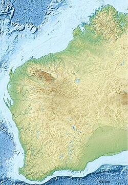
Australia Western Australia relief location map.png
Red pog.svg
Horizontal Falls
Coordinates: 16°23′00″S123°57′29″E / 16.38325°S 123.95797°E / -16.38325; 123.95797
Location Kimberley region, Western Australia
Part ofTalbot Bay
Offshore water bodies Indian Ocean
Dimensions
  Width10m (landward gap)
20m (seaward gap)
  Dropup to 4m
Elevation0m
Designation Marine park
Indigenous nameGaraanngaddim
Horizontal Falls

The Horizontal Falls, or Horizontal Waterfalls, nicknamed the "Horries" and known as Garaanngaddim by the local Indigenous people, are an unusual natural phenomenon on the coast of the Kimberley region in Western Australia, where tidal flows cause waterfalls on the ebb and flow of each tide. The Lalang-garram / Horizontal Falls Marine Park is a protected area covering the falls and wider area.

Contents

Description

The falls form when seawater rushes through two short and narrow gorges which are about 300 metres (1,000 ft) apart from each other. They are located in the coastal McLarty Ranges situated within Talbot Bay (Ganbadba) within the Buccaneer Archipelago. The seaward gap is about 20 metres (70 ft) wide and the landward one is about 10 metres (30 ft).

The natural phenomenon is caused by the changing local sea level due to tides of up to 10 metres (33 ft). The water builds up on one side or the other of the gaps faster than it can flow through them, creating a waterfall up to 4 metres (13 ft) high. With each change of the tide, the direction of the falls reverses from inflow to outflow and back again. [1]

The Horizontal Falls have been described by naturalist David Attenborough as "one of the greatest wonders of the natural world". [2] [1]

Boats are able to travel through the gap, [1] and thrill-seeking tourists are catered for by several tourism companies. [3] On May 27 2022, the Falls Express was conducting a tour of the natural phenomenon, about 250km north-east of Broome, when it ran into trouble with 26 passengers and two crew on board. The vessel appeared to have collided with a rock wall. More than a dozen tourists were left with critical injuries and required surgery. [4] The safe rescue of passengers was made more difficult due to the falls remote location and accessibility only by sea and air. The presence of box jellyfish and estuarine crocodiles at the falls made rescue efforts more urgent. [5]

Beginning in 2026, the West Australian government will ban boats from traversing the iconic Horizontal Falls on the Kimberley coast. The Dambimangari Aboriginal Corporation, which represents the traditional owners of the area, pushed for the boat pass tours to be stopped because it was a sacred area.

Marine parks

The Kimberley Marine Park is a Commonwealth government area covered by the national EPBC Act , covering an expanse of ocean outside the limits of the Camden Sound and other state parks, stretching from south of King Sound to nearly the top of the North Kimberley Marine Park. This area consists mostly of Multiple Use Zone (IUCN VI), but also includes sections of national park (IUCN II) and Habitat Protection (IUCN IV) zones, the latter two mostly just outside the Camden Sound and King Sound areas. [6]

Lalang-garram / Horizontal Falls Marine Park

The Lalang-garram / Horizontal Falls Marine Park is jointly managed by the Government of Western Australia's Department of Biodiversity, Conservation and Attractions [7] (formerly the Department of Parks and Wildlife (DPaW) [8] ) via its agency, the Parks and Wildlife Service and the traditional owners of the land and waters, the Dambimangari (Worrorra) group. The Dambimangari people chose the name "Lalang-garram", being a Worrorra word meaning “the saltwater as a spiritual place as well as a place of natural abundance”, relating to the ocean in a general sense. [9]

The Horizontal Falls are known as Garaanngaddim by the Dambimangari, and the Lalang-garram / Horizontal Falls and North Lalang-garram Marine Parks lie within their native title determination area. The two marine parks were declared by the Government of Western Australia. [10]

New marine park

An 2016 management plan saw this park, along with the Lalang-garram / Camden Sound Marine Park and the North Kimberley Marine Park make up part of what was to be named the Great Kimberley Marine Park, covering about 30,000 square kilometres (12,000 sq mi) of coastal waters from west of Ganbadba (Talbot Bay) to the Northern Territory border. [10]

In 2020, a new management plan was released, titled Lalang-gaddam Marine Park: Amended joint management plan for the Lalang-garram / Camden Sound, Lalang-garram / Horizontal Falls and North Lalang-garram marine parks and indicative joint management plan for the proposed Maiyalam Marine Park. It was published ahead of the gazettal of the proposed Maiyalam Marine Park under the CALM Act as a Class A reserve. Under the new arrangements, the zoning of the Camden Sound park would not change, but the plan is now to amalgamate the four marine parks (Lalang-garram / Horizontal Falls Marine Park, North Lalang-garram Marine Park and the new Maiyalam Marine Park) to form the Lalang-gaddam Marine Park, all in the sea country of the Dambeemangarddee people. This plan will be amended by another 10-year final joint management plan. [7]

The new Maiyalam Marine Park will add 47,000 hectares (120,000 acres) to the Kimberley marine reserves. The larger plan is to create a total of 5,000,000 hectares (12,000,000 acres) of new national and marine reserves in Western Australia. The new spelling, "Lalang-gaddam", reflects the correct pronunciation of the word, and "Maiyalam" means "between islands", or "a gap through". The new Maiyalam Marine Park covers an area off the north-western coast of King Sound and around Macleay Island. The new Lalang-gaddam Marine Park borders the proposed Mayala Marine Park to the west (covering the Buccaneer Archipelago), and the North Kimberley Marine Park (Uunguu waters) to the north-east. The land and sea border to the south abut Bardi Jawi land and a proposed Bardi Jawi Marine Park. Maps show the extent of the various marine parks, native title determinations, zones within the areas, etc. [7]

Details such as port areas are outlined in the plan. An Indigenous land use agreement (ILUA) already covers the Lalang-garram/ Camden Sound, Lalang-garram/ Horizontal Falls and North Lalang-garram marine parks, but an additional ILUA will be needed to allow the creation of the proposed Maiyalam Marine Park in accordance with the Native Title Act 1993 . Much of Collier Bay will remain a general use zone, but the Walcott Inlet will be zoned as sanctuary. [7]

2022 tour boat incident

On 27 May 2022 at around 7:00 am, the 'Falls Express' tourist boat, owned by Horizontal Falls Seaplane Adventures, crashed into a rock wall at the falls, with 28 people on board. The Royal Flying Doctor Service deployed six aircraft to the scene, with a triage zone established at the Koolan Island iron ore mine nearby. 18 patients were transported by the service, the majority to Perth. [11] [12] Injuries included broken bones and head injuries. [13]

Related Research Articles

A marine park is a designated park consisting of an area of sea set aside to achieve ecological sustainability, promote marine awareness and understanding, enable marine recreational activities, and provide benefits for Indigenous peoples and coastal communities. Most marine parks are managed by national governments, and organized like 'watery' national parks, whereas marine protected areas and marine reserves are often managed by a subnational entity or non-governmental organization, such as a conservation authority.

The Kimberley is the northernmost of the nine regions of Western Australia. It is bordered on the west by the Indian Ocean, on the north by the Timor Sea, on the south by the Great Sandy and Tanami deserts in the region of the Pilbara, and on the east by the Northern Territory.

<span class="mw-page-title-main">Cleland National Park</span> Protected area in South Australia

Cleland National Park, formerly Cleland Conservation Park, is a protected area located in the Adelaide Hills, South Australia about 22 kilometres (14 mi) south-east of the Adelaide city centre. It conserves a significant area of natural bushland on the Adelaide Hills face, including Mount Lofty Summit and Waterfall Gully.

<span class="mw-page-title-main">Buccaneer Archipelago</span> Archipelago of the Western Australian Kimberley coast

The Buccaneer Archipelago is a group of islands off the coast of Western Australia near the town of Derby in the Kimberley region. The closest inhabited place is Bardi located about 54 kilometres (34 mi) from the western end of the island group.

<span class="mw-page-title-main">Shire of Wyndham–East Kimberley</span> Local government area in Western Australia

The Shire of Wyndham East Kimberley is one of the four local government areas in the Kimberley region of northern Western Australia, covering an area of 117,514 square kilometres (45,372 sq mi) at Western Australia's northeastern corner. The Shire's seat of government was originally in Wyndham but now in the town of Kununurra, which is home to over half of the Shire's permanent population of around 7,000, while a council office is located at Wyndham.

<span class="mw-page-title-main">Department of Conservation and Land Management (Western Australia)</span> Gormer government department in Western Australia

The Department of Conservation and Land Management (CALM) was a department of the Government of Western Australia that was responsible for implementing the state's conservation and environment legislation and regulations. It was created by the Conservation and Land Management Act 1984, also known as the CALM Act, which is still in force as of 2020.

Western Australia has the longest coastline of any state or territory in Australia, at 10,194 km or 12,889 km. It is a significant portion of the coastline of Australia, which is 35,877 km.

<span class="mw-page-title-main">Mitchell River National Park (Western Australia)</span> Protected area in Western Australia

Mitchell River National Park is a national park in the Kimberley region of Western Australia, 2,140 kilometres (1,330 mi) northeast of Perth. The park adjoins the northern boundary of the Prince Regent National Park. The nearest towns are Derby, 350 kilometres (217 mi) to the southwest, as well as Wyndham, 270 km (168 mi) to the southeast. Created in 2000, the park covers an area of over 1,150 km2 (440 sq mi) on the Mitchell Plateau (Ngauwudu).

<span class="mw-page-title-main">Camden Sound</span> Coastal feature in Western Australia

Camden Sound is a relatively wide body of water in the Indian Ocean located in the Kimberley region of Western Australia. The Sound is bounded by the Bonaparte Archipelago to the north-east, the Buccaneer Archipelago to the south-west, and Montgomery Reef to the south.

<span class="mw-page-title-main">Prince Regent National Park</span> Protected area in Western Australia

Prince Regent National Park, formerly the Prince Regent Nature Reserve, is a protected area in the Kimberley region of Western Australia. In 1978 the area was nominated as a UNESCO World Biosphere Reserve.

<span class="mw-page-title-main">Worrorra language</span> Aboriginal Australian language of northern Western Australia

Worrorra, also written Worora and other variants, and also known as Western Worrorran, is a moribund Australian Aboriginal language of northern Western Australia. It encompasses a number of dialects, which are spoken by a group of people known as the Worrorra people.

<span class="mw-page-title-main">Montgomery Reef</span> Reef in the Kimberley region of Western Australia

Montgomery Reef is a reef off the Kimberley coast of Western Australia. It is situated at the south western end of Camden Sound and surrounds Yawajaba (Montgomery) Island. With its total area of 400 square kilometres (154 sq mi), it is the world's largest inshore reef. The nearest populated place is Bardi, which is approximately 130 kilometres (81 mi) to the south west.

Champagny Island, known to the traditional owners as Nimenba, is an island off the coast of the Kimberley region in Western Australia.

<span class="mw-page-title-main">Worrorra</span> Indigenous people in Western Australia

The Worrorra, also written Worora, are an Aboriginal Australian people of the Kimberley area of north-western Australia.

The Ngarinyin or Ngarinjin are an Aboriginal Australian people of the Kimberley region of Western Australia. Their language, Ngarinyin, is also known as Ungarinyin. When referring to their traditional lands, they refer to themselves as Wilinggin people.

The Yawijibaya, also written Jaudjibaia, are an Aboriginal Australian people of the Kimberley region of northern Western Australia. Along with the Unggarranggu people, they are the traditional owners of the Buccaneer Archipelago, off Derby, together known as the Mayala group for native title purposes. Yawijibaya country includes Yawajaba Island and the surrounding Montgomery Reef.

The Ngardi, also spelled Ngarti, are an Aboriginal Australian people of the Northern Territory and Western Australia.

The Kimberley Marine Park, formerly known as the Kimberley Commonwealth Marine Reserve and also known as the Great Kimberley Marine Park, is an Australian marine park offshore of Western Australia, near the Kimberley region. Proclaimed under the EPBC Act in 2013, the marine park covers an area of 74,469 km2 (28,753 sq mi) and is assigned IUCN category VI. It is one of the 13 parks managed under the North-west Marine Parks Network. It covers a number of state-managed marine parks.

The North Kimberley Marine Park is the largest state-managed marine park in Western Australia and second largest in Australia. covering 1,845,000 ha or 18,450 km2 (7,120 sq mi) about 270 km (170 mi) north-east of Derby. It is located in the Indian Ocean and the Timor Sea, extending from York Sound north-eastwards to the WA border with the Northern Territory.

References

  1. 1 2 3 "Horizontal Falls". Kimberley Australia. Retrieved 8 November 2020.
  2. Great natural wonders — tidal waves at Talbot Bay, Australia — David Attenborough - BBC on YouTube (2013)
  3. "Horizontal Falls Tour". Go Horizontal Falls Tours. 15 January 2020. Retrieved 8 November 2020.
  4. "Boat carnage rattles medicos as authorities reveal crash cause". ABC News. 31 May 2022.
  5. Leonard, Owen; Murray, Duncan (27 May 2022). "Fears up to 28 injured in horror boating incident at Horizontal Falls". Sky News Australia. NCA NewsWire . Retrieved 27 May 2022.
  6. "Kimberley Marine Park: North-west Network Management Plan 2018" (PDF). 2018. (From Parks Australia web page.
  7. 1 2 3 4 Department of Biodiversity, Conservation and Attractions (WA) (2020). Lalang-gaddam Marine Park amended joint management plan for the Lalang-garram / Camden Sound, Lalang-garram / Horizontal Falls and North Lalang-garram marine parks and indicative joint management plan for the proposed Maiyalam Marine Park 2020 (PDF). Government of Western Australia. ISBN   978-1-925978-20-9 . Retrieved 31 December 2020.
  8. Department of Parks and Wildlife (WA) (2013). Lalang-garram / Camden Sound Marine Park 2013–2023 (PDF). Management Plan 73. Government of Western Australia. ISSN   2200-9973 . Retrieved 31 December 2020.
  9. "Lalang-garram/Camden Sound Marine Park". Parks and Wildlife Service (WA). Archived from the original on 20 January 2021. Retrieved 2 January 2021.
  10. 1 2 Government of Western Australia. Department of Parks and Wildlife. Conservation and Parks Commission (November 2016). Lalang-garram / Horizontal Falls and North Lalang-garram marine parks: Joint management plan 2016 (PDF). Management plan 88. State of Western Australia. ISBN   978-1-921703-76-8.
  11. "Boat carnage rattles medicos as authorities reveal crash cause". ABC News. 31 May 2022. Retrieved 20 September 2022.
  12. "Speed boat ride SCRAPPED after Horizontal Falls crash". PerthNow. 15 June 2022. Retrieved 20 September 2022.
  13. Brookes, Sarah (29 May 2022). "Multiple tourists still in surgery after Horizontal Falls boat accident". WAtoday. Retrieved 20 September 2022.