
Kudremukha is the name of a mountain range and an individual mountain peak located in Chikmagaluru district, in Karnataka, India. It is also the name of a small hill station and iron ore-mining town situated near the mountain, about 20 kilometres from Kalasa in Kalasa Taluk. The name Kuduremukha literally means "horse-faced" in Kannada and refers to a particular picturesque view of a side of the mountain that resembles a horse's face. It was also referred to as 'Samseparvata', historically since it was approached from Samse village. Kuduremukha is Karnataka's 2nd highest peak after Mullayanagiri and 26th highest peak in western ghats. The nearest International Airport is at Mangalore which is at a distance of 99 kilometres.
Bantwal is a suburb of Mangalore in Dakshina Kannada district, Karnataka, India, and the headquarters of Bantwal taluk. It is located 25 km (16 mi) East of Mangalore city center. BC Road-Kaikamba of Bantwal is one of the fastest developing areas in Dakshina Kannada district of Karnataka.

Somwarpet is a panchayat town in Kodagu district in the Indian state of Karnataka. It is the main town of the Somwarpet taluk, in the north-east of the district. 2nd highest Administrative town in Karnataka in terms of elevation. The main crops grown in the area are coffee and spice crops such as cardamom, peppers, oranges, ginger and vegetables.
Bajpe is a locality in Mangalore city of Dakshina Kannada district in the state of Karnataka, now also known as Bajpe Town, India. It is around 18 km (11 mi) from the city of Mangalore. The Mangalore International Airport is located at Bajpe and was previously known as the Bajpe Aerodrome. City bus number 47 connects Bajpe to State Bank. There are a number of villages surrounding Bajpe, for which it serves as a hub. The nearby villages to which Bajpe serves as hub are Permude, Hosabettu, Kinnigoli, Kalamundkur and Kateel. Bajpe is derived from the Tulu word, Bija da Appe since it was famous for its agricultural market in olden days.
Kotekara is a census town in Dakshina Kannada district in the Indian state of Karnataka.Kotekar is located on NH-17 south of Mangalore towards Talapady.
Mudushedde is a village within Mangalore city in Dakshina Kannada district in the Indian state of Karnataka.
Mulki is a panchayat town located at Mangalore taluk in Dakshina Kannada district in the Indian state of Karnataka. It is on the banks of Shambhavi River. It was earlier known as Moolikapur, turned to Mulki. A small town with people of diverse religions, it is 10 km north of Suratkal. Karnad is a locality within Mulki. Nearest railway station is Mulki railway station

Sakleshpur, Sakleshpura or Sakleshapura is a hill station town and headquarters of Sakleshpur taluk in Hassan district in the Indian state of Karnataka.
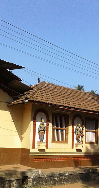
MoodabidriMūḍubidire;, is a town and taluk in Dakshina Kannada district. It lies 34 km northeast of the district headquarters, Mangalore, in Karnataka, India.
Kannur is a census town in Dakshina Kannada district, and a locality in the Mangalore City Corporation, in the Indian state of Karnataka.
Golthamajal is a village in the southern state of Karnataka, India. It is located in the Bantwal taluk of Dakshina Kannada district in Karnataka. It is situated at a distance of 34 km towards the east of Mangalore city.
Ilanthila is a village in the southern state of Karnataka, India. It is located in the Beltangadi taluk of Dakshina Kannada district.
Mandekolu is a village in the southern state of Karnataka, India. The nearest cities are Sullia, Adoor and Kasaragod. It is located near the Karnataka-Kerala border on the banks of River Payaswini(Chandragiri), at a distance of 86 km from Mangalore city. It is located in the Sullia taluk of Dakshina Kannada district in Karnataka.
Manjanady is a village in the Indian state of Karnataka, India. It is located in the Mangalore taluk of Dakshina Kannada district in Karnataka.
Sampaje is a village in the southern state of Karnataka, India. It is located in the Madikeri taluk of Kodagu district in Karnataka. It lies on NH-275 which connects Mangalore city in Dakshina Kannada district with Madikeri town in Kodagu distrtict. It is a border village in between Kodagu and Dakshina kannada.
Tenkayedapadavu is a panchayat village in the southern state of Karnataka, India. Administratively, it is under Mangalore taluk of Dakshina Kannada district in Karnataka. It is located at a distance of 26 km from Mangalore city. There are two villages in the gram panchayat, Tenkayedapadavu and Badagayedapadavu. The village Tenka Yedapadav is the part of Yedapadavu, divided for easier administration of village. The Post name is "Shibrikere" which means "Shabari lake". In Yedapadav there are 2 temples, the Shri Rama Mandira and the Shri Adishakthi Durga Parameshwari Temple. There are also 2 primary and secondary level schools, and one Pre-University college named "Swami Vivekananda Pre-University college, Yedapadavu". Shri Krishna Janmastami & Ramanavami are two festivals that are held in the village, with the people taking to celebrate "Masaru Kuduke ustava" in a grand manner. Yedapadav is the middle village for Ganjimatt and Moodbidiri and also Kuppe Padavu.
Laila is a village in the southern state of Karnataka, India. It is located in the Beltangadi taluk of Dakshina Kannada district.
Bantwal taluk is a taluk of Dakshina Kannada district. The headquarters is the town of Bantwal, an eastern suburb of Mangalore.

Suralpady also known as Badagulipady is a suburban town located in Mangalore City of Dakshina Kannada district in the state of Karnataka, India. Suralpady lies between Moodbidri & Mangalore city in National highway 169. The town is 13.6 km away from Mangalore International Airport, 19.9 km from Mangalore Central Railway Station, 21.8 km from Mangalore old Port and 25.9 km from New Mangalore port.
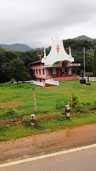
Shishila is a village located at the base of Western Ghats in Belthangady taluk of the Karnataka State, India. The main attraction of the village is a temple dedicated to Lord Shishileshwara.
