The Chūbu region, Central region, or Central Japan is a region in the middle of Honshū, Japan's main island. In a wide, classical definition, it encompasses nine prefectures (ken): Aichi, Fukui, Gifu, Ishikawa, Nagano, Niigata, Shizuoka, Toyama, and Yamanashi.

The Hida Mountains, or Northern Alps, is a Japanese mountain range which stretches through Nagano, Toyama and Gifu prefectures. A small portion of the mountains also reach into Niigata Prefecture. William Gowland coined the phrase "Japanese Alps" during his time in Japan, but he was only referring to the Hida Mountains when he used that name. The Kiso and Akaishi mountains received the name in the ensuing years.

Ibi District is a district located in Gifu Prefecture, Japan. As of July 2011, the district has an estimated population of 72,109. The total area is 876.65 km2.

Kamo is a district located in Gifu Prefecture, Japan. As of July, 2011 the district has an estimated population of 52,536. The total area is 615.17 km2.

Kani is a district located in Gifu Prefecture, Japan. As of July 2011, the district has an estimated population of 18,709. The total area is 56.61 km2.

Yamaguchi was a village located in Kiso District, Nagano Prefecture, Japan.

Kiso is a district located in Nagano Prefecture, Japan.

The Takayama Main Line is a Japanese railway line between Gifu Station in Gifu and Toyama Station in Toyama, operated by Central Japan Railway Company and West Japan Railway Company. The line directly links the Chūkyō Metropolitan Area and Hokuriku region in a shorter distance, but with a longer travel time, than by using the combination of the Tōkaidō Shinkansen and Hokuriku Main Line. Now the line primarily functions as a way to access the scenic areas of Hida, in the rugged mountains of northern Gifu Prefecture, such as Gero onsen, Takayama, Shirakawa-gō, and the Kiso River. The first section of the line, between Gifu and Kagamigahara, opened in 1920. The whole line was completed in 1934.

The Ibi River is a tributary of the Kiso River located in Gifu and Mie Prefectures in Japan. Along with the Nagara and Kiso rivers, the Ibi is the third of the Kiso Three Rivers of the Nōbi Plain. It is one of Japan's first-class rivers. The former Tōkaidō post station of Kuwana-juku was located on the western banks of this river during the Edo period.
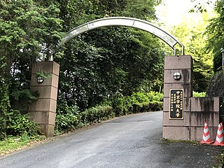
Chukyo Gakuin University is a private university at Nakatsugawa, Gifu, Japan. The school was founded as a junior college in 1966 and became a four-year college in 1993.
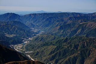
The Kiso Valley is a geographical area that centers on the valley of the upper portions of the Kiso River in the southwestern part of Nagano Prefecture in Japan. It is a v-shaped valley with length of approximately 60 km (36 mi) that follows the river as it flows from north by northwest to south by southwest into Gifu Prefecture.

The Shō River has its source in Mount Eboshi in the Shōkawa-chō area of Takayama, Gifu Prefecture, Japan. After flowing for 115 km (71 mi) through the northern part of Gifu Prefecture and the western part of Toyama Prefecture, it empties into Toyama Bay.
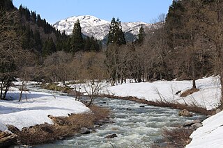
The Itoshiro River is a river through Gifu and Fukui prefectures in Japan.

The Hida River has its source in Mount Norikura in Takayama, Gifu Prefecture, Japan. It flows from the northern to the southern section of the prefecture before emptying into the Kiso River in Minokamo.

Mount Mikuni is the name of three mountains in Gifu Prefecture, Japan. One of the mountains is on the border of Gifu and Aichi prefectures. Another mountain is on the border of Gifu and Nagano prefectures. The third mountain is located on the border of all three prefectures. All three mountains are included in this article.

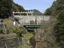
The Ōi Dam is a dam located between the cities of Ena and Nakatsugawa in Gifu Prefecture, Japan. It was built to produce electricity for the surrounding area. The Agi River flows through the dam.

Hiraoka Dam is a dam in Tenryū, Nagano Prefecture, Japan, completed in 1951. It is located on the Tenryū River upstream from the Sakuma Dam.
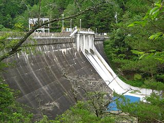
Iwakura Dam is a dam in Urugi, Nagano Prefecture, Japan, completed in 1936.

Katagiri Dam is a dam in the Nagano Prefecture, Japan, completed in 1989.

Kiso Dam is a dam in the Nagano Prefecture, Japan, completed in 1968.
