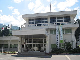
Shirakawa is a village located in Ōno District, Gifu Prefecture, Japan. It is best known for being the site of Shirakawa-gō, a small, traditional village showcasing a building style known as gasshō-zukuri. Together with Gokayama in Nanto, Toyama, it is one of UNESCO's World Heritage Sites.

The Shinano River, known as the Chikuma River in its upper reaches, is the longest and widest river in Japan and the third largest by basin area. It is located in northeastern Honshu, rising in the Japanese Alps and flowing generally northeast through Nagano and Niigata Prefectures before emptying into the Sea of Japan.

Qiandao Lake, a human-made, freshwater lake located in Chun'an County, Zhejiang Province, China, was formed after the completion of the Xin'an River hydroelectric station in 1959.

Longtan Dam is a large roller-compacted concrete (RCC) gravity dam on the Hongshui River in Tian'e County of the Guangxi Zhuang Autonomous Region, China, a tributary of the Xi River and the Pearl River. The dam is 216.2 metres (709.3 ft) high and 849 m (2,785 ft) long; it is the tallest of its type in the world. The dam is intended for hydroelectric power production, flood control and navigation. The dam contains seven surface spillways, two bottom outlets and an underground power station. The Longtan ship lift, part of the dam complex, will be the tallest ship lift system in the world.

Hirakud Dam is built across the Mahanadi River, about 15 kilometres (9 mi) from Sambalpur in the state of Odisha in India. Behind the dam extends a lake, Hirakud Reservoir, 55 km (34 mi) long. It is one of the first major multipurpose river valley projects started after India's independence.

The Historic Villages of Shirakawa-gō and Gokayama are one of Japan's UNESCO World Heritage Sites. The cultural property consists of three historic mountain villages over an area of 68 hectares in the remote Shogawa river valley, stretching across the border of Gifu and Toyama Prefectures in central Japan. Shirakawa-gō is located in the village of Shirakawa in Gifu Prefecture. The Gokayama area is divided between the former villages of Kamitaira and Taira in Nanto, Toyama Prefecture.

Lake Qaraoun is an artificial lake or reservoir located in the southern region of the Beqaa Valley, Lebanon. It was created near Qaraoun village in 1959 by building a 61-metre-high (200 ft) concrete-faced rockfill dam in the middle reaches of the Litani River. The reservoir has been used for hydropower generation, domestic water supply, and for irrigation of 27,500 hectares.

The Shō River has its source in Mount Eboshi in the Shōkawa-chō area of Takayama, Gifu Prefecture, Japan. After flowing for 115 km (71 mi) through the northern part of Gifu Prefecture and the western part of Toyama Prefecture, it empties into Toyama Bay.

The Iwaya Dam is a dam in the city of Gero, Gifu Prefecture, Japan on the Maze River, part of the Kiso River system. The dam is a rockfill dam with a height of 127 meters and was constructed as a multipurpose dam for flood control, supply of municipal and industrial water, irrigation water and hydroelectric power generation. The reservoir created by the dam supplies the Chubu Electric Power Company's Mazegawa No.1 Power plant with a capacity of 288 MW hydroelectric power station.

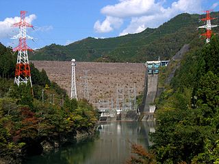
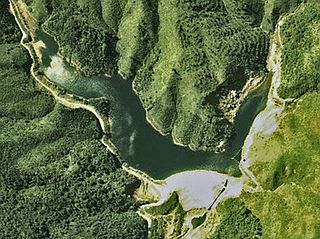
Sakaigawa Dam is a dam in Nanto, Toyama Prefecture and Shirakawa, Gifu Prefecture, Japan. It is named for the Sakaigawa River, upon which it is built. The dam has an associated 27 MW hydroelectric power station about 2.9 km (1.8 mi) downstream. It was commissioned in June 1993.

The Wu River is the largest southern tributary of the Yangtze River. Nearly its entire length of 1,150 kilometres (710 mi) runs within the isolated, mountainous and ethnically diverse province of Guizhou. The river takes drainage from a 80,300-square-kilometre (31,000 sq mi) watershed.

The Jinping-I Dam also known as the Jinping-I Hydropower Station or Jinping 1st Cascade, is a tall arch dam on the Jinping Bend of the Yalong River in Liangshan, Sichuan, China. Construction on the project began in 2005 and was completed in 2014. Its power station has a 3,600 MW capacity to produce between 16 and 18 TW·h annually. Supplying the power station is a reservoir created by the 305-meter-tall arch dam, the tallest in the world. The project's objective is to supply energy for expanding industrialization and urbanization, improve flood protection, and prevent erosion.

The Okutadami Dam (奥只見ダム) is a concrete gravity dam on the Tadami River, 26 km (16 mi) east of Uonuma on the border of Niigata and Fukushima Prefectures, Japan. The primary purpose of the dam is hydroelectric power generation and it supports a 560 MW power station which is the largest conventional hydroelectric power station in Japan. The dam also forms the second largest reservoir in Japan, next to that of the Tokuyama Dam.

The Otori Dam is a concrete arch-gravity dam on the Tadami River, 17 km (11 mi) southwest of Tadami in Fukushima Prefecture, Japan. The primary purpose of the dam is hydroelectric power generation and it supports a 182 MW power station. The power station contains two Kaplan turbine-generators. Unit 1 was commissioned on 20 November 1963 while Unit 2 was commissioned on 7 June 2003 as part of a power plant expansion project that included an additional 200 MW generator at Okutadami Dam upstream. The dam is 83 m (272 ft) tall and 188 m (617 ft) long. Its reservoir has a 15,800,000 m3 (12,809 acre⋅ft) capacity of which 5,000,000 m3 (4,054 acre⋅ft) is active for power generation. The reservoir has a catchment area of 656.9 km2 (254 sq mi) and surface area of 89 ha. Of the two generators, Unit 1 has a maximum effective hydraulic head of 50.8 m (167 ft) and Unit 2 is afforded 48.1 m (158 ft). The design flood discharge of the dam is 2,200 m3/s (77,692 cu ft/s) and its service spillway is controlled by three tainter gates.

The Tankeng Dam is a concrete-face rock-fill embankment dam on the Ou River located 24 km (15 mi) west of Qingtian, Zhejiang Province, China. The main purpose of the dam is hydroelectric power generation but it also provides for flood control, irrigation, and tourism. The 162 m (531 ft) tall dam creates a reservoir with a maximum capacity of 4,190,000,000 m3 (3,396,888 acre⋅ft). The power station contains 3 x 200 MW Francis turbine-generators for a total installed capacity of 600 MW. The dam was planned beginning in the early 1980s and approved in May 2003. Construction on the dam began that same year and in April 2008, the dam began to impound the river. On 15 August 2008, the first generator became operational, the second on 12 January 2009 and the third on 10 July 2009.

Hingol Dam is a proposed small, low-head, Central Core Zone, hydroelectric power generation dam of 3.5 megawatt generation capacity, located in Lasbela District across Hingol River in Balochistan Province of Pakistan at a distance of 260 km (162 mi) North West of Karachi and about 16 km (10 mi) North of Bridge across Hingol River on Makran Coastal Highway and about 8 km (5 mi) north of Kund Malir where the river falls into the sea.

The Hatogaya Dam is a gravity dam on the Shō River about 2 km (1.2 mi) south of Shirakawa in Gifu Prefecture, Japan. It was constructed between 1954 and 1956. The dam has an associated 43 MW hydroelectric power station which was commissioned in 1956. Of the nine dams on the Shō River it is the eighth furthest downstream.

The Oshirakawa Dam is a rock-fill dam on the Oshirakawa River about 16 km (9.9 mi) southwest of Shirakawa in Gifu Prefecture, Japan. It was constructed between 1961 and 1963. The dam has an associated 66.3 MW hydroelectric power station located about 7.1 km (4.4 mi) downstream which was commissioned in 1963.

The Okurodani Dam is a rock-fill dam on the Oshirakawa River about 7 km (4.3 mi) west of Shōkawa in Gifu Prefecture, Japan. It was constructed between 1969 and 1971. The dam has an associated 21.2 MW hydroelectric power station located about 3.5 km (2.2 mi) downstream which was commissioned in 1971.

Gulpur Hydropower Plant (GHPP) is an operational run-of-the-river hydroelectric generation project located on Poonch River, a major tributary of Jhelum River near Gulpur in Kotli District of Azad Kashmir, Pakistan. The site is about 167 km from Federal Capital Islamabad and 285 kilometres (177 mi) from Punjab's Provincial Capital Lahore and is approachable directly from Islamabad and Lahore by a two-lane, all weather paved, partly mountainous road. The location of the Project is about 28 km upstream of Mangla Dam Reservoir.


