Hove, Norway

Last updated
Hove

Hovefestivallocation.jpg

Hove Point
Norway Aust-Agder adm location map.svg
Red pog.svg
Hove
Location in Aust-Agder
Coordinates 58°26′33″N8°50′35″E / 58.44250°N 8.84306°E / 58.44250; 8.84306

Hove is a largely beach area on the island of Tromøy in the municipality of Arendal in Aust-Agder county, Norway. [1] [2]

Arendal Municipality in Aust-Agder, Norway

Arendal is a municipality in the county of Aust-Agder in southeastern Norway. Arendal belongs to the region of Sørlandet. The administrative centre of the municipality is the city of Arendal. Some of the notable villages in Arendal include Rykene, Eydehavn, Færvik, Strengereid, Kongshavn, Kilsund, Brattekleiv, Longum, Saltrød, Staubø, Vrengen, and Kolbjørnsvik. The offices of UNEP/GRID-Arendal are also located in the city of Arendal.

Aust-Agder County (fylke) of Norway

Aust-Agder is one of 18 counties (fylker) in Norway, bordering Telemark, Rogaland, and Vest-Agder counties. In 2002, there were 102,945 inhabitants, which is 2.2% of the total population in Norway. Its area is 9,212 square kilometres (3,557 sq mi). The administrative center of the county is the town of Arendal.

Counties of Norway administrative regions that form the primary first-level subdivisions of Norway

Norway is divided into 18 administrative regions, called counties ; until 1918, they were known as amter. The counties form the first-level subdivisions of Norway and are further divided into 422 municipalities. The island territories of Svalbard and Jan Mayen are outside the county division and ruled directly at the national level. The capital Oslo is considered both a county and a municipality.

Contents

Location

The Hove area lies on the southwest part of the island of Tromøy. The Skagerrak lies to the southeast, and to the northwest is Hove Bay (Hovekilen), a shallow protected marine area. [3] There is a strait to the southwest, separating Hove from the islands of Merdø and Gjessøya, and northeast of Hove is Spornes, with a beach that alternates between a sandy beach and a pebble beach depending on the wind and weather. [2] Tromøy Church and the Brekka farm stand further to the northeast. The entire area is characterized by a large moraine, [2] which creates the natural basis for pebble beaches, sandy beaches, and large areas of Aust-Agder's best arable land. The outer part of the Hove area is part of a moraine landscape area with the protected Hove Woods (Hoveskogen), containing windswept Scots pine. The inner part, facing Hove Bay, has extensive camping and beaches for swimming. [3] Hove Camping and the Hove Farm [4] are also located here. It is about 10 kilometers (6.2 mi) from Hove to the town of Arendal.

Skagerrak sea between Denmark, Norway and Sweden connecting the North Sea and the Kattegat sea area

The Skagerrak is a strait running between the southeast coast of Norway, the southwest coast of Sweden, and the Jutland peninsula of Denmark, connecting the North Sea and the Kattegat sea area, which leads to the Baltic Sea.

Merdø island in Norway

Merdø is an island in Arendal municipality in Aust-Agder county, Norway. The 0.3-square-kilometre (74-acre) island lies along the Skaggerak coast, near the entrance to the Galtesundet, the main shipping channel leading to the town of Arendal on the mainland. The islands of Tromøy and Hisøya lie to the north and northwest. The small islands of Ærøya and Havsøya lie to the southwest. A part of the island is included in Raet National Park.

Tromøy Church Church in Aust-Agder, Norway

Tromøy Church is a parish church in Arendal municipality in Aust-Agder county, Norway. It is located in the village of Brekka on the east coast of the island of Tromøy. It is one of the two churches for the Tromøy parish which is part of the Arendal prosti (deanery) in the Diocese of Agder og Telemark. This was the main church for the municipality of Tromøy from 1878 until its dissolution in 1992.

History

Viking era

There are 17 registered burial mounds in Hove. The mounds date from the Bronze Age to the Viking Age. Hove was a part of a southwest Norwegian Viking kingdom around 800 AD. The name Hove suggests that it may have been the site of an old heathen hof. [5]

Tumulus Mound of earth and stones raised over graves

A tumulus is a mound of earth and stones raised over a grave or graves. Tumuli are also known as barrows, burial mounds or kurgans, and may be found throughout much of the world. A cairn, which is a mound of stones built for various purposes, may also originally have been a tumulus.

Viking Age Period of European history from the 8th to the 11th century dealing with the Scandinavian expansion

The Viking Age is a period in European history, especially Northern European and Scandinavian history, following the Germanic Iron Age. It is the period of history when Scandinavian Norsemen explored Europe by its seas and rivers for trade, raids, colonization, and conquest. In this period, the Norsemen settled in Norse Greenland, Newfoundland, and present-day Faroe Islands, Iceland, Norway, Sweden, Normandy, Scotland, England, Wales, Ireland, Isle of Man, the Netherlands, Germany, Ukraine, Russia, Turkey and Italy.

Modern history

Hove Camp was taken over by the German occupation forces during the Second World War. Three radar installations were set up on Hove, a Regelbau R618 communications bunker, and an antiaircraft training center (the Feld Flakartillerie-schule (Nord) 50) from 1941 to 1944, probably along with four pieces of 88 mm antiaircraft artillery.

German occupation of Norway Nazi occupation of Norway during World War II

The German occupation of Norway during World War II began on 9 April 1940 after German forces invaded the neutral Scandinavian country of Norway. Conventional armed resistance to the German invasion ended on 10 June 1940 and the Germans controlled Norway until the capitulation of German forces in Europe on 8/9 May 1945. Throughout this period, Norway was continuously occupied by the Wehrmacht. Civil rule was effectively assumed by the Reichskommissariat Norwegen, which acted in collaboration with a pro-German puppet government, the Quisling regime, while the Norwegian King Haakon VII and the prewar government escaped to London, where they acted as a government in exile. This period of military occupation is in Norway referred to as the "war years" or "occupation period".

<i>Regelbau</i> type of bunker

The Regelbau were a series of standardised bunker designs built in large numbers by the Germans in the Siegfried Line and the Atlantic Wall as part of their defensive fortifications prior to and during the Second World War.

After the Second World War, Hove Camp was used by the Norwegian Armed Forces until 1962. In the 1970, the Workers' Communist Party conducted some of its annual summer camps at Hove Camp. For many years, until 2006, the state also used Hove Camp as an asylum reception center.

Norwegian Armed Forces military organization responsible for the defence of Norway

The Norwegian Armed Forces is the military organisation responsible for the defence of Norway. It consists of four branches, the Norwegian Army, the Royal Norwegian Navy, which includes the Coast Guard, the Royal Norwegian Air Force, and the Home Guard, as well as several joint departments.

Workers Communist Party (Norway) Norwegian communist party

The Workers' Communist Party was a Norwegian communist party (1973–2007). AKP was a Maoist party and one of two communist parties in Norway; the other was the older Communist Party of Norway which had remained pro-Soviet. The relationship between the two parties was characterized by strong hostility.

In 2003, the Friends of Hove (Hoves Venner) society was established, dedicated to helping preserve the area. Hove Camp is now administered by the Hove Operation and Development Company (Hove Drifts- og Utviklingsselskap AS), under 100% ownership of the municipality of Arendal, and it is being developed for cultural and tourism purposes. Starting in 2007, the camp was used for the Hove Festival, which was Norway's largest music festival that year.

Hove Festival Norwegian music festival (2007–2014, 2019–)

The Hove Festival was a music festival held on the island Tromøya outside of Arendal in southern Norway. It was held for the first time from 26 – 30 June 2007. Running for eight years and at one time the largest festival music festival in Norway, Hove Festival was discontinued after its 2014 show due to negative profits. Hove Festival was acquired by Festival Republic in 2008 after going bankrupt. As with other Festival Republic events, there were no age restrictions, and children under the age of 12 were admitted free of charge.

The Norwegian reality television series 71° nord has used Hove several times for its broadcasts.

Agriculture

Hove has easily cultivated self-draining soil, and was therefore a favorable place for early agriculture. The Hove area originally belonged to the Hove Farm, which was one of the most important farms on Tromøy. The first known records of growing potatoes in Norway show that they were grown at the Hove Farm; on May 31, 1757 the customs clerk Niels Ålholm wrote in his garden diary that he had "observeret Potatoes at opkomme" (seen the potatoes come up). In 1773, 5,015 potatoes were planted at the farm. [6] Together with other farms located along Hove Bay, in the 19th century the Hove Farm was able to develop modern agriculture built around the sale of products in Arendal. The products were transported to the town by sea.

Recreation

Hove has a shallow, sandy beach along the north side, facing Hove Bay; this was a popular swimming beach in the 1900s, especially for families with children. It is possible to take boat trips to Hove from Arendal in the summer, and ferry service operates from the town center. There is a campsite connected to the beach. The area is also a popular recreation area for hikers and other outdoor enthusiasts.

Related Research Articles

Hisøy Former Municipality in Southern Norway, Norway

Hisøy is a former municipality in Aust-Agder county, Norway. The 10-square-kilometre (3.9 sq mi) municipality existed from 1881 until 1992 when it was merged into the municipality of Arendal. At the time of its dissolution, it was the smallest municipality in the whole county. The municipality encompassed the islands of Hisøya, Gjervoldsøy, Havsøya, Ærøya, Store Torungen, Lille Torungen, and several other small, unpopulated islands. The administrative centre was the village of Kolbjørnsvik on Hisøya island. Hisøy Church was the main church for the municipality, located in the village of His in the central part of Hisøya.

Austre Moland Former Municipality in Southern Norway, Norway

Austre Moland is a former municipality in Aust-Agder county, Norway. The municipality existed from 1838 until 1962 when it was merged into the neighboring municipality of Arendal. The administrative centre was at Brekka where the Austre Moland Church is located.

Eydehavn Village in Southern Norway, Norway

Eydehavn or Eydehamn is a village in the municipality of Arendal in Aust-Agder county, Norway. The village is located about 10 kilometres (6.2 mi) northeast of the centre of the town of Arendal, about 2 kilometres (1.2 mi) northeast of the village of Saltrød, about 2 kilometres (1.2 mi) south of the village of Strengereid, and just across the Tromøysundet strait from Kongshamn on the island of Tromøy. The village is named after Sam Eyde, the Norwegian engineer and industrialist. The local sports team is called IL Sørfjell. Eydehavn has about 1,100 residents as of 2015.

Tromøya island in Norway

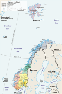
Tromøya or Tromøy is the largest island in Southern Norway. The 28.6-square-kilometre (11.0 sq mi) island is entirely located in the municipality of Arendal in Aust-Agder county, Norway. The island has about 5,300 residents which gives it a population density of about 185 inhabitants per square kilometre (480/sq mi). The island is located directly across the harbor from the town of Arendal. The highest point on the island is the 95-metre (312 ft) tall Vardåsen. The island is separated from the mainland to the north by the Tromøysundet strait and it is separated from the island of Hisøya to the southwest by the Galtesundet strait.

Ærøya island in Arendal, Norway

Ærøya is an unpopulated island in Arendal municipality in Aust-Agder county, Norway. The 0.12-square-kilometre (30-acre) island lies along the Skaggerak coast about 700 metres (2,300 ft) south of the larger island of Hisøya. The islands of Havsøya and Merdø lie to the northeast, the islands of Store Torungen and Lille Torungen lie to the southeast, and the island of Gjervoldsøy lies to the west.

Brattekleiv Village in Southern Norway, Norway

Brattekleiv is a village in Arendal municipality in Aust-Agder county, Norway. The village is located along the Galtesundet strait on the southwestern shore of the island of Tromøy. The village lies about 1 kilometre (0.62 mi) southwest of the town of Arendal which is located across the strait. The smaller industrial village of Pusnes lies immediately north of Brattekleiv, the small village of Revesand lies just south of the village, and the village of Færvik lies a short distance to the east.

Færvik Village in Southern Norway, Norway

Færvik is a village in Arendal municipality in Aust-Agder county, Norway. The village is located on the southwestern part of the island of Tromøy. It sits east of Pusnes and Brattekleiv and north of Revesand. Færvik Church is located just southwest of the village. Færvik was the administrative centre of the old Tromøy municipality from 1878 until 1992.

Pusnes, Arendal Village in Southern Norway, Norway

Pusnes is a village in Arendal municipality in Aust-Agder county, Norway. The village is located on the southwestern edge of the island of Tromøy, just across the strait from the town of Arendal. There is a ferry that regularly crosses the strait from Pusnes to Arendal. Pusnes is primarily an industrial area.

Revesand Village in Southern Norway, Norway

Revesand is a village in Arendal municipality in Aust-Agder county, Norway. The village is located at the southern coast of the island of Tromøy, about 1 kilometre (0.62 mi) north of the island outport of Merdø.

Saltrød Village in Southern Norway, Norway

Saltrød is a village in Arendal municipality in Aust-Agder county, Norway. The village is located along the Norwegian County Road 410, about 5 kilometres (3.1 mi) northeast of the town of Arendal and about 2 kilometres (1.2 mi) southwest of the village of Eydehavn. The village lies along the Tromøysundet strait, looking across the water towards the island of Tromøy. Stokken Church is located in Saltrød.

Åmdalsøyra Village in Southern Norway, Norway

Åmdalsøyra or Omdalsøyra is a village in Arendal municipality in Aust-Agder county, Norway. The village is located along the Tromøysundet strait on the northern shore of the island of Tromøy. The village of Kongshavn lies just to the southwest of Åmdalsøyra and the village of Eydehavn lies just across the strait on the mainland.

Hove Farm

Hove Farm is an original undivided farm (matrikkelgård) on the southwest part of the island of Tromøy in the municipality of Arendal in Aust-Agder county, Norway. The farm is located on a headland, with the sea behind it to the southeast and facing Hove Bay (Hovekilen) to the northwest. Hove Bay is a protected marine area, accessible only to small vessels. The islands of Merdø and Gjesøya lies closest to Hove. Until 1942, Hove Farm had a single registration number and a single owner. The farm was purchased by the state in 1942, and was then used by the German occupation forces during the Second World War. Today the farm belongs to the municipality of Arendal.

Flostaøya island in Arendal, Norway

Flostaøya is an island in Arendal municipality in Aust-Agder county, Norway. The 7.9-square-kilometre (3.1 sq mi) island lies along the Skaggerak coast between the islands of Tromøy to the southwest and Tverrdalsøya to the northeast. The island lies about 11 kilometres (6.8 mi) northeast of the town of Arendal. Some of the larger villages on the island include Arnevik, Narestø, and Kalvøysund. The island has a bridge connection to the mainland at the southwest corner of the island and there is a bridge connection to Kilsund on the neighboring island of Tverrdalsøya at the north end.

Store Torungen Lighthouse lighthouse on the island of Store Torungen in Arendal, Aust-Agder county, Norway

Store Torungen Lighthouse is a coastal lighthouse on the island of Store Torungen in the municipality of Arendal in Aust-Agder county, Norway. This lighthouse, together with the nearby Lille Torungen Lighthouse, mark the entrance from the Skaggerak through the outlying islands to the mainland town of Arendal. Both lighthouses were built in 1844 with the same specifications, making "twin" lighthouses marking the way to Arendal. The two lighthouses were put on the coat-of-arms for the local municipality of Hisøy in which the lighthouses were located. Over time, both lighthouses were replaced, and the only one still standing is the Lille Torungen Lighthouse, although it is no longer in use. The site of the Store Torungen Lighthouse is accessible only by boat. The island and site is open to the public, the tower is open daily during the summers, and the lighthouse keepers house is available to rent for overnight accommodations.

Lille Torungen Lighthouse lighthouse on the island of Lille Torungen in Arendal, Aust-Agder county, Norway

Lille Torungen Lighthouse is a coastal lighthouse on the island of Lille Torungen in the municipality of Arendal in Aust-Agder county, Norway. This lighthouse, together with the nearby Store Torungen Lighthouse, mark the entrance from the Skaggerak through the outlying islands to the mainland town of Arendal. Both lighthouses were built in 1844 with the same specifications, making "twin" lighthouses marking the way to Arendal. The two lighthouses were put on the coat-of-arms for the local municipality of Hisøy in which the lighthouses were located. Over time, both lighthouses were replaced, and the only one still standing is the Lille Torungen Lighthouse, although it is no longer in use. The site of the Lille Torungen Lighthouse is accessible only by boat. The island and site is open to the public, but the buildings are not.

References

  1. Store norske leksikon: Hove – sted i Arendal kommune.
  2. 1 2 3 Opplevelseskart Hove – Botne. 2005. Arendal: Friluftsrådet Sør. Archived 2016-03-04 at the Wayback Machine .
  3. 1 2 Kongeriget Norges ordentlige Stortings forhandlinger. 1969. Oslo: Lundhske bogtrykkerie, p. 453.
  4. Molden, Gunnar. 2012. Tromøyfolk gjennom tidene: gårds- og slektshistorie for den midtre delen av Tromøy, vol. 2. Arendal: Tromøy bygdeboknemnd, p. 64.
  5. Helle, Knut, Ottar Grepstad, & Arnvid Lillehammer . 2006. Vestlandets historie: Kultur. Bergen: Vigmostad & Bjørke, p. 58.
  6. Vadum, Kristoffer. Tromøypoteten. Aust-Agder kulturhistoriske senter (AAks).