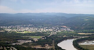
Wilkes-Barre is a city in and the county seat of Luzerne County, Pennsylvania, United States. Located at the center of the Wyoming Valley in Northeastern Pennsylvania, it had a population of 44,328 in the 2020 census. It is the second-largest city, after Scranton, in the Scranton–Wilkes-Barre–Hazleton, PA Metropolitan Statistical Area, which had a population of 567,559 as of the 2020 census, making it the fifth-largest metropolitan area in Pennsylvania after the Delaware Valley, Greater Pittsburgh, the Lehigh Valley, and Greater Harrisburg.

Schuylkill County is a county in the Commonwealth of Pennsylvania. As of the 2020 census, the population was 143,049. The county seat is Pottsville. The county is part of the Northeast Pennsylvania region of the state.

Luzerne County is a county in the Commonwealth of Pennsylvania. According to the United States Census Bureau, the county has a total area of 906 square miles (2,350 km2), of which 890 square miles (2,300 km2) is land and 16 square miles (41 km2) is water. It is Northeastern Pennsylvania's second-largest county by total area. As of the 2020 census, the population was 325,594, making it the most populous county in the northeastern part of the state. The county seat and most populous city is Wilkes-Barre. Other populous communities include Hazleton, Kingston, Nanticoke, and Pittston. Luzerne County is included in the Scranton–Wilkes-Barre–Hazleton Metropolitan Statistical Area, which has a total population of 555,426 as of 2017. The county is part of the Northeast Pennsylvania region of the state.

Nanticoke is a city in Luzerne County, Pennsylvania, United States. As of the 2020 census, the population was 10,628, making it the third largest city in Luzerne County. It occupies 3.6 square miles (9.3 km2) of land. Nanticoke is part of Northeastern Pennsylvania.

Plains Township is a township in Luzerne County, Pennsylvania, United States. The population was 9,816 at the 2020 census. The municipality is the birthplace of Chicago White Sox hall of famer Ed Walsh and John J. Yeosock, a United States Army general who commanded the 3rd U.S. Army during Operation Desert Shield and Operation Desert Storm. Mohegan Pennsylvania is a casino in Plains Township.

White Haven is a borough in Luzerne County, Pennsylvania, United States. It is located along the Lehigh River. The population was 1,163 at the 2020 census.

Anthracite, also known as hard coal and black coal, is a hard, compact variety of coal that has a submetallic lustre. It has the highest carbon content, the fewest impurities, and the highest energy density of all types of coal and is the highest ranking of coals.

The Coal Region is a region of Northeastern Pennsylvania. It is known for being home to the largest known deposits of anthracite coal in the world with an estimated reserve of seven billion short tons.

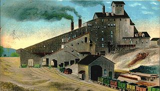
A coal breaker is a coal processing plant which breaks coal into various useful sizes. Coal breakers also remove impurities from the coal and deposit them into a culm dump. The coal breaker is a forerunner of the modern coal preparation plant.

Delaware & Lehigh Canal National and State Heritage Corridor (DLNHC) is a 165-mile (266 km) National Heritage Area in eastern Pennsylvania in the United States. It stretches from north to south, across five counties and over one hundred municipalities. It follows the historic routes of the Lehigh and Susquehanna Railroad, Lehigh Valley Railroad, the Lehigh Navigation, Lehigh Canal, and the Delaware Canal, from Bristol northeast of Philadelphia to Wilkes-Barre in the northeastern part of the state.

St. Nicholas Breaker was a historic coal breaker in Schuylkill County, Pennsylvania.
Stephen Anthony Urban is an American politician and former military officer who served as a commissioner of Luzerne County, Pennsylvania from 2000 to 2012 and later as a member of the Luzerne County Council from 2012 to 2020.

Luzerne Presbyterial Institute, also known as the Wyoming Institute is a historic church school on Institute Street in Wyoming, Pennsylvania. It was built in 1849 for use as a school, the Luzerne Presbyterial Institute, which closed in 1869. The building was then used as a Sunday school by the Wyoming Presbyterian Church. It was added to the National Register in 1979.
The Avondale Colliery was a coal mine in Plymouth Township, Luzerne County, near Plymouth, Pennsylvania in the small town of Avondale. The mine was considered to be "one of the best and worst" operating in Pennsylvania's Wyoming Valley.
The Wyoming Division Canal was an anthracite canal in Luzerne County, Pennsylvania, in the United States. It was a branch of the North Branch Canal, which was one of only two major canals in Pennsylvania to be owned by the state. The creek went from West Nanticoke to Pittston, going through Luzerne County.

Solomon Creek is a tributary of the Susquehanna River in Luzerne County, Pennsylvania, in the United States. It is approximately 8.8 miles (14.2 km) long and flows through Fairview Township, Hanover Township, and Wilkes-Barre. The creek is affected by acid mine drainage and has significant loads of iron, aluminum, and manganese. The creek's named tributaries are Spring Run, Sugar Notch Run, and Pine Creek. The Solomon Creek watershed is located in the Anthracite Valley section of the ridge-and-valley geographical province. Major rock formations in the watershed include the Mauch Chunk Formation, the Spechty Kopf Formation, and the Catskill Formation.

Moon Lake State Forest Recreation Area is a 942-acre (381 ha), recreation area within Pinchot State Forest in Plymouth Township, Luzerne County, Pennsylvania. It is open for mountain biking, hiking, fishing, bird watching, and nature study. The recreation area consists of open fields and woodlots surrounding Moon Lake, a 48-acre (19 ha), spring-fed lake. Moon Lake SFRA is in the Delaware and Lehigh National Heritage Corridor. It is located near Pennsylvania Route 29 on the western edge of the Scranton—Wilkes-Barre—Hazleton metropolitan statistical area.
The James Bell Tavern, also known as Stone House Auto Sales, was a historic building in Cumberland County, Pennsylvania that was the site of a significant Anti-Federalist Party meeting in 1788. Built sometime after 1744, it was located at 7086 Carlisle Pike in Silver Spring Township, Pennsylvania, prior to its demolition in 2017.
Plymouth, Pennsylvania sits on the west side of Pennsylvania's Wyoming Valley, wedged between the Susquehanna River and the Shawnee Mountain range. Just below the mountain are hills that surround the town and form a natural amphitheater that separates the town from the rest of the valley. Below the hills, the flat lands are formed in the shape of a frying pan, the pan being the Shawnee flats, once the center of the town's agricultural activities, and the handle being a spit of narrow land extending east from the flats, where the center of town is located. At the beginning of the 19th century, Plymouth's primary industry was agriculture. However, vast anthracite coal beds lay below the surface at various depths, and by the 1850s, coal mining had become the town's primary occupation.


