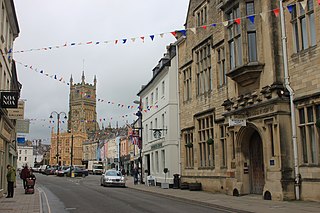
Cotswold is a local government district in Gloucestershire, England. It is named after the wider Cotswolds region and range of hills. The council is based in the district's largest town of Cirencester. The district also includes the towns of Chipping Campden, Fairford, Lechlade, Moreton-in-Marsh, Northleach, Stow-on-the-Wold and Tetbury, along with numerous villages and surrounding rural areas.

Kingswood is a town and civil parish in the South Gloucestershire district of the ceremonial county of Gloucestershire, England. The town is situated 3 miles (4.8 km) east-northeast of Bristol.

Stroud District is a local government district in Gloucestershire, England. The district is named after its largest town of Stroud. The council is based at Ebley Mill in Cainscross. The district also includes the towns of Berkeley, Dursley, Nailsworth, Stonehouse and Wotton-under-Edge, along with numerous villages and surrounding rural areas. Over half of the district lies within the Cotswolds Area of Outstanding Natural Beauty.

Forest of Dean is a local government district in west Gloucestershire, England, named after the Forest of Dean. Its council is based in Coleford. Other towns and villages in the district include Blakeney, Cinderford, Drybrook, English Bicknor, Huntley, Littledean, Longhope, Lydbrook, Lydney, Mitcheldean, Newnham and Newent.

Brockworth is a village and parish in the Borough of Tewkesbury, Gloucestershire, England, situated on the old Roman road that connects the City of Gloucester with Barnwood. It is located 4 miles (6.4 km) southeast of central Gloucester, 6 miles (9.7 km) southwest of Cheltenham and 11.5 miles (18.5 km) north of Stroud. The population taken at the 2011 census was 7,387. The population increased to 9,422 at the 2021 Census.

Henbury is a suburb of Bristol, England, approximately 5 miles (8.0 km) north west of the city centre. It was formerly a village in Gloucestershire and is now bordered by Westbury-on-Trym to the south; Brentry to the east and the Blaise Castle Estate, Blaise Hamlet and Lawrence Weston to the west. To the north lie the South Gloucestershire village of Hallen and the entertainment/retail park Cribbs Causeway.

Hucclecote is a suburb in Gloucestershire, United Kingdom, comprising a ward in the City of Gloucester. It is located on the periphery of the city, between Barnwood and Brockworth, along Ermin Way, an old Roman road connecting Gloucester with Cirencester and the Cotswolds.

Barnwood is a suburb and former civil parish in the city of Gloucester, in the county of Gloucestershire, England. It lies about 1.8 miles (2.9 km) east of the centre of the city.

Gloucester is a constituency centred on the cathedral city and county town of the same name, represented in the House of Commons of the UK by Alex McIntyre of the Labour Party

Innsworth is a village near Gloucester, and a civil parish in the borough of Tewkesbury, in the county of Gloucestershire, England. The parish population taken at the 2011 census was 2,468.
Longlevens, originally Longleavens, is a suburb of Gloucester, in Gloucestershire, England. It developed from a farmstead during the twentieth century, the name may be based on the old Roman name Colonia Glevensis, or the name could be based on an original field name "Long Elevens". This could have related to a long field about eleven acres therefore this could have been adopted as a name for the hamlet, first recorded in 1750, as part of the estate of Gloucester Cathedral. One of the oldest roads is 'The Avenue', which is shown on old maps as a number of farm cottages built in the 1850s. The population of Longlevens was 9,532 at the time of the 2011 Census.
Rodborough is a large village and civil parish in the district of Stroud, Gloucestershire, in South West England. It is directly south of the town of Stroud, north of the town of Nailsworth and north-west of the town of Minchinhampton. The parish includes the settlements of Bagpath, Butterrow, Kingscourt, Lightpill and Rooksmoor, and is adjacent to the Stroud suburb of Dudbridge. The population taken at the 2011 census was 5,334.
Cainscross is a suburban town and civil parish in Gloucestershire, England, bordering the town of Stroud and forming part of the Stroud urban area. The parish includes the communities of Ebley, Cashes Green and Cainscross, and part of Dudbridge.

Hucclecote Meadows is a 5.74-hectare (14.2-acre) biological Site of Special Scientific Interest divided into two areas on each side of the M5 road in the Severn Vale, Gloucestershire. It was notified in 1984. The western area is also a Local Nature Reserve.
Gloucester 1 is an English rugby union league which sits at the ninth level of league rugby union in England for teams based primarily in the county of Gloucestershire but also on occasion teams from Bristol. Promoted clubs move into Gloucester Premier and relegated clubs drop into either Gloucester 2 North or Gloucester 2 South depending on location. Each year clubs in this division also take part in the RFU Junior Vase - a level 9-12 national competition.
The Borough of Tewkesbury is a local government district with borough status in Gloucestershire, England. The borough is named after its largest town, Tewkesbury, which is where the council is based. The district also includes the town of Winchcombe and numerous villages including Bishops Cleeve, Ashchurch, Churchdown, Innsworth and Brockworth as well as other hamlets and surrounding rural areas. Parts of the district lie within the Cotswolds Area of Outstanding Natural Beauty. In September 2024 the council voted to formally change the borough's name to North Gloucestershire, with the new name due to be brought into use from December 2024.

Ham and Stone is a civil parish in the Stroud district, in the county of Gloucestershire, England. It includes the settlements of Bevington, Ham, Hystfield and Stone. As of 2019, it has a population of 776.

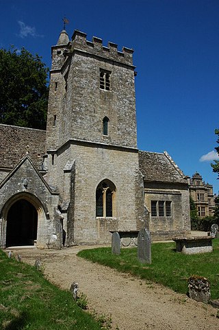
Clapton, also known as Clapton-on-the-Hill, is a small village and civil parish in the district of Cotswold, in the county of Gloucestershire, England. In 2019 it had a population of 110. It is very difficult to park and turn around in Clapton due to the narrow roads.
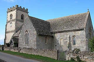
Westonbirt with Lasborough is a civil parish in the district of Cotswold, in the county of Gloucestershire, England. It includes the villages of Lasborough and Westonbirt. As of 2019, it has a population of 293.
Leigh is a village and civil parish in the district of Tewkesbury, in the county of Gloucestershire, England. As of 2019, it has a population of 325.

