A ZIP Code is a system of postal codes used by the United States Postal Service (USPS). The term ZIP was chosen to suggest that the mail travels more efficiently and quickly when senders use the code in the postal address.

Brownsville is a home rule-class city in Edmonson County, Kentucky, in the United States. It is the county seat and is a certified Kentucky Trail Town. The population was 836 at the time of the 2010 census, down from 921 at the 2000 census. It is included in the Bowling Green metropolitan area. It is just outside Mammoth Cave National Park.

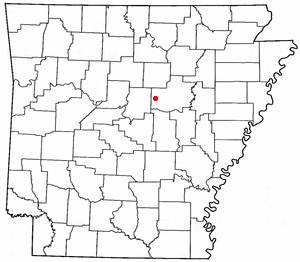
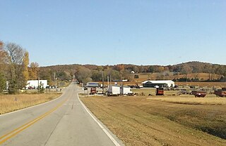
Romance is an unincorporated community in west-central White County, Arkansas, United States. The community is located approximately halfway between the town of Rose Bud to the north, and the unincorporated community of El Paso to the south. Alternately, the community is about 16 miles (26 km) northwest of Beebe, and less than 5 miles (8 km) east of Mount Vernon.

Elmira is an unincorporated community in the U.S. state of Michigan. Located along M-32, the community is on the county line between Warner Township in Antrim County to the west and Elmira Township in Otsego County to the east.
Bee Spring is an unincorporated community in northern Edmonson County, Kentucky, United States. The population of the community's ZCTA was 1,335 at the 2000 census.

Elizaville is a census-designated place and unincorporated community in Fleming County, Kentucky, United States. Its population was 181 as of the 2010 census. Elizaville is located at the junction of Kentucky Route 32 and Kentucky Route 170, 5 miles (8.0 km) west of Flemingsburg. Elizaville has a post office with ZIP code 41037.
Sunfish is an unincorporated community located in the northwest corner of Edmonson County, Kentucky, United States, near the Grayson County line. It is approximately 25 miles (40 km) north-northeast of Bowling Green.
Asphalt is an unincorporated community located in Edmonson County, Kentucky, United States.

Belfry is an unincorporated community and census-designated place in Pike County, Kentucky. Belfry is located on U.S. Route 119, 16.8 miles (27.0 km) northeast of Pikeville. Belfry has a post office with ZIP code 41514, which opened on February 26, 1921. The origin of the name "Belfry" is obscure.
Harned is an unincorporated community in Breckinridge County, Kentucky, United States. Harned is located on U.S. Route 60, 3.2 miles (5.1 km) southeast of Hardinsburg. Harned has a post office with ZIP code 40144.
Fall Rock is an unincorporated community in Clay County, Kentucky, United States. They are located on the Morgan Branch tributary of Laurel Creek, just under 1 mile upstream from the branch mouth, on United States Highway 421, the school across the road from the post office.
Rogers is an unincorporated community in Wolfe County, Kentucky. Rogers is on Kentucky Route 715 4.9 miles (7.9 km) west of Campton. Rogers has a post office with ZIP code 41365. Rogers Elementary School, a K-6 school in the Wolfe County Schools district, is located in Rogers.
Sharon Grove is an unincorporated community located in Todd County, Kentucky, United States.
Caballo is a census-designated place in Sierra County, New Mexico, United States. Its population was 112 as of the 2010 census. Caballo has a post office with ZIP code 87931. The community is located along New Mexico State Road 187, north and south of Exit 63 on Interstate 25.

Roundhill is an unincorporated community in Butler County, Kentucky, United States, situated on Butler County's eastern boundary with Edmonson County.
Jetson is an unincorporated community in Butler County, Kentucky, United States.
Cromwell is an unincorporated community in Ohio County, Kentucky, United States.
Kyrock is a ghost town in Edmonson County in south central Kentucky, United States. The ghost town is located about 2.4 miles (3.9 km) east of Sweeden, or about 5 miles (8.0 km) north-northeast of the county seat of Brownsville. It was once a referred to as a “company town” along the Nolin River during much of the first half of the 20th century, but the industrial town was disincorporated in 1966, about nine years after the closure of the company that created the town.
Reedyville is an Unincorporated community in Butler County, Kentucky, United States. The town is supposedly named for the nearby Big Reedy Creek, a tributary of the Green River.
Segal is an unincorporated community in west-central Edmonson County in south-central Kentucky, United States. Segal is part of the Bowling Green Metropolitan Statistical Area.


