Hullshire

Last updated

Hullshire, or the County of the Town of Kingston upon Hull, was a county corporate in the East Riding of Yorkshire, England, which was created in 1440. It was an area that was removed from the jurisdiction of the Sheriff of Yorkshire to come under the authority of the Sheriff of Kingston upon Hull instead. The term Hullshire was particularly used for the part of the county corporate that lay outside the borough of Kingston upon Hull, covering an area to the west of the borough containing the three parishes of Hessle, Kirk Ella and North Ferriby. In 1838 the county corporate was reduced in area to match the borough. The borough remained a county corporate with its own sheriff until 1974.

Contents

History

The borough of Kingston upon Hull (generally known as Hull) was granted county corporate status in 1440 in the reign of Henry VI, when it was given the right to appoint its own sheriff, giving it judicial independence from the Sheriff of Yorkshire. An area to the west of Hull was added to the county corporate in 1447. [1] [2] [3] The area was self-governing in respect of it having its own courts, with powers of oyer and terminer , to hold assizes on civil and criminal cases. [4] The county corporate then included the borough plus the parishes of Hessle, North Ferriby, and Kirk Ella, including the various townships which belonged to those parishes, including Swanland, West Ella, Tranby (an area south of Anlaby and north of Hessle), Willerby and Anlaby. The county corporate also included the extra-parochial area of Haltemprice Priory. [5] The rights previously given to the town of Hull were extended to the county corporate, with the Mayor acting as the king's escheator, and with the town bailiffs replaced by a sheriff and twelve aldermen, acting as justices of the peace, with the burgesses to answer before the mayor and sheriff first, not the king. The justices of the peace of the East Riding had no legal authority over the area. [6] At the same time Hull Castle became the responsibility of the town. [7]

In 1515 a skirmish or battle was fought between the Sheriff of Hull and the Prior of Haltemprice Priory over the authority over Willerby (Willarby) and Wolfreton (Woolfreton) – the Prior claimed that though the priory was within Hullshire it was not part of it, and was within the Lordship of Cottingham, and had taken the issue to the Star Chamber; the case was referred to the Abbott of Meaux; Bryan Palmes; and Sir William Constable who had decided in the Prior's favour. Despite this decision on 6 October the Sheriff of Hull together with 200 people of the town began to approach Wolfreton; the Prior, who had been informed of the Sheriff's intentions roused his tenants, and armed the monks of the Priory, who then blocked the roads, and hurled abuse on the Sheriff and his people. The Sheriff's party returned the insults in turn using foul language. Subsequently, the altercation came to blows and a quarrel with arrows ensued. The battle continued until the monks, many being old or fat, gave way, and fled to their priory, followed by the Sheriff's group. The situation was prevented from becoming more inflamed by the arrival of the Lord Mayor of Hull, who having learned of what was happening hastened to the scene with 60 horsemen. Subsequently, the Prior sought redress in the Star Chamber, with the Sheriff accused of riot and other crimes – the legal proceedings continued for three years at much expense, leading to the settlement that the Prior was given Willerby and Newton within his authority, whilst Hull obtained free right to the freshwater springs of Anlaby. [8]

Sculcoates, Drypool, the southern part of Sutton (Sutton-on-Hull), Garrison Side as well as the liberties of Myton and Trippett were added to the parliamentary borough in 1832, and in 1836 the new municipal borough was made to be of the same extent. (see also Municipal Corporations Act 1835). The parishes of Hessle, Kirk Ella and North Ferriby (including their associated hamlets and townships) were removed from the county corporate in 1838, such that thereafter the county corporate covered the same area as the borough. The name Hullshire had primarily been used for the parts of the county corporate that lay outside the borough of Kingston upon Hull, and so the term Hullshire fell out of use after 1838. [9]

The borough of Kingston upon Hull then remained a county corporate with its own sheriff until 1974. The borough boundaries were subsequently enlarged on several occasions. Newington (parishes of Kirk Ella and North Ferriby); Stoneferry; Marfleet and Newland were added in the second half of the 19th century. [10] For most practical purposes, the county corporate was effectively superseded in 1889 when Hull became a county borough. [11] (See Local Government Act 1888)

See also

Related Research Articles

<span class="mw-page-title-main">East Riding of Yorkshire</span> County of England

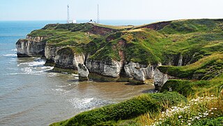
The East Riding of Yorkshire, often abbreviated to the East Riding or East Yorkshire, is a ceremonial county in the Yorkshire and the Humber region of England. It borders North Yorkshire to the north and west, South Yorkshire to the south-west, and Lincolnshire to the south across the Humber Estuary. The city of Kingston upon Hull is the largest settlement.

<span class="mw-page-title-main">Haltemprice</span> Area of the East Riding of Yorkshire, England

Haltemprice is an area in the East Riding of Yorkshire, England, directly to the west of Kingston upon Hull. Originally an extra-parochial area, it became a civil parish in 1858, in 1935 it was expanded by the combination of the urban districts of Cottingham, Anlaby, and Sculcoates to form a new urban district; the district included the villages of Anlaby, Cottingham, Hessle, Kirk Ella, Skidby, West Ella and Willerby. Urban districts were abolished 1974.

<span class="mw-page-title-main">Hessle</span> Town and civil parish in the East Riding of Yorkshire, England

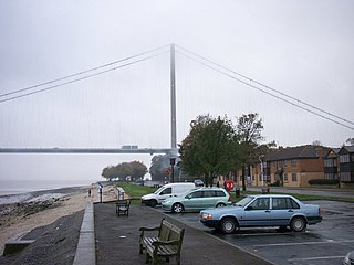
Hessle is a town, civil parish and electoral ward in the East Riding of Yorkshire, England, five miles west of Kingston upon Hull city centre. Geographically it is part of a larger urban area consisting of the city of Kingston upon Hull, the town of Hessle and a number of other villages but is not part of the city. It is on the north bank of the Humber Estuary where the Humber Bridge crosses.

<span class="mw-page-title-main">Haltemprice and Howden (UK Parliament constituency)</span> Parliamentary constituency in the United Kingdom, 1997–2024

Haltemprice and Howden was a constituency in the East Riding of Yorkshire from 1997 to 2024.

<span class="mw-page-title-main">Kingston upon Hull West and Hessle (UK Parliament constituency)</span> Parliamentary constituency in the United Kingdom, 1997–2024

Kingston upon Hull West and Hessle was a borough constituency for the House of Commons of the Parliament of the United Kingdom. It elected one Member of Parliament (MP) at least once every five years by the first-past-the-post electoral system.

<span class="mw-page-title-main">Anlaby with Anlaby Common</span> Civil parish in the East Riding of Yorkshire, England

Anlaby with Anlaby Common is a civil parish in the East Riding of Yorkshire, England. The parish includes the village suburb of Anlaby and the part of the area known as Anlaby Common.

<span class="mw-page-title-main">Swanland</span> Village and civil parish in the East Riding of Yorkshire, England

Swanland is a village and civil parish in the East Riding of Yorkshire in England. The village is about seven miles (11 km) to the west of Kingston upon Hull city centre and two miles (3.2 km) north of the Humber Estuary in the foothills of the Yorkshire Wolds on the B1231 road.

<span class="mw-page-title-main">Willerby, East Riding of Yorkshire</span> Village and civil parish in the East Riding of Yorkshire, England

Willerby is a village and civil parish located on the western outskirts of the city of Kingston upon Hull in the East Riding of Yorkshire, England.

<span class="mw-page-title-main">Hull City Council</span> Local government body in England

Hull City Council, or Kingston upon Hull City Council, is the local authority for the city of Kingston upon Hull in the ceremonial county of the East Riding of Yorkshire, England. Hull has had a council since 1299, which has been reformed on numerous occasions. Since 1996 the council has been a unitary authority, being a district council which also performs the functions of a county council; it is independent from East Riding of Yorkshire Council, the unitary authority which administers the rest of the county.

<span class="mw-page-title-main">Kirk Ella</span> Village in the East Riding of Yorkshire, England

Kirk Ella is a village and civil parish on the western outskirts of Kingston upon Hull, approximately five miles west of the city centre, situated in the East Riding of Yorkshire, England. The parish includes West Ella.

<span class="mw-page-title-main">West Ella</span> Village in the East Riding of Yorkshire, England

West Ella is a small village in the civil parish of Kirk Ella, west of Kirk Ella settlement, within the East Riding of Yorkshire, England, on the eastern edge of the Yorkshire Wolds, approximately 6 miles (10 km) west of the city of Kingston upon Hull.

<span class="mw-page-title-main">Anlaby</span> Village in the East Riding of Yorkshire, England

Anlaby is a village forming part of the western suburbs of Kingston upon Hull, in the East Riding of Yorkshire, England. It forms part of the civil parish of Anlaby with Anlaby Common.

<span class="mw-page-title-main">Anlaby Common</span> Suburb of Kingston upon Hull, England

Anlaby Common is former common land, now an outer suburb of Kingston upon Hull. The area includes the residential areas which are located on the western urban fringe of Hull; the B1231 road passes through all of Anlaby Common's estates, east to west.

Haltemprice Priory was an Augustinian monastery approximately two miles south of the village of Cottingham in the East Riding of Yorkshire, England. The original monastic buildings have long since gone, although ruins of a farmhouse, built in 1584, remain on site and incorporate some of the Priory stonework.

The East Riding of Yorkshire is a local government district with unitary authority status, and is a ceremonial county of England. It is named after the historic East Riding of Yorkshire which was one of three ridings alongside the North Riding and West Riding, which were constituent parts a Yorkshire ceremonial and administrative county until 1974. From 1974 to 1996 the area of the modern East Riding of Yorkshire constituted the northern part of Humberside.

<span class="mw-page-title-main">Dairycoates</span> Area of Kingston upon Hull in the East Riding of Yorkshire, England

Dairycoates is an area of Kingston upon Hull, East Riding of Yorkshire, England, a former hamlet.

<span class="mw-page-title-main">Kingston upon Hull West and Haltemprice (UK Parliament constituency)</span> Parliamentary constituency in the United Kingdom, 2024 onwards

Kingston upon Hull West and Haltemprice is a constituency of the House of Commons in the UK Parliament. Further to the completion of the 2023 Periodic Review of Westminster constituencies, it was first contested in the 2024 general election.

References

  1. Tickell 1798, pp. 661–2.
  2. Gent 1869, Chap. VII pp. 99–100 (p).
  3. A History of the County of York East Riding: Volume 1, The City of Kingston upon Hull. London: Victoria County History. 1969. pp. 1–10. Retrieved 8 July 2024.
  4. Tickell 1798, p. 685.
  5. Tickell 1798, pp. 93–95.
  6. Tickell 1798, pp. 92–3, 96–8.
  7. Gent 1869, Chap. VII p. 118 (ccc).
  8. Tickell 1798, pp. 141–3.
  9. Sheahan, J. J.; Whellan, T. (1856). History and Topography of the City of York; the Ainsty Wapentake; and the East Riding of Yorkshire: Volume II. Beverley. p. 544. Retrieved 8 July 2024.{{cite book}}: CS1 maint: location missing publisher (link)
  10. Allison, K. J., ed. (1969), "The City of Kingston upon Hull : Boundaries", A History of the County of York East Riding, vol. 1. The city of Kingston upon Hull, Victoria County Histories, pp. 1–10
  11. Kingston upon Hull County of Itself (Vision of Britain) Relationships and changes

Sources

53°46′16″N0°24′40″W / 53.771°N 0.411°W / 53.771; -0.411