
Lincoln National Park is a protected area in the Australian state of South Australia located about 249 kilometres (155 mi) west of the state capital of Adelaide and about 9.5 kilometres (5.9 mi) south of the municipal seat of Port Lincoln. It consists of a mainland area on the Jussieu Peninsula on the south eastern tip of Eyre Peninsula and a number of nearby islands. The national park contains significant sites of natural, indigenous and early European heritage.

The Wirangu language, also written Wirrongu, Wirrung, Wirrunga, and Wirangga, and also known by other exonyms, is a moribund Australian Aboriginal language traditionally spoken by the Wirangu people, living on the west coast of South Australia across a region encompassing modern Ceduna and Streaky Bay, stretching west approximately to the head of the Great Australian Bight and east to Lake Gairdner. It is a language of the Thura-Yura group, and some older sources placed it in a subgroup called Nangga.
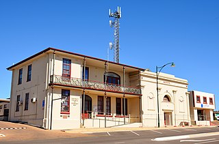
The District Council of Streaky Bay is a local government area in South Australia located on the Eyre Peninsula. Streaky Bay is the main population centre of about 1200 people serving an agricultural district based on farming wheat and other cereal crops, sheep, supplemented by fishing and tourism industries. The district covers an area of 6,251.1 square kilometres with a population of 2,074 people in 2016, according to the Australian Bureau of Statistics. Mayor of Streaky Bay is Travis Barber.

Streaky Bay is a coastal town on the western side of the Eyre Peninsula, in South Australia just off the Flinders Highway 303 km north west of Port Lincoln and 727 km by road from Adelaide. At the 2011 census, Streaky Bay recorded a population of 1,625.

Baird Bay is a small fishing village located 50 kilometres south of Streaky Bay on the west coast of Eyre Peninsula in South Australia. It is situated on the east coast of a bay named Baird Bay which opens into the north end of Anxious Bay.

Haslam is a town and a locality in the Australian state of South Australia located on the Eyre Peninsula on the coastline of Streaky Bay about 487 kilometres (303 mi) north-west of the state capital of Adelaide and about 32 kilometres (20 mi) north of the municipal seat of Streaky Bay.

Perlubie is a locality in the Australian state of South Australia located on the west coast of Eyre Peninsula about 472 kilometres (293 mi) north-west of the state capital of Adelaide and about 24 kilometres (15 mi) north-east of the municipal seat of Streaky Bay.
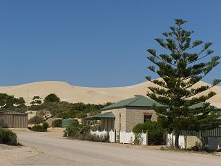
Fowlers Bay, formerly Yalata, is a town and locality in the Australian state of South Australia located about 658 kilometres (409 mi) north-west of the state capital, Adelaide. Situated on the Nullarbor Plain, it was once an active port and a gateway to the western reaches of the continent, but fell into decline in the 1960s. At the 2016 census, the localities of Fowlers Bay and Coorabie shared a population of 51.

Calca is a small township around 20 kilometres (12 mi) south-east of Streaky Bay, on the southern border of the Calpatanna Waterhole Conservation Park, Eyre Peninsula.
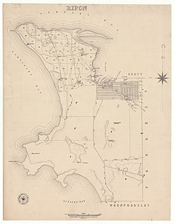
The Hundred of Ripon is a cadastral hundred of the County of Robinson in South Australia, and is near Streaky Bay, South Australia on the Eyre Peninsula.
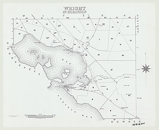
The Hundred of Wright is a cadastral hundred of County of Robinson in South Australia. It spans the west coast of the state at Venus Bay, 655 kilometres (407 mi) west of Adelaide.

The Hundred of Bartlett is a cadastral hundred of South Australia located in the remote County of Way. It was created in 1889.

The Hundred of Horn is a cadastral hundred of South Australia located in the remote County of Way.

The Hundred of Campbell is a cadastral hundred of the County of Robinson in South Australia.

The Hundred of Murray is a cadastral hundred in the County of Robinson, South Australia. It occupies land midway between the towns of Streaky Bay and Poochera.

The Hundred of Witera is a cadastral hundred of the County of Robinson in South Australia.
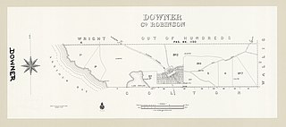
The Hundred of Downer is a cadastral hundred of County of Robinson in South Australia.
The Hundred of Wallis is a cadastral hundred of County of Robinson in South Australia.

Yantanabie is a town and rural locality in the wheat belt of South Australia, 37 miles inland from Streaky Bay, South Australia.

Eba Anchorage is a locality in the Australian state of South Australia located in the state's west on the eastern shore of Streaky Bay on the west coast of the Eyre Peninsula about 469 kilometres (291 mi) north-west of the state capital of Adelaide and about 14 kilometres (8.7 mi) north-east of the municipal seat of Streaky Bay.


