The Murray Mallee is the grain-growing and sheep-farming area of South Australia. It is bounded to the north and west by the Murray River, called the "River Murray" in South Australia, to the east by the Victorian border, and extending about 50 km south of the Mallee Highway.
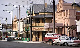
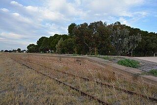
Pinnaroo is a town in the Murray Mallee region of South Australia, near the border with Victoria, 243 km east of Adelaide. Pinnaroo is on the north side of the Mallee Highway, and on the railway line between Tailem Bend and Ouyen. The roadhouse on the highway at Pinnaroo is the first "food and leg-stretch" stop on the bus route from Adelaide to Sydney.
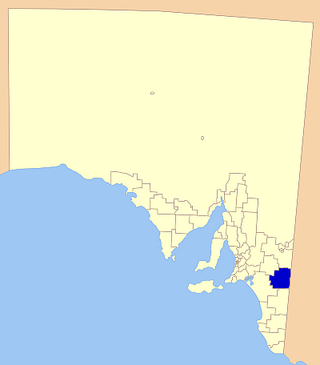
The Southern Mallee District Council is a local government area in the Murray and Mallee region of South Australia. The council offices are in Pinnaroo and Lameroo. It was established on 23 January 1997 when the District Council of Lameroo and District Council of Pinnaroo agreed to merge. Their predecessors date from 1908.
Parilla is a town and a locality in the Australian state of South Australia located in the state's Murray Mallee region about 192 kilometres (119 mi) east of the state capital of Adelaide, about 32 kilometres (20 mi) west of the municipal seat of Pinnaroo and about 14 kilometres (8.7 mi) east of the town of Lameroo.
Lameroo is a town in the Murray Mallee region of South Australia. It is on the Mallee Highway and Pinnaroo railway line about 40 km west of the Victorian border, or 210 km east of Adelaide. It is primarily a service town for the surrounding rural areas, growing grain and sheep. Lameroo now includes the former settlements of Kulkami, Mulpata, Wirha and Gurrai, which were on the Peebinga railway line, and Wilkawatt, which was between Parrakie and Lameroo on the Pinnaroo railway.

Ngarkat Conservation Park is a protected area located in South Australia's south-eastern corner about 200 kilometres south east of the Adelaide city centre.

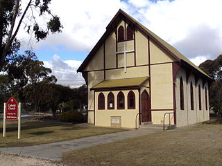
Buccleuch is a place in South Australia situated along the Pinnaroo railway line and Mallee Highway (B12), approximately 140 km east of Adelaide. It is part of the Coorong District Council. There is an active Lutheran Church in Buccleuch.

The Melbourne–Adelaide rail corridor consists of the 828-kilometre (514-mile) long 1435 mm standard-gauge main line between the Australian state capitals of Melbourne, Victoria and Adelaide, South Australia, and the lines immediately connected to it. Most of its traffic is freight; the only passenger train along the entire route is the twice-weekly passenger service The Overland, operated by Journey Beyond.
Albert was an electoral district of the House of Assembly in South Australia, spanning its time as both a colony and a state. It was created in 1875, taking much territory from adjacent Victoria, merged with Victoria in 1902 as Victoria and Albert, separated again in 1915, and abolished in 1970.
Moorlands is a locality in the Australian state of South Australia.

The County of Hindmarsh is one of the 49 cadastral counties of South Australia. It was proclaimed by Governor George Grey in 1842 and named for Governor John Hindmarsh.

County of Carnarvon is a cadastral unit located in the Australian state of South Australia which covers the full extent of Kangaroo Island. It was proclaimed in 1874 by Governor Musgrave in response to the demand for agriculture land on Kangaroo Island.

County of Fergusson is a cadastral unit located in the Australian state of South Australia which spans Yorke Peninsula south of Price. It was proclaimed in 1869 by Governor Fergusson after whom the county was named.

The County of Hamley is a cadastral unit located in the Australian state of South Australia covers land located in the state's east north of the Murray River, bordering New South Wales and Victoria. It was proclaimed in 1869 by Governor Fergusson and named after Francis Hamley.

County of Young is a cadastral unit located in the Australian state of South Australia covers land located in the state’s east on the north side of the Murray River. It was proclaimed in 1860 by Governor MacDonnell and named after his predecessor, Governor Young. It has been partially divided in the following sub-units of hundreds – Markaranka, Parcoola, Pooginook and Stuart.
Scorpion Springs Conservation Park was a protected area in the Australian state of South Australia located in the state’s south-east in the locality of Pinnaroo at the border with the state of Victoria about 215 kilometres (134 mi) south-east of the state capital of Adelaide and about 16 kilometres (9.9 mi) south of the town of Pinnaroo.
The District Council of Lameroo was a local government area in South Australia from 1908 until 1997. For the first eleven years of the council's history it was known as District Council of Pinnaroo, not to be confused with its sister, the District Council of Pinnaroo (1913–1997) which was initially called Pinnaroo East council and also based in the town of Lameroo until 1919. Lameroo and Pinnaroo councils were amalgamated in 1997 to create the District Council of Southern Mallee.
The Hundred of Allenby is a Hundred in the county of Chandos County in South Australia. The Hundred is in the Murray Mallee region of South Australia, near the border with Victoria, Australia.
Karte Conservation Park is a protected area located in the Australian state of South Australia in the localities of Karte and Parilla about 193 kilometres (120 mi) east of the state capital of Adelaide and about 26 kilometres (16 mi) north-west of the town of Pinnaroo.
The County of Chandos is one of the 49 cadastral counties of South Australia. It was proclaimed in 1893 and named by Governor Kintore for the Duke of Buckingham and Chandos, Richard Temple-Nugent-Brydges-Chandos-Grenville who was appointed Secretary of State for the Colonies in 1867. It covers a large portion of the southern Mallee region, adjacent to the state border with Victoria in the state's south east.
