
The Hundred of Wirreanda is a cadastral unit of hundred in the County of Granville, South Australia. [1] The township of Cradock is at the hundred's centre.
Contents
The hundred is crossed from east to west by Wirreanda Creek.

The Hundred of Wirreanda is a cadastral unit of hundred in the County of Granville, South Australia. [1] The township of Cradock is at the hundred's centre.
The hundred is crossed from east to west by Wirreanda Creek.
The hundred was first locally governed by the District Council of Hawker, with Wirreanda ward electing one dedicated councillor. [2] In 1997 the hundred become a part of the Flinders Ranges Council with the amalgamation of Hawker and Kanyaka councils. [3]

Flinders Ranges Council is a local government area (LGA) located in the Flinders Ranges of South Australia.

The Mount Remarkable District Council is a local government area located between the top of the Spencer Gulf and the base of the Southern Flinders Ranges in South Australia. The district encompasses a wide variety of towns, including coastal ports and agricultural centres. The economy of the district council is largely based on agriculture.

Kanyaka Station was a cattle and sheep station in the Flinders Ranges of South Australia located at Kanyaka, approximately 40 km (25 mi) north-north-east of Quorn, South Australia. along Hawker-Stirling North Road (B83)

Cradock is a town and locality in the Australian state of South Australia 320 kilometres north of the state capital of Adelaide on the RM Williams Way. The nearest town with a greater population is Hawker which is approximately 20 km away with a population of around 360. Cradock is in the Flinders Ranges Council area, the state Electoral district of Stuart and the federal Division of Grey.
The District Council of Port Germein was a local government area in South Australia, centred on the town of Port Germein. It was gazetted on 5 January 1888 under the provisions of the District Councils Act 1887 and encompassed the hundreds of Baroota, Wongyarra, Booleroo, Telowie, Darling and Appila. It replaced an abortive earlier municipality, the Corporate Town of Port Germein, which had been established on 15 September 1887 when residents, concerned about increased taxation and their interests being lost in a broader shire under the forthcoming reforms, decided to incorporate the town. The local residents reportedly regretted the decision, and when the Act passed late in the year creating the new District Council, state parliament agreed to amalgamate the Corporate Town into the new municipality.

The District Council of Kanyaka was a local government area in South Australia that existed from 1888 to 1969.
The District Council of Kanyaka-Quorn was a local government area in South Australia that existed from 1969 to 1997.
The District Council of Hawker was a local government area in South Australia from 1888 to 1997, centred on the town of Hawker. At its creation it was the northernmost local government area in the state.

Kanyaka is a rural locality in the Far North region of South Australia, situated in the Flinders Ranges Council.
The Hundred of Boolcunda is a cadastral hundred of the County of Newcastle in South Australia. It was proclaimed by Governor Anthony Musgrave in 1876.
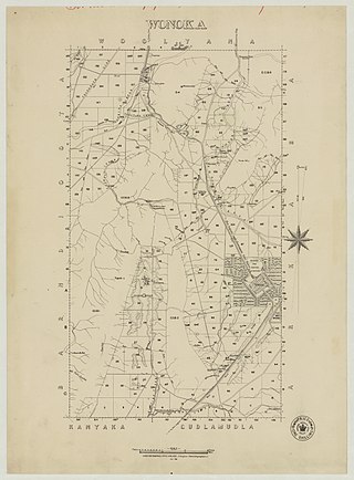
The Hundred of Wonoka is a cadastral unit of hundred in the County of Blachford, South Australia.

The Hundred of Yednalue is a cadastral unit of hundred in the County of Granville, South Australia.

The County of Frome is one of the 49 cadastral counties of South Australia in straddling the Mid North and Flinders Ranges regions. It was proclaimed in 1851 by Governor Henry Young and was named for the former Surveyor-General of South Australia, Edward Charles Frome. The iconic Mount Remarkable in the Hundred of Gregory is at the centre of the county.
Wallerberdina Station, most commonly known simply as Wallerberdina, is a pastoral lease that operates as a cattle station in South Australia.

County of Taunton is a cadastral unit located in the Australian state of South Australia on land on the east coast of Lake Torrens about 160 kilometres (99 mi) from the city of Port Augusta. It was proclaimed in 1877 and named after Lord Taunton who was the Secretary for the Colonies from 1855 to 1858. It has been partially divided in the following sub-units of hundreds – Bunyeroo, Carr, Edeowie, Nilpena, Oratunga and Parachilna.

County of Blachford is a cadastral unit located in the Australian state of South Australia that covers land between the east coast of Lake Torrens and the western side of the Flinders Ranges about 90 kilometres (56 mi) north-east of the city of Port Augusta. It was proclaimed in 1877 and named after Frederic Rogers, 1st Baron Blachford who was the Under Secretary of State for the Colonies from 1860 to 1871. It has been partially divided in the following sub-units of hundreds – Barndioota, Cotabena, Warrakimbo, Wonoka and Woolyana.

County of Herbert is a cadastral unit located in the Australian state of South Australia that covers land to the east of the Flinders Ranges about 55 kilometres (34 mi) north-east of the town of Peterborough. It was proclaimed in 1877 and named after a prominent man of the time with either a title or a surname containing the name ‘Herbert’. It has been partially divided in the following sub-units of hundreds – Cavenagh, Coglin, Minburra, Nackara, Paratoo and Waroonee.
The County of Granville is one of the 49 counties of South Australia located in the Flinders Ranges region. It was proclaimed in 1876 by Governor Anthony Musgrave and was named for the Granville Leveson-Gower, the second Earl of Granville and the Secretary of State for the Colonies until a few years prior.

County of Kimberley is a cadastral unit located in the Australian state of South Australia that covers land to the east of the Flinders Ranges about 45 kilometres (28 mi) east of the town of Peterborough. It was proclaimed in 1871 and named after John Wodehouse, 1st Earl of Kimberley, a British Secretary of State for the Colonies. It has been partially divided in the following sub-units of hundreds – Gumbowie, Hardy, Ketchowla, Parnaroo, Terowie and Wonna.

County of Hanson is a cadastral unit located in the Australian state of South Australia that covers land in the Flinders Ranges immediately east of the town of Hawker. It was proclaimed on 20 July 1877 and is named after Sir Richard Davies Hanson who served as Premier, Administrator and Chief Justice of South Australia. It has been partially divided in the following sub-units of hundreds – Adams, Arkaba, French, Moralana and Warcowie.
-32.047410, 138.516450; Named By: Governor Musgrave; Date Named: 18/01/1877; Derivation of Name: Abna for a forest of knotty trees; Other Details: Area 92 square miles.
32°02′49″S138°30′58″E / 32.047°S 138.516°E Coordinates: 32°02′49″S138°30′58″E / 32.047°S 138.516°E
| | This South Australia geography article is a stub. You can help Wikipedia by expanding it. |