Hamilton is a large town in South Lanarkshire, Scotland. It serves as the main administrative centre of the South Lanarkshire council area. It sits 10 miles (16 km) south-east of Glasgow, 37 miles (60 km) south-west of Edinburgh and 74 miles (120 km) north of Carlisle. It is situated on the south bank of the River Clyde at its confluence with the Avon Water. Hamilton is the county town of the historic county of Lanarkshire and is the location of the headquarters of the modern local authority of South Lanarkshire.

East Kilbride, sometimes referred to as EK, is the largest town in South Lanarkshire in Scotland, and the country's sixth-largest locality by population. Historically a small village, it was designated Scotland's first "new town" on 6 May 1947. The area lies on a raised plateau to the south of the Cathkin Braes, about eight miles southeast of Glasgow and close to the boundary with East Renfrewshire.

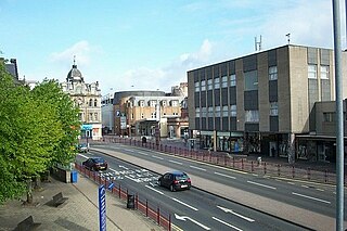
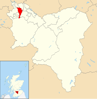
Motherwell is a town and former burgh in North Lanarkshire, Scotland, United Kingdom, south east of Glasgow. It has a population of around 32,120. Historically in the parish of Dalziel and part of Lanarkshire, Motherwell is the headquarters for North Lanarkshire Council. Geographically the River Clyde separates Motherwell from Hamilton to the west whereas the South Calder Water separates Motherwell from Carfin to the north-east and New Stevenston and Bellshill towards the north.

Castlemilk is a district of Glasgow, Scotland. It lies to the far south of the city centre, adjacent to the Croftfoot and Simshill residential areas within the city to the north-west, the town of Rutherglen - neighbourhoods of Spittal to the north-east and Fernhill to the east, Linn Park and its golf course to the west, and the separate village of Carmunnock further south across countryside.

The Rotten Calder is a river to the east of East Kilbride, South Lanarkshire, Scotland and along with the Rotten Burn it forms the southern and western boundaries of Blantyre.
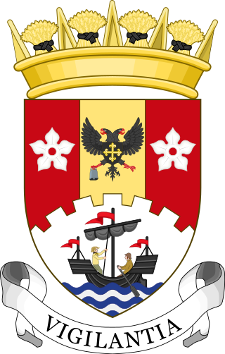
South Lanarkshire Council is the unitary authority serving the South Lanarkshire council area in Scotland. The council has its headquarters in Hamilton, has 16,000 employees, and an annual budget of almost £1bn. The large and varied geographical territory takes in rural and upland areas, market towns such as Lanark, Strathaven and Carluke, the urban burghs of Rutherglen, Cambuslang, and East Kilbride which was Scotland's first new town. The area was formed in 1996 from the areas of Clydesdale, Hamilton and East Kilbride districts, and some outer areas of Glasgow district ; all were previously within the Strathclyde region from 1975 but in historic Lanarkshire prior to that.
Nerston is a village situated on the northern green-belt boundary of the new town of East Kilbride in South Lanarkshire, Scotland.

Stonelaw High School is a non-denominational state high school located in Rutherglen, Scotland near the city of Glasgow.

Duncanrig Secondary School is a secondary school within the town of East Kilbride in the South Lanarkshire council area in Scotland. The original building was designed in 1953 by the Scottish architect Basil Spence.
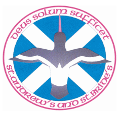
St Andrew's and St Bride's High School is a Roman Catholic school in East Kilbride, Scotland. The current head teacher is Barry Quinn. The school opened in 2007, and has a roll of 1,698 pupils. The new buildings are adjacent to St Bride's Roman Catholic church, built in 1964 by Gillespie, Kidd & Coia. The school and church fall under the Diocese of Motherwell.
Claremont High School was a non-denominational, state-funded secondary school based in the St Leonards area of East Kilbride. It closed in June 2007 and merged with Hunter High School to form the new Calderglen High School, although Calderglen met in the Claremont building until February 2008 when the new building opened on the same site. It was originally one of six state Secondary schools in East Kilbride until, after a school modernisation program by South Lanarkshire Council, they were merged into three schools.

Calderglen High School is a state-run secondary school in the St Leonards area of the Scottish new town East Kilbride, in South Lanarkshire. The complex of buildings is situated on the precipitous bank of the Rotten Calder Water, overlooking a meander named the 'School Bend'. The school derives its name from the Calder Glen (gorge) which the river occupies, which is a site of special scientific interest (SSSI). The school has a potential pupil roll of approximately 1800, with 130 teachers, making it one of the largest secondary institutions in Europe. The school's houses are named Jura, Uist, Harris, Tiree and Lewis.

Hunter House Museum was a museum in Calderwood, East Kilbride, South Lanarkshire, Scotland.

Calderwood is a neighbourhood of the Scottish new town of East Kilbride, in South Lanarkshire. It lies on its north-east edge and is one of the largest areas of the town.

Calderwood Castle was located in East Kilbride, Scotland. The castle was situated near the banks of the Rotten Calder Water in what is now Calderglen Country Park. Most likely constructed in the early to mid fifteenth century by the Maxwell family, the original peel tower collapsed in 1773. It was replaced by an extension to a large 18th-century country house called Calderwood House, which has itself since been demolished along with a later 1840s Gothic Revival addition.
Calderwood is a place-derived surname, of Brythonic and Old English origins in Lanarkshire Scotland.

Calderglen Country Park is a country park in the town of East Kilbride, South Lanarkshire, Scotland. It is situated along the eastern edge of the town and is its principal greenspace and recreation area.

Whitlawburn is a residential area in the town of Cambuslang in South Lanarkshire, Scotland. It is located south of the town centre on high ground slightly north of the Cathkin Braes, overlooking the Greater Glasgow urban area.

East Kilbride Central North is one of the 20 electoral wards of South Lanarkshire Council. Created in 2007, the ward initially elected four councillors using the single transferable vote electoral system and covers an area with a population of 16,547 people. Following a boundary review, the ward has elected three councillors since 2017.
East Kilbride East is one of the 20 electoral wards of South Lanarkshire Council. Created in 2007, the ward elects three councillors using the single transferable vote electoral system and covers an area with a population of 15,275 people.


