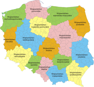
Mińsk Mazowiecki(listen) "Masovian Minsk" is a town in central Poland with 40,211 inhabitants (2015). It is situated in the Masovian Voivodeship, previously in Siedlce Voivodeship (1975–1998). It is the capital of Mińsk County.
Helenowo is a village in the administrative district of Gmina Złotniki Kujawskie, within Inowrocław County, Kuyavian-Pomeranian Voivodeship, in north-central Poland.

Faliszowice is a village in the administrative district of Gmina Samborzec, within Sandomierz County, Świętokrzyskie Voivodeship, in south-central Poland. It lies approximately 7 kilometres (4 mi) west of Samborzec, 14 km (9 mi) west of Sandomierz, and 72 km (45 mi) east of the regional capital Kielce.
Józefków is a village in the administrative district of Gmina Szczawin Kościelny, within Gostynin County, Masovian Voivodeship, in east-central Poland.
Janików-Folwark is a village in the administrative district of Gmina Kozienice, within Kozienice County, Masovian Voivodeship, in east-central Poland.

Arynów is a village in the administrative district of Gmina Mińsk Mazowiecki, within Mińsk County, Masovian Voivodeship, in east-central Poland. It lies approximately 3 kilometres (2 mi) north-west of Mińsk Mazowiecki and 37 km (23 mi) east of Warsaw.
Barcząca is a village in the administrative district of Gmina Mińsk Mazowiecki, within Mińsk County, Masovian Voivodeship, in east-central Poland. It lies approximately 5 kilometres (3 mi) east of Mińsk Mazowiecki and 44 km (27 mi) east of Warsaw.
Budy Janowskie is a village in the administrative district of Gmina Mińsk Mazowiecki, within Mińsk County, Masovian Voivodeship, in east-central Poland. It lies approximately 6 kilometres (4 mi) east of Mińsk Mazowiecki and 45 km (28 mi) east of Warsaw.
Dłużka is a village in the administrative district of Gmina Mińsk Mazowiecki, within Mińsk County, Masovian Voivodeship, in east-central Poland. It lies approximately 4 kilometres (2 mi) north of Mińsk Mazowiecki and 40 km (25 mi) east of Warsaw.
Dziękowizna is a village in the administrative district of Gmina Mińsk Mazowiecki, within Mińsk County, Masovian Voivodeship, in east-central Poland. It lies approximately 6 kilometres (4 mi) east of Mińsk Mazowiecki and 45 km (28 mi) east of Warsaw.

Józefów is a village in the administrative district of Gmina Mińsk Mazowiecki, within Mińsk County, Masovian Voivodeship, in east-central Poland. It lies approximately 10 kilometres (6 mi) south-west of Mińsk Mazowiecki and 35 km (22 mi) east of Warsaw.
Królewiec is a village in the administrative district of Gmina Mińsk Mazowiecki, within Mińsk County, Masovian Voivodeship, in east-central Poland. It lies approximately 3 kilometres (2 mi) north-west of Mińsk Mazowiecki and 38 km (24 mi) east of Warsaw.
Osiny is a village in the administrative district of Gmina Mińsk Mazowiecki, within Mińsk County, Masovian Voivodeship, in east-central Poland. It lies approximately 4 kilometres (2 mi) east of Mińsk Mazowiecki and 43 km (27 mi) east of Warsaw.
Stojadła is a village in the administrative district of Gmina Mińsk Mazowiecki, within Mińsk County, Masovian Voivodeship, in east-central Poland. It lies approximately 3 kilometres (2 mi) west of Mińsk Mazowiecki and 37 km (23 mi) east of Warsaw.
Targówka is a village in the administrative district of Gmina Mińsk Mazowiecki, within Mińsk County, Masovian Voivodeship, in east-central Poland. It lies approximately 3 kilometres (2 mi) south-east of Mińsk Mazowiecki and 42 km (26 mi) east of Warsaw.
Wólka Mińska is a village in the administrative district of Gmina Mińsk Mazowiecki, within Mińsk County, Masovian Voivodeship, in east-central Poland.
Stelągi-Kolonia is a village in the administrative district of Gmina Sterdyń, within Sokołów County, Masovian Voivodeship, in east-central Poland. It lies approximately 19 kilometres (12 mi) north of Sokołów Podlaski and 97 km (60 mi) north-east of Warsaw.

Wolkowo is a village in the administrative district of Gmina Kamieniec, within Grodzisk Wielkopolski County, Greater Poland Voivodeship, in west-central Poland.
Silecki Folwark is a village in the administrative district of Gmina Srokowo, within Kętrzyn County, Warmian-Masurian Voivodeship, in northern Poland, close to the border with the Kaliningrad Oblast of Russia.