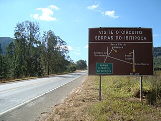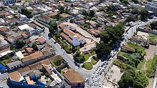
Cunha is a municipality in the state of São Paulo in Brazil. It is part of the Metropolitan Region of Vale do Paraíba e Litoral Norte. The population is 21,459 in an area of 1,407.25 km2. The first inhabitants arrived in the beginning of the 18th century. The municipality was founded in 1785, it was elevated to a city in 1858. Since 1975 Cunha has become an important center of stoneware ceramics, with 5 Noborigama wood fired kilns and 16 ceramics studios in all. The city is visited for ceramics, a pleasant climate, natural parks and gastronomy. In recent years tourism to the region has grown, with visitors coming from around the region to enjoy the local state park, artisan shops such as Aracatu and Oficina da Lã as well as festivals like the annual lamb festival. On October 25, 2015, Cunha hosted the first edition of the Brazilian portion of the Tour de France cycling competition.

→

Resende is a municipality located in the Brazilian state of Rio de Janeiro. The population is 132,312 in an area of 1094 km2. Resendense refers to people or things that come from or inhabit Resende. It is the oldest town in this region, which has boundaries with the state of São Paulo and Minas Gerais. It is an important industrial, automotive, metallurgical, and tourist center, and headquarters of the world's second-largest military complex, the Academia Militar das Agulhas Negras (AMAN). Resende is of national importance and houses the Nuclear Fuel Factory complex of the "Indústrias Nucleares" of Brasil, the only one able to enrich uranium. Resende's automotive area holds MAN Latin America, the biggest truck and bus factory of Brazil, limited to PSA Peugeot Citroën and Michelin.
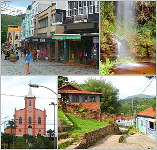
Lima Duarte is a municipality in the state of Minas Gerais, Brazil. It has a population of 16,724 inhabitants (2020) and a total area of 848 square kilometres (327 sq mi) and lies at an elevation of 860 metres (2,822 ft) in the foothills of the Mantiqueira Mountains. It was given city status in 1881.

The Mantiqueira Mountains are a mountain range in Southeastern Brazil, with parts in the states of São Paulo, Minas Gerais and Rio de Janeiro.

Serra Azul de Minas is a Brazilian municipality located in the state of Minas Gerais. The city belongs to the mesoregion Metropolitana de Belo Horizonte and to the microregion of Conceição do Mato Dentro. As of 2020, the estimated population was 4,292.

Serro is a Brazilian municipality located in the state of Minas Gerais. The city belongs to the metropolitan area of Belo Horizonte and to the microregion of Conceição do Mato Dentro. As of 2020, the estimated population was 20,940.
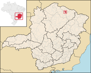
Mato Verde is a municipality located in the north of the state of Minas Gerais in Brazil. It was founded in 1953. The population was 12,412 as of 2020 and the area was 664 km². The elevation of the city is 541 metres. The postal code (CEP) is 39527-000.
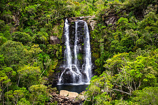
The Serra do Papagaio State Park is a state park in the state of Minas Gerais, Brazil. It protects a mountainous region of Atlantic Forest.

The Três Picos State Park is a state park in the state of Rio de Janeiro, Brazil. It preserves a large, mountainous region of Atlantic Forest.

The Canudos State Park is a state park in Bahia, Brazil. It protects the area of the War of Canudos, where peasants of mixed blood were massacred by Republican soldiers in 1896–97.

The Biribiri State Park is a state park in the state of Minas Gerais, Brazil. It protects a mountainous region of cerrado. The park contains an abandoned village, once home to workers in a textile factory, which is now a tourist attraction.

The Tainhas State Park is a state park in the state of Rio Grande do Sul, Brazil. It protects forests in the valley of the Tainhas River surrounded by open fields. The main attraction is the Cachoeira do Passo do S, a waterfall.
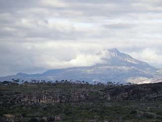
The Pico do Itambé State Park is a state park in the state of Minas Gerais, Brazil. It protects one of the higher peaks in the state.
The Baleia State Park is a state park in the state of Minas Gerais, Brazil. It protects a rugged area in the cerrado biome near the state capital of Belo Horizonte. As of 2014 nothing had been done to implement the park, which existed only on paper.

The Serra do Rola-Moça State Park is a state park in the state of Minas Gerais, Brazil. It protects a rugged area in the transition zone between cerrado and Atlantic Forest. Springs in the park are important to the water supply of the state capital, Belo Horizonte.

The Serra Negra State Park Portuguese: Parque Estadual da Serra Negra is a state park in the state of Minas Gerais, Brazil. It protects a mountainous area in the Atlantic Forest biome, an important source of water in a dry region, and a potential source of tourism revenue in an area with many social problems.

The Rio Preto State Park is a state park in the state of Minas Gerais, Brazil. It protects a mountainous area of cerrado vegetation that is home to various endemic, rare or endangered species. Trails provide environmental interpretation, and lead to lookouts that give panoramic views, to rivers and waterfalls, and to archaeological sites with rock paintings.
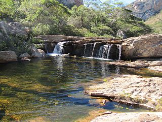
The Serra Nova State Park Portuguese: Parque Estadual de Serra Nova is a state park in the state of Minas Gerais, Brazil. It protects an area of rugged terrain with considerable diversity of flora and fauna.

The Rio Doce State Park is a state park in the state of Minas Gerais, Brazil. It protects a large remnant of Atlantic Forest, and includes a system of lagoons rich in species of native fish.


