
Gromadzyn is a village in the administrative district of Gmina Sochocin, within Płońsk County, Masovian Voivodeship, in east-central Poland. It lies approximately 3 kilometres (2 mi) south-east of Sochocin, 8 km (5 mi) north-east of Płońsk, and 62 km (39 mi) north-west of Warsaw.
Korzybie is a village in the administrative district of Gmina Baboszewo, within Płońsk County, Masovian Voivodeship, in east-central Poland. It lies approximately 4 kilometres (2 mi) south of Baboszewo, 9 km (6 mi) west of Płońsk, and 70 km (43 mi) north-west of Warsaw.
Kozarzewo is a village in the administrative district of Gmina Naruszewo, within Płońsk County, Masovian Voivodeship, in east-central Poland. It lies approximately 5 kilometres (3 mi) west of Naruszewo, 13 km (8 mi) south-west of Płońsk, and 60 km (37 mi) north-west of Warsaw.
Krysk is a village in the administrative district of Gmina Naruszewo, within Płońsk County, Masovian Voivodeship, in east-central Poland. It lies approximately 4 kilometres (2 mi) east of Naruszewo, 12 km (7 mi) south of Płońsk, and 53 km (33 mi) north-west of Warsaw.
Naruszewo is a village in Płońsk County, Masovian Voivodeship, in east-central Poland. It is the seat of the gmina called Gmina Naruszewo. It lies approximately 12 kilometres (7 mi) south of Płońsk and 56 km (35 mi) north-west of Warsaw.
Biele is a village in the administrative district of Gmina Sochocin, within Płońsk County, Masovian Voivodeship, in east-central Poland. It lies approximately 3 kilometres (2 mi) south-west of Sochocin, 6 km (4 mi) north-east of Płońsk, and 63 km (39 mi) north-west of Warsaw.
Ciemniewo is a village in the administrative district of Gmina Sochocin, within Płońsk County, Masovian Voivodeship, in east-central Poland. It lies approximately 4 kilometres (2 mi) north of Sochocin, 12 km (7 mi) north-east of Płońsk, and 66 km (41 mi) north-west of Warsaw.
Drożdżyn is a village in the administrative district of Gmina Sochocin, within Płońsk County, Masovian Voivodeship, in east-central Poland. It lies approximately 6 kilometres (4 mi) south of Sochocin, 5 km (3 mi) east of Płońsk, and 60 km (37 mi) north-west of Warsaw.
Gutarzewo is a village in the administrative district of Gmina Sochocin, within Płońsk County, Masovian Voivodeship, in east-central Poland. It lies approximately 4 kilometres (2 mi) north of Sochocin, 10 km (6 mi) north-east of Płońsk, and 67 km (42 mi) north-west of Warsaw.
Jędrzejewo is a village in the administrative district of Gmina Sochocin, within Płońsk County, Masovian Voivodeship, in east-central Poland. It lies approximately 4 kilometres (2 mi) south-east of Sochocin, 10 km (6 mi) east of Płońsk, and 60 km (37 mi) north-west of Warsaw.
Kołoząb is a village in the administrative district of Gmina Sochocin, within Płońsk County, Masovian Voivodeship, in east-central Poland. It lies approximately 4 kilometres (2 mi) south of Sochocin, 8 km (5 mi) east of Płońsk, and 60 km (37 mi) north-west of Warsaw.
Kondrajec is a village in the administrative district of Gmina Sochocin, within Płońsk County, Masovian Voivodeship, in east-central Poland. It lies approximately 4 kilometres (2 mi) north-east of Sochocin, 12 km (7 mi) north-east of Płońsk, and 63 km (39 mi) north-west of Warsaw.
Kuchary Żydowskie is a village in the administrative district of Gmina Sochocin, within Płońsk County, Masovian Voivodeship, in east-central Poland. It lies approximately 3 kilometres (2 mi) south-east of Sochocin, 9 km (6 mi) north-east of Płońsk, and 61 km (38 mi) north-west of Warsaw.
Rzy is a village in the administrative district of Gmina Sochocin within Płońsk County, Masovian Voivodeship in east-central Poland. It lies approximately 7 kilometres (4 mi) east of Sochocin, 15 km (9 mi) north-east of Płońsk, and 62 km (39 mi) north-west of Warsaw.
Ślepowrony is a village in the administrative district of Gmina Sochocin, within Płońsk County, Masovian Voivodeship, in east-central Poland. It lies approximately 8 kilometres (5 mi) south of Sochocin, 9 km (6 mi) east of Płońsk, and 56 km (35 mi) north-west of Warsaw.
Smardzewo is a village in the administrative district of Gmina Sochocin, within Płońsk County, Masovian Voivodeship, in east-central Poland. It lies approximately 5 kilometres (3 mi) west of Sochocin, 8 km (5 mi) north of Płońsk, and 68 km (42 mi) north-west of Warsaw.
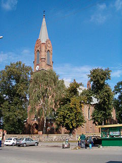
Sochocin is a village in Płońsk County, Masovian Voivodeship, in east-central Poland. It is the seat of the gmina called Gmina Sochocin. It lies approximately 8 kilometres (5 mi) north-east of Płońsk and 64 km (40 mi) north-west of Warsaw.
Wycinki is a village in the administrative district of Gmina Sochocin, within Płońsk County, Masovian Voivodeship, in east-central Poland. It lies approximately 4 kilometres (2 mi) south-west of Sochocin, 5 km (3 mi) north-east of Płońsk, and 62 km (39 mi) north-west of Warsaw.
Żelechy is a village in the administrative district of Gmina Sochocin, within Płońsk County, Masovian Voivodeship, in east-central Poland. It lies approximately 3 kilometres (2 mi) west of Sochocin, 6 km (4 mi) north-east of Płońsk, and 64 km (40 mi) north-west of Warsaw.
Koryciska is a village in the administrative district of Gmina Załuski, within Płońsk County, Masovian Voivodeship, in east-central Poland. It lies approximately 6 kilometres (4 mi) north-east of Załuski, 17 km (11 mi) south-east of Płońsk, and 46 km (29 mi) north-west of Warsaw.


