Namutumba District, sometimes referred to as Busiki District is a district in Eastern Uganda. It's named after its 'chief town', Namutumba, where the district headquarters are located.
Gulu–Nimule Road is a road in the Northern Region of Uganda, connecting the city of Gulu in Gulu District and the town of Nimule in Eastern Equatoria State in South Sudan, just north of the international border between the two countries. The road, known as Highway A104 in Uganda, continues into South Sudan as Highway A43.
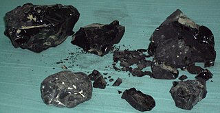
Kaliro Power Station is a 12 MW (16,000 hp) bagasse-fired thermal power plant in Uganda, the third-largest economy in the East African Community.
The Musita–Mayuge–Lumino–Majanji–Busia Road is a road in the Eastern Region of Uganda, connecting the town of Musita in Mayuge District to Busia in Busia District at the international border with Kenya.

Musita is a town in Mayuge District, in the Eastern Region of Uganda.
Tororo–Mbale–Soroti Road is a road in Eastern Uganda, connecting the towns of Tororo in Tororo District to Mbale in Mbale District and Soroti in Soroti District.
Soroti–Katakwi–Moroto–Lokitanyala Road is a road in the Eastern and Northern regions of Uganda. The road connects the towns of Soroti, the largest town in Teso sub-region, to Katakwi, the district headquarters of Katakwi District and to Moroto, the largest town in the Karamoja sub-region. It ends at Lokitanyala, at the international border with Kenya.
The Masaka–Masaka Road is a road in the Central and Western Regions of Uganda, connecting the towns of Masaka in Masaka District, Central Region and Mbarara in Mbarara District, Western Region.
The Kampala–Mityana Road is a road in the Central Region of Uganda, connecting the capital city of Kampala to the town of Mityana in Mityana District.
The Tirinyi–Pallisa–Kamonkoli–Kumi Road is a road in the Eastern Region of Uganda, connecting the towns of Tirinyi in Kibuku District, Pallisa in Pallisa District, Kamonkoli in Budaka District, and Kumi in Kumi District.
Tirinyi is a town in the Kibuku District in the Eastern Region of Uganda.
Kamonkoli is a town in Budaka District, in the Eastern Region of Uganda.
The Kampala–Gayaza Road is a road in the Central Region of Uganda, connecting the capital city of Kampala to the town of Gayaza in the Wakiso District. The road is part of the 44 kilometres (27 mi) Kampala–Gayaza–Ziroobwe Road Project.
Iganga General Hospital, also, Iganga District Hospital or Iganga Main Hospital, commonly known as Iganga Hospital is a hospital in Iganga, Eastern Uganda.
The Iganga–Tirinyi–Kamonkoli–Mbale Road, also known as the Mbale–Kamonkoli–Tirinyi–Mbale Road, is a road in the Eastern Region of Uganda, connecting the towns of Iganga in Iganga District, Namutumba in Namutumba District, Tirinyi in Kibuku District, Kamonkoli in Budaka District, and Mbale in Mbale District.
The Jinja–Iganga–Bugiri–Tororo Road is a road in the Eastern Region of Uganda, connecting the towns of Jinja and Tororo. Sometimes referred to as Tororo–Jinja Road, it is a busy transport corridor, connecting traffic from neighboring Kenya, and northeastern Uganda to Jinja, a major commercial and industrial center, and ultimately to Kampala, the country's capital and points beyond.
Masaka–Villa Maria–Bukomansimbi–Sembabule Road also Nyendo–Villa Maria–Bukomansimbi–Sembabule Road, is a road in the Central Region of Uganda, connecting the towns of Masaka in Masaka District, Villa Maria in Kalungu District, Bukomansimbi in Bukomansimbi District to Sembabule in Sembabule District.