Kaliro

Last updated
Kaliro
Kaliro town council
Uganda location map.svg
Red pog.svg
Kaliro
Location in Uganda
Coordinates: 00°53′42″N33°30′18″E / 0.89500°N 33.50500°E / 0.89500; 33.50500
Country Flag of Uganda.svg Uganda
Region Eastern Uganda
Sub-region Busoga sub-region
District Kaliro District
Government
  MayorSam Gamutambuli
Elevation
3,540 ft (1,080 m)
Population
 (2014 Census)
  Total16,796 [1]

Kaliro is a town in the Eastern Region of Uganda. It is the main municipal, administrative, and commercial center of Kaliro District and the site of the district headquarters.

Contents

Location

Kaliro is approximately 40 kilometres (25 mi) north of Iganga, the nearest large town, on an all-weather tarmacked road. [2] This is approximately 153 kilometres (95 mi), by road, northeast of Kampala, Uganda's capital and largest city. [3] The coordinates of the town are 0°53'42.0"N, 33°30'18.0"E (Latitude:0.8950; Longitude:33.5050). [4]

Population

In 2002, the national population census estimated the town's population at 39,900. In 2010, the Uganda Bureau of Statistics (UBOS) estimated the population at 13,300. In 2011, UBOS estimated the population at 13,700. [5] In 2014, the national census put the population at 16,796. [1]

Administration

Kaliro is led by an elected mayor and elected town council. As of 2017, the mayor is Sam Gamutambuli. [6]

Points of interest

The following points of interest lie within the town or close to its borders:

See also

Related Research Articles

<span class="mw-page-title-main">Iganga District</span> District in Eastern Uganda, Uganda

Iganga District is a district in the Eastern Region of Uganda. The town of Iganga is the site of the district headquarters.

<span class="mw-page-title-main">Masindi</span> Place in Western Region of Uganda, Uganda

Masindi is a town in the Western Region of Uganda. It is on the road between Kampala and the Murchison Falls National Park. It is the site of the headquarters of the Masindi District.

Hoima is a city in the Western Region of Uganda. It is the main municipal, administrative, and commercial center of Hoima District. It is also the location of the palace of the Omukama of Bunyoro.

Bugiri is a town in the Eastern Region of Uganda. It is the chief town of Bugiri District, and the district headquarters are located there. The town was elevated to Municipal Council status in 2019.

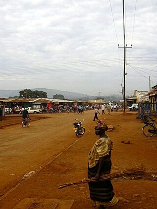
Iganga is a town in the Eastern Region of Uganda. It is the main municipal, administrative, and commercial center of Iganga District.

Mayuge is a town in the Eastern Region of Uganda. It is the location of the headquarters of Mayuge District.

<span class="mw-page-title-main">Kibaale</span> Place in Western Uganda, Uganda

Kibaale is a town in the Western Region of Uganda. It is the main municipal, administrative, and commercial center of Kibaale District, and the district headquarters are located there.

<span class="mw-page-title-main">Kaliro District</span> District in Eastern Region of Uganda, Uganda

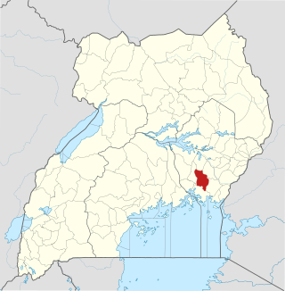
Kaliro District is a district in the Eastern Region of Uganda. It was created out of the eastern part of Kamuli District in 2006. Kaliro is the site of the district headquarters.

<span class="mw-page-title-main">Mukono Town</span> Urban centre in Uganda

Mukono Town is a municipality in Mukono District in the Central Region of Uganda. The town is administered by the Mukono Town Council. The district headquarters are located in this town.

Kumi Town, commonly called Kumi, is a town in the Eastern Region of Uganda. It is the main municipal, administrative, and commercial center in Kumi District and is the site of the district headquarters.

<span class="mw-page-title-main">Namutumba District</span> District in Eastern Uganda, Uganda

Namutumba District, sometimes referred to as Busiki District is a district in Eastern Uganda. It is named after its 'chief town', Namutumba, where the district headquarters are located.

Namutumba is a town in the Namutumba District of the Eastern Region of Uganda. It is the main municipal, administrative, and commercial centre of the district.

Busembatya, sometimes spelled Busembatia, is a town in the Eastern Region of Uganda.

Kagadi is a town in the Western Region of Uganda. It is the commercial and administrative headquarters of Kagadi District.

Busoga University (BU), is a private university in Uganda, affiliated with Central Busoga Diocese of the Church of Uganda.

<span class="mw-page-title-main">Buyende District</span> District in Eastern Uganda, Uganda

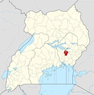
Buyende District is a district in Eastern Uganda. It is named after Buyende, the 'chief town' in the district and the location of the district headquarters.

<span class="mw-page-title-main">Luuka District</span> District in Eastern Uganda, Uganda

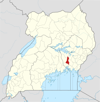
Luuka District is a district in Eastern Uganda.

Kaliro Power Station is a 12 MW (16,000 hp) bagasse-fired thermal power plant in Uganda, the third-largest economy in the East African Community.

Rwekunye is a settlement in Kiryandongo District in the Western Region of Uganda.

Kagulu Hill, also Kagulu Rock, is a rocky prominence that rises 3,500 feet (1,067 m), above sea level, in the Eastern Region of Uganda.

References

  1. 1 2 " "The Population of The Regions of the Republic of Uganda And All Cities And Towns of More Than 15,000 Inhabitants". Citypopulation.de Quoting Uganda Bureau of Statistics. 29 November 2014. Retrieved 28 February 2015.
  2. "Map Showing Iganga And Kaliro With Distance Marker". Globefeed.com. Retrieved 31 May 2014.
  3. "Road Distance Between Kampala And Kaliro With Map". Globefeed.com. Retrieved 31 May 2014.
  4. Google (12 July 2015). "Location of Kaliro At Google Maps" (Map). Google Maps . Google. Retrieved 12 July 2015.
  5. "Estimated Population of Kaliro In 2002, 2010 & 2011" (PDF). Uganda Bureau of Statistics. Archived from the original (PDF) on 7 July 2014. Retrieved 31 May 2014.
  6. Gwebayanga, Tom (8 January 2012). "Kaliro Mayor, Speaker Survive Lynching". New Vision. Archived from the original on 1 June 2014. Retrieved 31 May 2014.

Coordinates: 0°53′40″N33°29′58″E / 0.89444°N 33.49944°E / 0.89444; 33.49944