Ihavandhoo (Haa Alif Atoll)

Last updated

'Ihavandhoo'
އިހަވަންދޫ
Maledives relief location map.jpg
Red pog.svg
'Ihavandhoo'
Location in Maldives
Coordinates: 6°57′17″N72°55′33″E / 6.95472°N 72.92583°E / 6.95472; 72.92583 Coordinates: 6°57′17″N72°55′33″E / 6.95472°N 72.92583°E / 6.95472; 72.92583
Country Maldives
Geographic atoll Ihavandhippolhu Atoll
Administrative atoll Haa Alif Atoll
Distance to Malé314.08 km (195.16 mi)
Government
   Council Ihavandhoo Island Council
Dimensions
  Length0.88 km (0.55 mi)
  Width0.86 km (0.53 mi)
Population
 (including foreigners 2021-(may-31)) [1]
  Total3,081
Time zone UTC+05:00 (MST)
Area code(s) 750, 20

Ihavandhoo is an island of Ihavandhippolhu Atoll. It is located in the northernmost geographic atoll in the country, and is administratively part of Haa Alif Atoll. It is an Atoll-island-level administrative constituency governed by the Ihavandhoo Island Council .

Contents

History

The story of Mohamed Thakurufaanu (Boduthankurufaanu), the Maldivian hero who defeated the Portuguese rule in Maldives, reveals that mother of Mohamed Thakurufaanu was an Ihavandhoo lady. The island has a mosque built by Sultan Ibrahim Muhirudheen in 1701 using brain corals. Through restorations, its origin is maintained as the mosque is the only remaining archaeological evidence in Ihavandhoo island.

Geography

The island is 314.08 km (195 mi; 170 nmi) north of the country's capital, Malé. [2]

One of the major environmental problems faced by Ihavandhoo islanders has been soil erosion.

Demography

Historical population
YearPop.±%
2006 2,547    
2014 3,627+42.4%
20161,007−72.2%
20192,054+104.0%
20213,089+50.4%
2006-2014-2016-2019-2021: Census populations
Source: [3]

Economy

Traditionally, the island has been a pure fishing island, with the majority of the working age group being experienced fishermen. Ihavandhoo also accounts for the country's export of tuna (chilled and frozen) and dried fish. The government owned fisheries company, Maldives Industrial Fisheries Company also operates in the region.

Education

Opened on 14 May 1969, Ihavandhoo School serves as the public school in the island, providing primary to higher secondary education. [4] Initially, the school was named "Ihavandhoo Madharusaa", when it was owned by the local people. The school started offering secondary grades in 1998, preparing students for international GCE Ordinary Level examinations, with A-Level grades in 2003. The school became a government owned school in 2000.

Transport

A harbour has been dug to solve the problem of getting into the island. An area of 13,150 m2 (141,500 sq ft) was dredged in 1992. The harbour was repaired in 2000. This harbour plays an important role in the economy of the island especially the fact that majority of the islands working population are fishermen who had to use the harbour every day.

On 11 November 2010, the government started a project costing US$4,490,678.94 to build a new harbour. The project is yet to be finished. According to MTCC, the contractor of the project, as of 7 September 2011, 36% of breakwater construction has been completed. This new harbour has an area of 35,945 m2 (386,910 sq ft).

Related Research Articles

<span class="mw-page-title-main">Maldives</span> Country in Southern Asia

Maldives, officially the Republic of Maldives, is an archipelagic state in South Asia, situated in the Indian Ocean. It lies southwest of Sri Lanka and India, about 750 kilometres from the Asian continent's mainland. Maldives' chain of 26 atolls stretches across the equator from Ihavandhippolhu Atoll in the north to Addu Atoll in the south.

<span class="mw-page-title-main">Malé</span> Capital of the Maldives

Malé is the capital and most populous city of the Maldives. With a population of 252,768 and an area of 8.30 square kilometres (3.20 sq mi), it is also one of the most densely populated cities in the world. The city is geographically located at the southern edge of North Malé Atoll. Administratively, the city consists of a central island, an airport island, and four other islands governed by the Malé City Council.

<span class="mw-page-title-main">Fuvahmulah</span> Inhabited island in Gnaviyani Atoll, Maldives

Fuvahmulah is an island (atoll) in the Maldives. It is under Maldives’ administrative divisions of Gnaviyani Atoll or Nyaviyani Atoll. The inhabitants speak a distinctive form of the Dhivehi language, locally known as "fuvahmulaki baha.”

Vaadhoo is an inhabited island of Gaafu Dhaalu region in the atoll of Huvadhu, Maldives. It has its own dialect of Maldivian, which is considerably different from northern and Mid-Maldivian speech.

Fonadhoo is the capital island in Laamu atoll of the Maldives.

<span class="mw-page-title-main">Meedhoo (Dhaalu Atoll)</span> Inhabited island in Nilandhe Atholhu, Maldives

Meedhoo is one of the inhabited islands of Dhaalu Atoll.

<span class="mw-page-title-main">Mahibadhoo</span> Inhabited island in Maldives

Mahibadhoo is an island town in central Maldives, and is the capital of South Ari Atoll.

<span class="mw-page-title-main">Naifaru</span> Inhabited island in Maldives

Naifaru is an island in the Maldives 141 km (88 mi) north of the capital, Malé. It is the capital and most populous island of Lhaviyani Atoll.

<span class="mw-page-title-main">Dharavandhoo</span> Inhabited island in Maldives

Dharavandhoo is one of the inhabited islands of Baa Atoll.

Kendhoo is one of the inhabited islands of Baa Atoll, Maldives. It is located in the northern part of the Baa Atoll.

Maakurathu is one of the inhabited islands of Raa Atoll in the Maldives. Sultan Mohamed I is from Maakurathu. He is also the husband of Sultana Raadhafathi.

<span class="mw-page-title-main">Maroshi (Shaviyani Atoll)</span> Inhabited island in Miladhummadulhu Atoll, Maldives

Maroshi is one of the inhabited islands of the Shaviyani Atoll administrative division and geographically part of the Miladhummadulhu Atoll in the Maldives.

Noomaraa is one of the inhabited islands of the Shaviyani Atoll administrative division, and geographically part of the North Miladhummadulhu Atoll in the Maldives. The Island code is C2.

Vaikaradhoo is one of the inhabited islands of Haa Dhaalu Atoll administrative division of the Maldives.

Baarah is an inhabited island in Haa Alif Atoll in the northern Maldives. It is an island-level administrative constituency governed by the Baarah Island Council.

Thakandhoo is one of the inhabited islands of Haa Alif Atoll administrative division and is geographically part of Thiladhummathi Atoll in the north of the Maldives. It is an island-level administrative constituency governed by the Thakandhoo Island Council.
<span class="mw-page-title-main">Utheemu (Haa Alif Atoll)</span> Island in Thiladhunmathi Atoll, Maldives

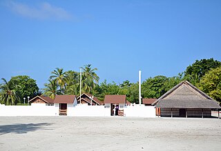
Utheemu is one of the inhabited islands of Haa Alif Atoll administrative division and geographically part of Thiladhummathi Atoll in the north of the Maldives. It is an island-level administrative constituency governed by the Utheemu Island Council.

<span class="mw-page-title-main">Hulhumeedhoo</span> Island in Addu Atoll, Maldives

Hulhumeedhoo or Hulhudhoo-Meedhoo is an island located on the northeastern point of Addu City. It is the fifth largest island in the Maldives. Although Hulhumeedhoo is geographically one island, it is divided into two administrative constituencies of Addu City, known as Meedhoo and Hulhudhoo, which are roughly the northern half and southern half of Hulhumeedhoo respectively. The name "Hulhumeedhoo" is an amalgamation of the names Hulhudhoo and Meedhoo.

Nilandhoo is the capital of Faafu Atoll, a region with five inhabited islands. It is the largest and most populated island in the region, and includes historical sites such as foah'mathi and Aasaari Miskiy and a school. Foah'mathi is a historical site with a Buddhist temple under it, while Aasaari Miskiy is the second mosque built in the Maldives.

Dhuvaafaru is an inhabited island of Maldives located in the eastern edge of Raa Atoll. Resettlement of the island started on 14 December 2008 to inhabit the displaced residents of Kandholhudhoo who were the victims of the 2004 Indian Ocean earthquake and tsunami.

References

  1. "Table PP5: Resident Population by sex, nationality and locality (administrative islands), 2014" (PDF). Population and Households Census 2014. National Bureau of Statistics. p. 33. Retrieved 9 August 2018.
  2. "Coordinate Distance Calculator". Boulter.com. Retrieved 9 August 2018.
  3. "Table 3.3: Total Maldivian Population by Islands" (PDF). National Bureau of Statistics. Retrieved 9 August 2018.
  4. http://isles.egov.mv/Island/Index.aspx?lid=2&tid=0&id=7 Archived 2013-10-04 at the Wayback Machine Isles: island profile