
Rovinj is a city in Croatia situated on the north Adriatic Sea with a population of 14,294 (2011). Located on the western coast of the Istrian peninsula, it is a popular tourist resort and an active fishing port. Istriot, a Romance language once widely spoken in this part of Istria, is still spoken by some of the residents. The town is officially bilingual, Croatian and Italian, hence both town names are official and equal.

Shirakawa is a town located in Kamo District, Gifu Prefecture, Japan. As of 1 January 2019, the town had an estimated population of 8,288 and a population density of 36 persons per km2, in 3159 households. The total area of the town was 237.90 square kilometres (91.85 sq mi).

Motegi is a town located in Tochigi Prefecture, Japan. As of 1 August 2020, the town had an estimated population of 11,777 in 4503 households, and a population density of 68 persons per km2. The total area of the town is 172.69 square kilometres (66.68 sq mi).
Swabi is a city in Khyber Pakhtunkhwa province of Pakistan, located near the banks of the Indus River. It is the 73rd largest city of Pakistan and eighth largest in the province of Khyber Pakhtunkhwa. Swabi is also a key city in Mardan Division, where it is the second-largest city.

Rapu-Rapu, officially the Municipality of Rapu-Rapu, is a 3rd class municipality in the province of Albay in the Bicol Region of the Philippines. The population was 36,151 at the 2020 census.

Prieto Diaz, officially the Municipality of Prieto Diaz, is a 5th class municipality in the province of Sorsogon, Philippines. According to the 2020 census, it has a population of 22,644 people.
Rathafandhoo is an inhabited island of the Gaafu Dhaalu Atoll, Maldives.
Kudafari is one of the inhabited islands of Noonu Atoll.
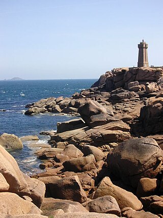
Perros-Guirec is a commune in the department of Côtes-d'Armor in Brittany. It has been a seaside resort since the end of the 19th century.

Louisville is a city in Jefferson County, in the U.S. state of Kentucky. It is located at the Falls of the Ohio River.

Parit Buntar is a town in Kerian District, Perak, Malaysia. It is bordering to Nibong Tebal in Penang and Bandar Baharu in Kedah.It is also the district capital of Kerian District.
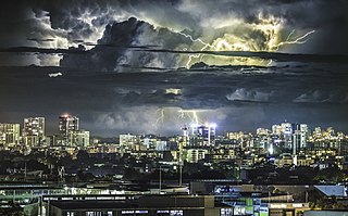
The climate of the city of Sydney, Australia is humid subtropical, shifting from mild and cool in winter to warm and hot in the summer, with no extreme seasonal differences as the weather is moderated by proximity to the ocean, although more contrasting temperatures are recorded in the inland western suburbs. Despite the fact that there is no distinct dry or wet season, rainfall peaks in the first few months of the year and is at its lowest just around the middle of the year, though precipitation can be erratic throughout the year. Precipitation varies across the region, with areas adjacent to the coast being the wettest. According to the Bureau of Meteorology, Sydney falls in the temperate climate zone which has warm to hot summers and no dry season. Sydney's plant hardiness zone ranges from zone 11a to 9b throughout the metropolitan area.

Australia's climate is governed mostly by its size and by the hot, sinking air of the subtropical high pressure belt. This moves north-west and north-east with the seasons. The climate is variable, with frequent droughts lasting several seasons, thought to be caused in part by the El Niño-Southern Oscillation. Australia has a wide variety of climates due to its large geographical size. The largest part of Australia is desert or semi-arid. Only the south-east and south-west corners have a temperate climate and moderately fertile soil. The northern part of the country has a tropical climate, varying between grasslands and desert. Australia holds many heat-related records: the continent has the hottest extended region year-round, the areas with the hottest summer climate, and the highest sunshine duration.

The Batang Hari is the longest river in Jambi province, Sumatra island, Indonesia, about 600 kilometres (370 mi) northwest of the capital Jakarta.

La Porta is a commune in the Haute-Corse department of France on the island of Corsica.

Tasmania has a cool temperate climate with four distinct seasons. The highest recorded maximum temperature in Tasmania is 42.2 °C (108.0 °F) at Scamander on 30 January 2009, during the 2009 southeastern Australia heat wave. Tasmania's lowest recorded minimum temperature is −14.2 °C (6.4 °F) on 7 August 2020, at Central Plateau.

Turmanin is a town in northern Syria, administratively part of the Idlib Governorate, located north of Idlib. Nearby localities include al-Dana and Sarmada to the southwest, Darat Izza to the northeast and Atarib to the south. According to the Syria Central Bureau of Statistics, Turmanin had a population of 10,394 in the 2004 census.
The Belayan River is a river of Borneo, Indonesia, 1300 km northeast of the capital Jakarta. It is a tributary of the Mahakam River.
Jdeidat Artouz is a town in southern Syria, administratively part of the Rif Dimashq Governorate, located southwest of Damascus. Nearby localities include Qatana to the west, Artouz to the south, Khan al-Shih to the southeast, and Darayya to the northeast. According to the Syria Central Bureau of Statistics, Jdeidat Artouz had a population of 45,000 in the 2004 census. It has a mixed population of Christians, Druze, and Sunni Muslims. Christians and Druze primarily live in the southern district of Jdeidat Artouz al-Balad, while Sunnis primarily live in the northern district of Jdeidat al-Wadl.
Perth, the capital city of the state of Western Australia, has a Mediterranean climate, with hot, dry summers and cool, wet winters. February is the hottest month of the year, with an average high of 31.6 °C (88.9 °F), and July is the coldest month of the year, with an average low of 7.9 °C (46.2 °F). 77% of rain in Perth falls between May and September. Perth has an average of 8.8 hours of sunshine per day, which equates to around 3,200 hours of annual sunshine, and 138.7 clear days annually, making it the sunniest capital city in Australia.
