Related Research Articles

The Firth of Thames is a large bay located in the north of the North Island of New Zealand. It is the firth of the rivers Waihou and Piako, the former of which was formerly named the Thames River, and the town of Thames lies on its southeastern coast.

Opiki is a small rural settlement in the Horowhenua district of New Zealand's North Island. It is located on the floodplain of the Manawatu River, 15 km (9 mi) southwest of Palmerston North.

The Ōtaki River is in the southwestern North Island of New Zealand. It originates in the Tararua Range and flows for 45 kilometres (28 mi), heading southwest through a valley in the Tararua Ranges. It turns northwest in the area of Ōtaki Forks, where it is joined by the Waiotauru River. After continuing through Otaki Gorge towards Kapiti Coast, it crosses State Highway 1 (SH1) south of Ōtaki and reaches the Tasman Sea south of the settlement of Ōtaki Beach.
Reikorangi is a rural locality on the Kapiti Coast in New Zealand's North Island. It is inland, behind Waikanae in the Akatarawa Valley of the Tararua Ranges. The Ngatiawa River and Reikorangi Stream both meet the Waikanae River in Reikorangi. Reikorangi contains a church, a monastery, and formerly contained a school, which closed in 1970 due to the declining population of the small locality.
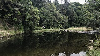
The Reikorangi Stream is a stream on the Kapiti Coast of New Zealand's North Island. It is one of the Waikanae River's major tributaries. Its headwaters are in the Tararua Ranges near Maungakotukutuku, and it flows north to Reikorangi in the Akatarawa Valley, where it meets the Waikanae River.
The Ngatiawa River is a river on the Kapiti Coast of New Zealand's North Island that is a major tributary of the Waikanae River. Its headwaters are in the Tararua Range and it flows north and northwest through the Akatarawa Valley to Reikorangi, where it meets the Waikanae River.

The Mangatainoka River flows in the Tararua District of New Zealand's North Island. Its water was considered so pure a brewery, now the well-known Tui Brewery, was established there.
Speigletown is a hamlet within the town of Schaghticoke, New York in Rensselaer County, New York, United States.

The Hector River is a river of New Zealand's southern North Island. It rises on the northern slopes of Mount Hector in the Tararua Range, flowing east through Tararua Forest Park before joining with the upper reaches of the Waiohine River.
The Kopuaranga River is a river of the Wairarapa, in New Zealand's North Island. It flows generally south from rough hill country southwest of Eketahuna, reaching its outflow into the Ruamahanga River 5 kilometres (3 mi) north of Masterton.
The Tokomaru River is a river of the Manawatū-Whanganui Region of the North Island of New Zealand. It rises to the southeast of Shannon and initially flows northeast down a long valley in the Tararua Range before turning northwest to reach the edge of the Manawatū Plain near the town of Tokomaru. From here it turns southwest, reaching the Manawatū River 3 kilometres (2 mi) north of Shannon.

The Waingawa River is a river of the Greater Wellington Region of New Zealand's North Island and a major tributary of the Ruamahanga River.

The Waiotauru River is a river of the Wellington Region of New Zealand's North Island. It flows generally north from two branches, the Southern Waiotauru River and the Eastern Waiotauru River. Both of these branches have their origins in the southwestern Tararua Range, with the Eastern branch having its origin on the slopes of Mount Hector. The Waiotauru meets the Ōtaki River at Ōtaki Forks, 15 kilometres (9 mi) southeast of Ōtaki.
The Waitewaewae River is a river of the Wellington Region of New Zealand's North Island. An upper tributary of the Ōtaki River, it flows south through Tararua Forest Park to reach the Ōtaki 20 kilometres (12 mi) east of Waikanae.

Fitzherbert Park is a cricket ground in Palmerston North in New Zealand, a home ground of the Central Districts. In February 2000, New Zealand Women defeated England Women at the ground.
The Mangaone River is a river of the Manawatū-Whanganui Region of New Zealand's North Island. Rising on the slopes of Mount Baker, it flows north and northeast to meet the Tiraumea River 2 kilometres (1.2 mi) south of the settlement of Kaitawa.
The northern Tiraumea River is a river of the Manawatū-Whanganui region of New Zealand's North Island. The river rises in the rough hill country of the Tararua District, just south of the settlement of Tiraumea. A tributary, Tiraumea Stream, drains the southern end of the Puketoi Range. The river flows west then north to reach the Manawatu River immediately above the highway and Rail bridges, 5 kilometres (3 mi) south of Woodville.
Piarere is a locality in the Waikato region of New Zealand's North Island. It is situated on State Highway 29 close to its junction with State Highway 1, close to the shore of Lake Karapiro. The nearest towns are Tīrau, six kilometres to the southeast, Matamata, 10 kilometres to the northeast, and Cambridge, 10 kilometres to the northwest.
Hurricane Ridge is an unincorporated community in New Madrid County, in the U.S. state of Missouri.
The Ngawapurua railway station on the Wairarapa Line was located in the Tararua District of the Manawatū-Whanganui region in New Zealand’s North Island.
References
- ↑ "Place name detail: Ihuraua River". New Zealand Gazetteer. New Zealand Geographic Board . Retrieved 12 July 2009.
Coordinates: 40°38′3″S175°52′16″E / 40.63417°S 175.87111°E