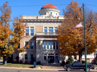
Warren County is a county in the U.S. state of Indiana. It lies in the western part of the state between the Illinois state line and the Wabash River. According to the 2020 census, it had a population of 8,440. Its county seat is Williamsport.

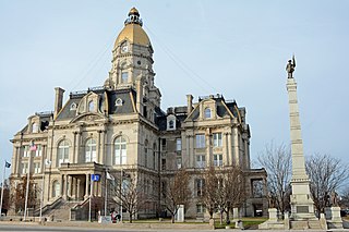
Vigo County is a county on the western border of the U.S. state of Indiana. According to the 2020 United States Census, it had a population of 106,153. Its county seat is Terre Haute.

Vermillion County lies in the western part of the U.S. state of Indiana between the Illinois border and the Wabash River. As of the 2020 census, the population was 15,439. The county seat is Newport. It was officially established in 1824 and was the fiftieth Indiana county created. Vermillion County is included in the Terre Haute, Indiana, Metropolitan Statistical Area. The county contains seven incorporated towns with a total population of about 9,900. as well as several unincorporated communities; it is also divided into five townships which provide local services. An interstate highway, two U.S. routes, and five state roads cross the county, as does a major railroad line.

Sullivan County is a county in the U.S. state of Indiana, and determined by the US Census Bureau to include the mean center of U.S. population in 1940. As of 2020, the population was 20,758. The county seat is Sullivan.

Vermilion County is a county in the eastern part of the U.S. state of Illinois, between the Indiana border and Champaign County. It was established in 1826 and was the 45th of Illinois' 102 counties. According to the 2020 United States census, it had a population of 74,188. It contains 21 incorporated settlements; the county seat and largest city is Danville.

Terre Haute is a city in, and the county seat of, Vigo County, Indiana, United States, about 5 miles (8 km) east of the state's western border with Illinois. As of the 2020 census, the city had a population of 58,389 and its metropolitan area had a population of 168,716.

Urbana is a city in and the county seat of Champaign County, Illinois, United States. As of the 2020 census, Urbana had a population of 38,336. It is a principal city of the Champaign–Urbana metropolitan area, which had 236,000 residents in 2020.

West Terre Haute is a town in Sugar Creek Township, Vigo County, Indiana, on the western side of the Wabash River near Terre Haute. The population was 2,236 at the 2010 census. It is part of the Terre Haute Metropolitan Statistical Area. Bethany Congregational Church was placed on the National Register of Historic Places in 2003.
The Illinois–Indiana–Iowa League was a Minor League Baseball organization that operated for the better part of 60 seasons, with teams based in Illinois, Indiana, Iowa, Kansas, Minnesota, Missouri, Nebraska and Wisconsin. The league began play in 1901 and disbanded after the 1961 season. It was popularly known as the Three–I League and sometimes as the Three–Eye League.

The Chicago and Eastern Illinois Railroad was a Class I railroad that linked Chicago to southern Illinois, St. Louis, and Evansville. Founded in 1877, it grew aggressively and stayed relatively strong throughout the Great Depression and two World Wars before finally being purchased by the Missouri Pacific Railroad and the Louisville and Nashville Railroad (L&N). Missouri Pacific merged with the C&EI corporate entity in 1976, and was later acquired itself by the Union Pacific Railroad.
Mary Fendrich Hulman was the wife of the late Indiana industrialist Anton "Tony" Hulman, Jr. and matriarch of the Hulman-George family that controls Hulman & Company.

The Wabash Valley is a region located in sections of both Illinois and Indiana. It is named for the Wabash River and, as the name is typically used, spans the middle to the middle-lower portion of the river's valley and is centered at Terre Haute, Indiana. The term Wabash Valley is frequently used in local media in Clinton, Lafayette, Mount Carmel, Princeton, Terre Haute, and Vincennes all of which are either on or near the Lower Wabash River.

Chauncey Rose was an American businessman during the 19th century.

Central Illinois is a region of the U.S. state of Illinois that consists of the entire central third of the state, divided from north to south. Also known as the Heart of Illinois, it is characterized by small towns and mid-sized cities. Agriculture, particularly corn and soybeans, as well as educational institutions and manufacturing centers, figure prominently.
The Illinois–Indiana League or Two–I League was based in Illinois and Indiana and refers the name of two different baseball circuits in Minor league baseball which operated in 1889 and 1892. The league was renamed to the Illinois-Iowa League in 1890 and 1891.

Mother Anastasie Brown, S.P.,, was the Superior General of the Sisters of Providence of Saint Mary-of-the-Woods, Indiana from 1868 to 1874. During her term, the congregation had financial difficulties stemming from the Panic of 1873. Both prior to and following her time in office, Brown was Directress of the Academy, a women's college run by the Sisters of Providence now known as Saint Mary-of-the-Woods College.

State Line is an unincorporated community in western Sugar Creek Township, Vigo County, in the U.S. state of Indiana.

Youngstown is an unincorporated community in southern Honey Creek Township, Vigo County, in the U.S. state of Indiana.

Doug Quick is an American broadcast weather newsman, author and web museum curator. He is best known as the news weather anchor at WCCU Fox-Illinois 27, serving Champaign, Urbana and Danville, Illinois. When he retired in 2021, after 47 years in broadcasting, he was Central Illinois' longest tenured weathercaster.


