The Pecos River originates in north-central New Mexico and flows into Texas, emptying into the Rio Grande. Its headwaters are on the eastern slope of the Sangre de Cristo mountain range in Mora County north of Pecos, New Mexico, at an elevation of over 12,000 feet (3,700 m). The river flows for 926 miles (1,490 km) before reaching the Rio Grande near Del Rio. Its drainage basin encompasses about 44,300 square miles (115,000 km2).
The Koyuk River is a river on the Seward Peninsula of western Alaska, in the United States. The river originates in the interior of the peninsula, at the Lost Jim Lava Flow of the Bering Land Bridge National Preserve, where it flows southeast towards the mouth of Norton Bay on Norton Sound. The native village of Koyuk is located at its mouth. The two major tributaries are the Peace and Salmon rivers; other tributaries include Dime and Sweepstakes.

The Kugruk River is a stream, 60 miles (97 km) long, in the northwestern part of the U.S. state of Alaska. It is the largest tributary of the Kuzitrin River. It begins near Imuruk Lake on the Seward Peninsula and flows generally north to Kugruk Lagoon, at Kotzebue Sound on the Chukchi Sea. The river enters the lagoon 5.5 miles (8.9 km) southeast of Cape Deceit in the Northwest Arctic Borough.

The Fish River is a waterway in the U.S. state of Alaska. The 47-mile-long (76 km) river rises in the Bendeleben Mountains and flows south to Golovnin Lagoon, before emptying into Golovnin Bay, Norton Sound, and the Bering Sea. The basin formed by the Fish River is known for its placer gold deposits, and in particular, the Niukluk River and its tributaries; production from this tributary valley is reported to be more than from any other place in the region. A galena mine existed 40 miles (64 km) from the sea, worked on occasion by a San Francisco corporation with a few hundred tons of ore taken to the city for smelting and refining for silver. Walter Curran Mendenhall found obscure fossils on Fish River at White Mountain.

The Columbia Plateau ecoregion is a Level III ecoregion designated by the United States Environmental Protection Agency (EPA) encompassing approximately 32,100 square miles (83,139 km2) of land within the U.S. states of Washington, Oregon, and Idaho. The ecoregion extends across a wide swath of the Columbia River Basin from The Dalles, Oregon to Lewiston, Idaho to Okanogan, Washington near the Canada–U.S. border. It includes nearly 500 miles (800 km) of the Columbia River, as well as the lower reaches of major tributaries such as the Snake and Yakima rivers and the associated drainage basins. It is named for the Columbia Plateau, a flood basalt plateau formed by the Columbia River Basalt Group during the late Miocene and early Pliocene. The arid sagebrush steppe and grasslands of the region are flanked by moister, predominantly forested, mountainous ecoregions on all sides. The underlying basalt is up to 2 miles (3 km) thick and partially covered by thick loess deposits. Where precipitation amounts are sufficient, the deep loess soils have been extensively cultivated for wheat. Water from the Columbia River is subject to resource allocation debates involving fisheries, navigation, hydropower, recreation, and irrigation, and the Columbia Basin Project has dramatically converted much of the region to agricultural use.

The Northern Basin and Range ecoregion is a Level III ecoregion designated by the United States Environmental Protection Agency (EPA) in the U.S. states of Oregon, Idaho, Nevada, Utah, and California. It contains dissected lava plains, rolling hills, alluvial fans, valleys, and scattered mountain ranges in the northern part of the Great Basin. Although arid, the ecoregion is higher and cooler than the Snake River Plain to the north and has more available moisture and a cooler climate than the Central Basin and Range to the south. Its southern boundary is determined by the highest shoreline of Pleistocene Lake Bonneville, which once inundated the Central Basin and Range. The western part of the region is internally drained; its eastern stream network drains to the Snake River system.

Sheep Creek is located 4 miles (6.4 km) southeast of Juneau, in the U.S. state of Alaska. The Juneau community of Thane was originally called Sheep Creek. Draining an area of about 5 square miles (13 km2), it empties into Gastineau Channel. The valley formed by the river has a flat, gravel, trekking trail of 3.5 miles (5.6 km), south of Mount Roberts. The Snettisham hydroelectric dam substation is situated on a trail spur. Sheep Creek Hatchery is located at the outflow.

Port Snettisham is a narrow fjord 30 miles (48 km) southeast of Juneau in the U.S. state of Alaska. It is a semi protected deep water port that was developed to transport many mineral deposits found in the Snettisham Peninsula. Lieutenant Joseph Whidbey of the Royal Navy discovered the fjord on August 12, 1794; George Vancouver named it after the town of Snettisham in England.
The Kruzgamepa River is a 55-mile (89 km) tributary of the Kuzitrin River on the Seward Peninsula in the U.S. state of Alaska. The river begins at Salmon Lake, elevation 447 feet (136 m), and descends to 20 feet (6.1 m) above sea level at its mouth. In turn, the Kuzitrin River empties into the Imuruk Basin. The basin drains via the bay of Port Clarence to the Bering Sea.
Nome River is a waterway on the Seward Peninsula in the U.S. state of Alaska. It has its source in a narrow valley in the southern margin of the Kigluaik Mountains, 4.5 miles (7.2 km) west of Salmon Lake.
Grand Central River is a waterway on the Seward Peninsula in the U.S. state of Alaska. It enters Salmon Lake from the west. Although the Grand Central and Kruzgamepa rivers form one stream, their names differ, and their physical features vary. The Grand Central flows into Salmon Lake, while the Kruzgamepa flows out.

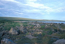
Salmon Lake is a natural lake on the Seward Peninsula in the U.S. state of Alaska. Situated 35 miles (56 km) north of Cape Nome, it drains into Port Clarence through Kruzgamepa River. The lake lies at the foot of the Kigluaik Mountains at an elevation of about 442 feet (135 m). It has a water surface area of 1,800 acres (730 ha) and a drainage area of 81 square miles (210 km2). Its principal supply comes from Grand Central River, which enters it at its western end. A number of small streams also enter the lake from both the north and the south; Fox Creek and Jasper Creek are the most notable of these. Efforts to dam the lake in order to provide power and water supply to mining endeavors occurred from 1906-1907, However these plans were later dropped due to disputes over land ownership and water rights.
Agiapuk River is a waterway on the Seward Peninsula in the U.S. state of Alaska. It is a tributary to Grantley Harbor from the north. American River is a main tributary.
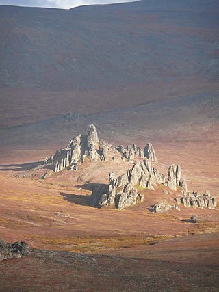
Brooks Mountain is the highest peak in the York Mountains range on the Seward Peninsula in the U.S. state of Alaska. It is located in the central part of the Teller Quadrangle, about 25 miles (40 km) east of Cape Prince of Wales. It has an elevation of 2,918 feet (889 m). It has tin ore deposits, and high-grade uranium has also been found in the form of zeunerite.
Bluestone River is a waterway located on the Seward Peninsula in the U.S. state of Alaska. A tributary of the Tuksuk Channel from the south, Bluestone is a north-flowing stream situated 11 miles (18 km) southeast of Teller. It was named in 1900 by Edward Chester Barnard, topographer of the United States Geological Survey.

Noxapaga River is a 56-mile (90 km) tributary of the Kuzitrin River on the Seward Peninsula in the U.S. state of Alaska. Heading in the Bering Land Bridge National Preserve, it flows northwest for 4 miles (6 km), then west for 22 miles (35 km), then south for 30 miles (48 km) to its mouth on the larger river. Tributaries include the creeks of Aurora, Berry, Black, Bluff, Boulder, Buzzard, Frost, Garfield, Goodall, Goose, Grouse, Last Chance, Little Garfield, Mascot, Money, Peuk, Stony, Turner, and Winona.
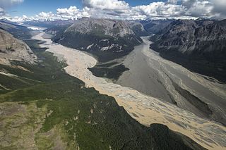
Nizina River is the largest tributary of the Chitina River in the U.S. state of Alaska. It is located in the Wrangell–St. Elias National Park and Preserve.

Lakina River is a tributary of the Chitina River in the U.S. state of Alaska. It is located in the Wrangell–St. Elias National Park and Preserve.
The Fairhaven Ditch is a historic canal on the Seward Peninsula of northwestern Alaska. Located in the Bering Land Bridge National Preserve, it is a 38-mile (61 km) ditch dug in 1906-07 without the benefit of heavy equipment in extremely hostile terrain. The ditch was dug by miners engaged in placer mining on the peninsula, and was used to transport water from Imuruk Lake, the largest body of fresh water on the peninsula, to mining areas north of the lake. It is one of a large number of such canals dug on the peninsula, and was one of the longest. At the bottom it was 11 feet (3.4 m) wide, and was hacked out of permafrost, a volcanic field surrounding the lake, and dirt. Cabins built to house workers and monitor water flow survive. The ditch was listed on the National Register of Historic Places in 1987.
Mary River is a waterway in the U.S. state of Alaska. Situated on the northwestern portion of Seward Peninsula, it was included in the Agiapuk River mining district.